Map Of Ohio, Michigan, Indiana, Illinois, Missouri, Wisconsin, & Iowa
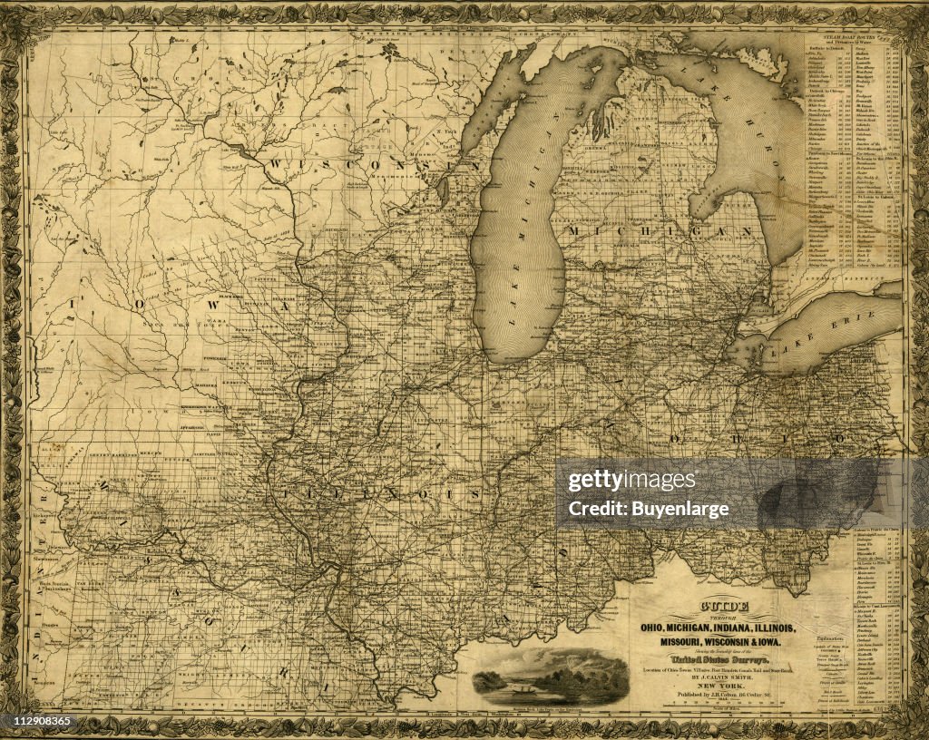
Map of Ohio, Michigan, Indiana, Illinois, Missouri, Wisconsin, & Iowa which shows rail, road, and steamboat routes, 1840. Illustration by J. Calvin Smith. (Photo by Buyenlarge/Getty Images)
PURCHASE A LICENCE
How can I use this image?
₹14,000.00
INR
Getty ImagesMap Of Ohio, Michigan, Indiana, Illinois, Missouri, Wisconsin, & Iowa, News Photo Map Of Ohio, Michigan, Indiana, Illinois, Missouri, Wisconsin, & Iowa Get premium, high resolution news photos at Getty ImagesProduct #:112908365
Map Of Ohio, Michigan, Indiana, Illinois, Missouri, Wisconsin, & Iowa Get premium, high resolution news photos at Getty ImagesProduct #:112908365₹23,000₹7,000
Getty Images
In stockPlease note: images depicting historical events may contain themes, or have descriptions, that do not reflect current understanding. They are provided in a historical context. Learn more.
DETAILS
Restrictions:
Contact your local office for all commercial or promotional uses.Ohio, Michigan, Indiana, Illinois, Missouri, Wisconsin & Iowa
Credit:
Editorial #:
112908365
Collection:
Archive Photos
Date created:
01 January, 1840
Upload date:
Licence type:
Release info:
Not released. More information
Source:
Archive Photos
Object name:
T1634984_111
Max file size:
4500 x 3587 px (38.10 x 30.37 cm) - 300 dpi - 17 MB