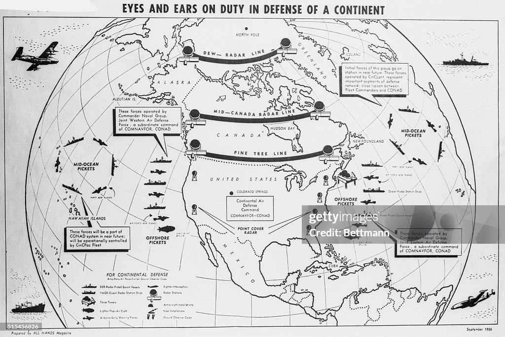
Map Showing the Positions of a Radar Line
(Original Caption) The map shows the position of the DEW (Distant Early Warning) radar line which is being constructed by the United States at a cost of over $1 billion. The line will extend from Alaska to Newfoundland roughly along the 70th parallel, and well within the Arctic Circle. When the operation is completed, the line will serve as a ready alert to warn the United States should any enemy aircraft approach the territory. Dr. William Petrie, chief of the operational research group of the Defense Research Board, said the major cities of the United States could not expect more than 3 hours warning in case of an enemy attack because of the supersonic speed of today's bombers.

PURCHASE A LICENCE
How can I use this image?
₹14,000.00
INR
Getty ImagesMap Showing the Positions of a Radar Line, News Photo Map Showing the Positions of a Radar Line Get premium, high resolution news photos at Getty ImagesProduct #:515456826
 Map Showing the Positions of a Radar Line Get premium, high resolution news photos at Getty ImagesProduct #:515456826
₹23,000₹7,000
Getty Images
In stockPlease note: images depicting historical events may contain themes, or have descriptions, that do not reflect current understanding. They are provided in a historical context. Learn more.
DETAILS
Restrictions:
Contact your local office for all commercial or promotional uses.
Credit:
Editorial #:
515456826
Collection:
Bettmann
Date created:
01 January, 1900
Upload date:
Licence type:
Release info:
Not released. More information
Source:
Bettmann
Object name:
u1103187.jpg
Max file size:
3831 x 2555 px (32.44 x 21.63 cm) - 300 dpi - 4 MB