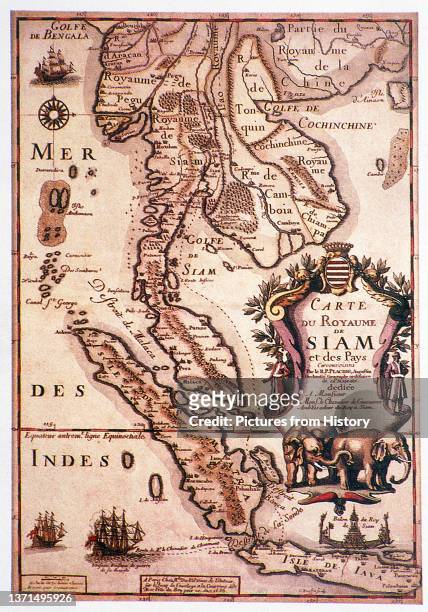
Placide de Sainte-Helene cartographer and Augustine monk was the brother-in-law of Pierre Duval , geographer to the King of France, Louis XIV.Carte du Royaume de Siam.Thailand, Map
'Bombardment of Bantam by the Dutch Fleet, September 1596', Levinus Hulsius , 1598.Indonesia: 'Bombardment of Bantam by the Dutch Fleet, September 1596', Levinus Hulsius (1546 - 1606), 1598
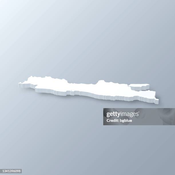
java island 3d render topographic map color - java map stock pictures, royalty-free photos & imagesJava Island 3D Render Topographic Map ColorIndonesia, Madura, Java
Jawa) is an island of Indonesia. With a population of 135 million , Java is the world's most populous island, and one of the most densely populated...Indonesia / Netherlands: Map of Java, Madura, Bali and southern Sumatra. Pieter van der Aa, Leiden, 1707.
Highly decorative map of the East Indies from the Mercator-Hondius Atlas. It extends from the Philippines to Timor and Sumatra to New Guinea,...Southeast Asia: Insulae Indiae Orientalis Praecipuae, In quibus Moluccae celeberrime sunt, or 'The principal islands of the East Indies, of which the most famous are the Moluccas'. Jodocus Hondius, Amsterdam, 1606.Map, Vietnam
indonesia map designed with lines on white background - java map stock illustrationsIndonesia map designed with lines on white backgroundMap, Indonesia
Satellite view of Indonesia . This image was compiled from data acquired by LANDSAT 5 & 7 satellites., Indonesia, Asia, True Colour Satellite Image...Indonesia, Asia, True Colour Satellite Image With MaskDeforestation, Papua New Guinea, Western New Guinea
Galunggung, Java, Indonesia, true colour satellite image. Galunggung volcano is located in West Java, Indonesia, near the city of Tasikmalaya. Image...Galunggung Volcano, Java, Indonesia, True Colour Satellite ImageMountain, Map
Greenleaf Map of the East Indies, Borneo, Java, Sumatra, Thailand, Vietnam.1842 Greenleaf Map of the East IndiesMap, East, Vietnam
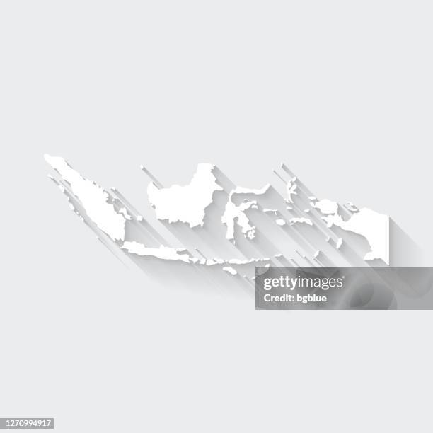
indonesia map with long shadow on blank background - flat design - java map stock illustrationsIndonesia map with long shadow on blank background - Flat DesignIndonesia, Three Dimensional, Map
Cartography, 16th century. The Indian Ocean and part of Asia and Africa: Malaysia and islands of Java and Sumatra, from Atlas of the World in...The Indian Ocean and part of Asia and Africa: Malaysia and islands of Java and Sumatra, from Atlas of the World in thirty-three Maps, by Battista Agnese, 1553Map, 16th Century Style
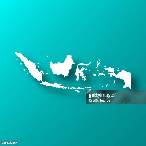
indonesia map on blue green background with shadow - java map stock illustrationsIndonesia map on Blue Green background with shadowIndonesia, Map
Greenleaf Map of the East Indies, Borneo, Java, Sumatra, Thailand, VietnamGreenleaf Map of the East IndiesMap, East, Vietnam
Tardieu Map of the East Indies, Singapore, Southeast Asia, Sumatra, Borneo, JavaTardieu Map of the East IndiesMap, East
Cary Map of the East Indies and Southeast Asia, Singapore, Borneo, Sumatra, Java, Philippines, John Cary, 1754 Ð 1835, English cartographerCary Map of the East Indies and Southeast AsiaPhilippines, Map
Map of Malacca, Sumatra, Java and Borneo, engraving form Atlante Novissimo , by Guillaume De L'Isle, Volume I, Venice, 1740.Map of Malacca, Sumatra, Java and BorneoMap, Island Of Borneo, Java
25 - indonesia - vintage golden 10 - java map stock illustrations25 - Indonesia - Vintage Golden 10Map, Indonesia, Indonesian Culture
22 - indonesia - vintage golden dark 10 - java map stock illustrations22 - Indonesia - Vintage Golden Dark 10Map
indonesia map in cork board texture on white background - java map stock illustrationsIndonesia map in cork board texture on white background
yin-yang sign on rural cityscape skyline background - java map stock illustrationsYin-Yang Sign on Rural Cityscape Skyline BackgroundYin Yang Symbol, Dieng Plateau
indonesia map hand drawn on white background, trendy design - java map stock illustrationsIndonesia map hand drawn on white background, trendy design
Ratna , studies a map she found amongst the rubbish, while her brother, Basir separates the plastic he has collected at the Bantar Gebang landfill...Children Juggle Scavenging With School At Jakarta Landfill Site
Brother and sister, 8-year-old Basir and Ratna , study a map they found amongst the rubbish at the Bantar Gebang landfill site, one of Jakarta's...Children Juggle Scavenging With School At Jakarta Landfill Site
Brother and sister, 8-year-old Basir and Ratna , play together after finding a map amongst the rubbish at the Bantar Gebang landfill site, one of...Children Juggle Scavenging With School At Jakarta Landfill Site
Brother and sister, Basir, eight years old, and Ratna, find a map amongst the rubbish at the Bantar Gebang landfill site, one of Jakarta's biggest...Children Juggle Scavenging With School At Jakarta Landfill Site
Brother and sister, 8-year-old Basir and Ratna , study a map they found amongst the rubbish at the Bantar Gebang landfill site, one of Jakarta's...Children Juggle Scavenging With School At Jakarta Landfill Site
Brother and sister, Ratna , studying a map she found amongst the rubbish, while Basir separates the plastic he has collected, at the Bantar Gebang...Children Juggle Scavenging With School At Jakarta Landfill Site
antique map of east indian archipelago - java map stock illustrationsAntique map of East Indian ArchipelagoIndonesia, Map, Antique
indonesia map with infographic elements - big creative graphic set - java map stock illustrationsIndonesia map with infographic elements - Big creative graphic setJakarta, Indonesia
An officer at Indonesia's Meteorology and Geophysics Agency points on a map the formation of clouds present when an Adam Air plane went missing three...An officer at Indonesia's Meteorology and Geophysics AgencyMap
indonesia map with paper cut on abstract white background - java map stock illustrationsIndonesia map with paper cut on abstract white background
indonesia map in distorted glitch style. modern trendy effect - java map stock illustrationsIndonesia map in distorted glitch style. Modern trendy effect
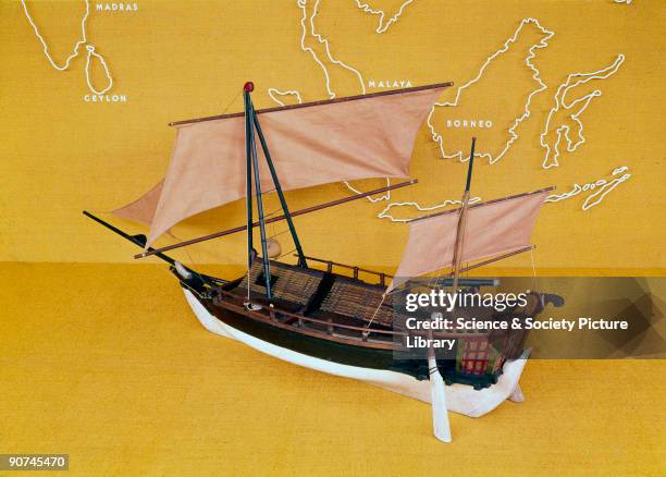
Model. The typical coasting vessel of the Java and Flores Seas had a double-ended hull, about 60 ft in length, derived from the smaller dugout canoe....Javanese proa, c 1850.
Indonesian firefighters work to extinguish a fire inside the 17th-century Dutch colonial building maritime museum in Jakarta on January 16, 2018. -...INDONESIA-MUSEUM-FIRE
indonesia map with embossed paper effect on blank background - java map stock illustrationsIndonesia map with embossed paper effect on blank background
Local celebrities place Indonesian flags over the island of Kalimantan on a mural size map of Indonesia during a protest by Greenpeace outside the...Local celebrities place Indonesian flags
indonesia map in retro vintage style - old textured paper - java map stock illustrationsIndonesia map in retro vintage style - old textured paper
indonesia map - flat icons on different color buttons - java map stock illustrationsIndonesia map - Flat icons on different color buttons
Map of Java in the Dutch East Indies, circa 1680, 17th century. Illustration from voyages made to Persia and India 1727, by Johan Albrecht de...Map of Java in the Dutch East Indies, circa 1680, 17th century.Map, 17th Century, Java
An Indonesian man, member of Hizbuth Tahrir Indonesia holds a placard reading "Erase Israel from the world map" during a protest against Israelis...An Indonesian man, member of Hizbuth Tah
An Indonesian official at Indonesia's Meterological, Climatological and Geophysical Agency in Jakarta sits at a desk in front of a map of North Korea...INDONESIA-NKOREA-NUCLEAR-MISSILE
An Indonesian official at Indonesia's Meterological, Climatological and Geophysical Agency in Jakarta points to a map of North Korea showing where...INDONESIA-NKOREA-NUCLEAR-MISSILE
Indoneasian military officers check a map in Bogor on June 27, 2008 as part of the search for an Indonesian air force plane which went missing over...Indoneasian military officers check a ma
Arif Havas Oegroseno, maritime sovereignty deputy of Indonesia's Coordinating Ministry for Maritime Affairs, points to the North Natuna Sea, renamed...Indonesia renames S. China Sea area located within its EEZIndonesia, Map, South China Sea
Students stand in front of a giant pictures of Indonesian people and the country's map at the national museum in Jakarta, 09 November 2007. Indonesia...Students stand in front of a giant pictu
Students stand in front of a giant pictures of Indonesian people and the country's map at the national museum in Jakarta, 09 November 2007. Indonesia...Students stand in front of a giant pictu
Student stands in front of a giant pictures of Indonesian people and the country's map at the national museum in Jakarta, 09 November 2007. Indonesia...A student stands in front of a giant pic
An Indonesian Navy soldier checks a map onboard the Indonesian KRI Fatahillah along with USNS Mary Sears and KRI Ajak as a search and rescue...An Indonesian Navy soldier checks a map
Indonesian military officers check a map as they search for the missing Adam aircraft at Limboru village in Majene, 05 January 2007. Indonesia...Indonesian military officers check a map
Indonesian Transport Minister, Hatta Rajasa , looks at a map showing a ferry accident location at Semarang Seaport Administrator control room, in...Indonesian Transport Minister, Hatta Raj
borobudur temple in central java, indonesia - java map stock pictures, royalty-free photos & imagesBorobudur temple in Central Java, Indonesia
indonesia map for design, long shadow, flat design - java map stock illustrationsIndonesia Map for design, Long Shadow, Flat Design