global air quality, 2005-2014 - geoscience map stock videos & royalty-free footage00:15Global air quality, 2005-2014Map, Pollution, Wind
earth oceania - geoscience map stock videos & royalty-free footage00:30Earth OceaniaIndonesia, Australia, Satellite View
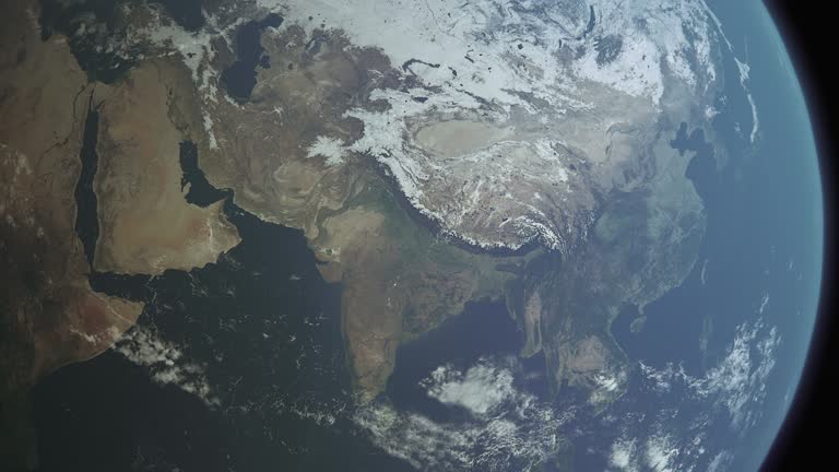
earth asia b - geoscience map stock videos & royalty-free footage00:30Earth Asia BIndia, Planet - Space, Satellite View
nostradamus adjusts a gyroscope compass. - geoscience map stock videos & royalty-free footage00:07Nostradamus adjusts a gyroscope compass.Map, Paper
cctv display at control room - geoscience map stock videos & royalty-free footage00:18CCTV Display at Control RoomSecurity, Data, Device Screen
southeast asia and china night lights satellite view of asean economic hubs - geoscience map stock videos & royalty-free footage00:15Southeast Asia and China Night Lights Satellite View of ASEAN Economic HubsAssociation of Southeast Asian Nations, Globe - Navigational Equipment, Planet - Space
zoom in to sagarmatha zone, nepal from earth. satellite view of the south asia. cinematic world map animation from outer space to territories. the concept of highlight the province, globe, tourism, travel, journey, aerial view of country - geoscience map stock videos & royalty-free footage00:16Zoom in to Sagarmatha Zone, Nepal from Earth. Satellite view of the South Asia. Cinematic world map animation from outer space to territories. The concept of highlight the province, globe, tourism, travel, journey, aerial view of countryMt Everest, Globe - Navigational Equipment, Planet - Space
zoom in to lumbini zone, nepal from earth. satellite view of the south asia. cinematic world map animation from outer space to territories. the concept of highlight the province, globe, tourism, travel, journey, aerial view of country - geoscience map stock videos & royalty-free footage00:16Zoom in to Lumbini Zone, Nepal from Earth. Satellite view of the South Asia. Cinematic world map animation from outer space to territories. The concept of highlight the province, globe, tourism, travel, journey, aerial view of countryMap
4k global business concept of connections and information transfer in the world - geoscience map stock videos & royalty-free footage00:254K Global business concept of connections and information transfer in the worldGlobe - Navigational Equipment, Connection, Computer Network
zoom in to victoria, australia from earth. satellite view of the eastern asia. cinematic world map animation from outer space to territories. the concept of highlight the province, globe, tourism, travel, journey, aerial view of country - geoscience map stock videos & royalty-free footage00:16Zoom in to Victoria, Australia from Earth. Satellite view of the Eastern Asia. Cinematic world map animation from outer space to territories. The concept of highlight the province, globe, tourism, travel, journey, aerial view of countryAustralia, Map, Victoria - Australia
zoom in to valle del cauca, colombia from earth. satellite view of the south america. cinematic world map animation from outer space to territories. the concept of highlight the province, globe, tourism, travel, journey, aerial view of country - geoscience map stock videos & royalty-free footage00:16Zoom in to Valle del Cauca, Colombia from Earth. Satellite view of the South America. Cinematic world map animation from outer space to territories. The concept of highlight the province, globe, tourism, travel, journey, aerial view of countryMap, Colombia
zoom in to yucatan, mexico from earth. satellite view of the north america. cinematic world map animation from outer space to territories. the concept of highlight the province, globe, tourism, travel, journey, aerial view of country - geoscience map stock videos & royalty-free footage00:16Zoom in to Yucatan, Mexico from Earth. Satellite view of the North America. Cinematic world map animation from outer space to territories. The concept of highlight the province, globe, tourism, travel, journey, aerial view of country
zoom in to chiapas, mexico from earth. satellite view of the north america. cinematic world map animation from outer space to territories. the concept of highlight the province, globe, tourism, travel, journey, aerial view of country - geoscience map stock videos & royalty-free footage00:16Zoom in to Chiapas, Mexico from Earth. Satellite view of the North America. Cinematic world map animation from outer space to territories. The concept of highlight the province, globe, tourism, travel, journey, aerial view of countryChiapas, Map
zoom in to baja california sur, mexico from earth. satellite view of the north america. cinematic world map animation from outer space to territories. the concept of highlight the province, globe, tourism, travel, journey, aerial view of country - geoscience map stock videos & royalty-free footage00:16Zoom in to Baja California Sur, Mexico from Earth. Satellite view of the North America. Cinematic world map animation from outer space to territories. The concept of highlight the province, globe, tourism, travel, journey, aerial view of countryBaja California Peninsula, Map, Mexico
a ufo flies in low orbit above earth, casting a shadow over the clouds. - geoscience map stock videos & royalty-free footage00:11A UFO flies in low orbit above Earth, casting a shadow over the clouds.Alien, UFO, Landscape - Scenery
loopable aerial view of digital data line landscape - geoscience map stock videos & royalty-free footage00:16Loopable Aerial View of Digital Data Line LandscapeData, Map, Mountain
visualization of a computer virus spreading across continents animation - geoscience map stock videos & royalty-free footage00:13Visualization of a computer virus spreading across continents animationComputer Virus, Virus Organism, Computer Crime
4k technologic network world map 4k video - geoscience map stock videos & royalty-free footage00:154K Technologic network world map 4K videoMap, World Map, Connection
global business concept of connections . - geoscience map stock videos & royalty-free footage00:13Global business concept of connections .Map, World Map, Globe - Navigational Equipment
pennsylvania flag and map of pennsylvania zoomed to earth from space, real-time photo-animation. - geoscience map stock videos & royalty-free footage00:21Pennsylvania flag and map of Pennsylvania zoomed to earth from space, real-time photo-animation.Map, Pennsylvania
global network earth or 3d globe with particles - geoscience map stock videos & royalty-free footage00:20Global Network Earth or 3D Globe with ParticlesGlobe - Navigational Equipment, Europe, World Map
earth's rotation loop with night side city lights - geoscience map stock videos & royalty-free footage00:30Earth's rotation loop with night side city lightsGlobe - Navigational Equipment, World Map, Planet - Space
united states of america. technology - geoscience map stock videos & royalty-free footage00:07United States of America. technologyUSA, Government, American Culture
global internet connections - geoscience map stock videos & royalty-free footage00:08Global internet connectionsCable, Undersea, Map
abstract blue plexus sphere background. abstract plexus sphere for work theme, business or technology - geoscience map stock videos & royalty-free footage00:15Abstract blue plexus sphere background. Abstract plexus sphere for work theme, business or technologyMap, Backgrounds, Blue
planet earth spinning in space - centered - global business, environmental issues, space and astronomy - geoscience map stock videos & royalty-free footage00:30Planet Earth Spinning In Space - Centered - Global Business, Environmental Issues, Space And AstronomyIn The Center, Globe - Navigational Equipment, Satellite View
abstract white swirly lines with map loopable background stock video - geoscience map stock videos & royalty-free footage00:10Abstract White swirly lines with Map Loopable background stock videoIn A Row, Outline, Map
plexus uk map - geoscience map stock videos & royalty-free footage00:20Plexus uk mapMap, Digital Animation, Three Dimensional
3d animation south america at night - planet earth seen from space stock video - geoscience map stock videos & royalty-free footage00:203d Animation South America At Night - Planet Earth Seen From Space stock videoMap, Latin America, South America
4k social media and technologic world backround - loopabl - geoscience map stock videos & royalty-free footage00:254K Social media and technologic world backround - LoopablUSA, Map, Connection
4k world map and danger signs - loopable - geoscience map stock videos & royalty-free footage00:254K World map and danger signs - LoopableRisk, Security, Digital Animation
4k globe map of india with flag (highlighted) - geoscience map stock videos & royalty-free footage00:154K Globe Map of India with flag (Highlighted)Map, Connection, Digitally Generated Image
planes routes flying over world map, tourism and travel concept, graphic animation, green screen - geoscience map stock videos & royalty-free footage00:18Planes routes flying over world map, tourism and travel concept, Graphic animation, green screenAeroplane, Direction, Flying
planes routes flying over world map, tourism and travel concept, graphic animation - geoscience map stock videos & royalty-free footage00:18Planes routes flying over world map, tourism and travel concept, Graphic animationAeroplane, Flying, Map
4k globe map of egypt with flag (highlighted) - geoscience map stock videos & royalty-free footage00:154K Globe Map of Egypt with flag (Highlighted)Map, Economy, Egyptian Culture
4k - abstract planet earth loopable blue - geoscience map stock videos & royalty-free footage00:154K - Abstract Planet earth loopable blueWorld Map, Spotted
a dashboard interface template, with abstract sensors, a digital city map, a tracker and a world map. - geoscience map stock videos & royalty-free footage00:20A dashboard interface template, with abstract sensors, a digital city map, a tracker and a world map.Heads Up Display - Video Game, Head-up display - Vehicle Part, Dashboard - Visual Aid
concept of covid-19-20-21 or sars-cov-2 vir 202012/01 coronavirus united kingdom - geoscience map stock videos & royalty-free footage00:06Concept of COVID-19-20-21 or SARS-CoV-2 VIR 202012/01 coronavirus united kingdomMap
pandemic flag on colifornia - geoscience map stock videos & royalty-free footage00:12Pandemic flag on ColiforniaCalifornia
african ethnicity scientist using microscope. pandemic cure research - geoscience map stock videos & royalty-free footage00:23African ethnicity scientist using microscope. Pandemic cure researchBiotechnology, Laboratory, Doctor
covid-19 - multi ethnic laboratory team working on coronavirus. wearing protective suits - geoscience map stock videos & royalty-free footage00:16COVID-19 - multi ethnic laboratory team working on coronavirus. Wearing protective suitsWorld Health Organisation, Genetic Research, Laboratory
zoom from earth to rome city italy fast travel in 4k resolution loop ready file - geoscience map stock videos & royalty-free footage00:12Zoom From Earth to Rome City Italy Fast Travel in 4K Resolution Loop Ready FileGlobe - Navigational Equipment, World Map, Zoom Out
zoom from earth to barcelona city spain fast travel in 4k resolution loop ready file - geoscience map stock videos & royalty-free footage00:12Zoom From Earth to Barcelona City Spain Fast Travel in 4K Resolution Loop Ready FileGlobe - Navigational Equipment, Barcelona - Spain, World Map
technologic earth connection to spain - 4k - geoscience map stock videos & royalty-free footage00:12Technologic Earth connection to Spain - 4KSpain, Connection, Map
cinematic realistic rotating earth cloud green color - geoscience map stock videos & royalty-free footage00:36Cinematic Realistic Rotating Earth Cloud Green ColorGreen Background, Globe - Navigational Equipment, Planet - Space
beautiful sunset over usa and canada - geoscience map stock videos & royalty-free footage00:30Beautiful sunset over USA and CanadaGlobe - Navigational Equipment, Time Lapse, Outer Space
breaking news intro in 4k - geoscience map stock videos & royalty-free footage00:18Breaking News intro in 4KBreaking News, Science, News Intro
global report - geoscience map stock videos & royalty-free footage00:27Global ReportMap, Data, Computer
1950s ms man pointing to map in a boardroom indicating the fallout from atomic testing / united states - geoscience map stock videos & royalty-free footage00:151950s MS man pointing to map in a boardroom indicating the fallout from atomic testing / United StatesMap, USA
virtual map - geoscience map stock videos & royalty-free footage00:10Virtual MapMap, Technology, Digital Display
abstract planet earth loopable blue - geoscience map stock videos & royalty-free footage00:20Abstract Planet earth loopable blueConnection, Globe - Navigational Equipment, Planet - Space
air quality, middle east, 2005-2014 - geoscience map stock videos & royalty-free footage00:15Air quality, Middle East, 2005-2014Map, Middle East, Wind
confident mixed race middle schoolgirl leads a geography study group - geoscience map stock videos & royalty-free footage00:11Confident mixed race middle schoolgirl leads a geography study groupChild, Education, Student
4k code background - information concept - geoscience map stock videos & royalty-free footage00:294k code background - information conceptMap
sat world - geoscience map stock videos & royalty-free footage00:29Sat WorldSatellite, Global Positioning System, Map
dotted map animation - geoscience map stock videos & royalty-free footage00:30Dotted Map animationMap, Heads Up Display - Video Game, Noise
zoom in to matanzas, cuba from earth. satellite view of the north america and caribbean. cinematic world map animation from outer space to territories. the concept of highlight the province, globe, tourism, travel, journey, aerial view of country - geoscience map stock videos & royalty-free footage00:16Zoom in to Matanzas, Cuba from Earth. Satellite view of the North America and Caribbean. Cinematic world map animation from outer space to territories. The concept of highlight the province, globe, tourism, travel, journey, aerial view of countryCuba, Map
zoom in to ciego de ávila, cuba from earth. satellite view of the north america and caribbean. cinematic world map animation from outer space to territories. the concept of highlight the province, globe, tourism, travel, journey, aerial view of country - geoscience map stock videos & royalty-free footage00:16Zoom in to Ciego de Ávila, Cuba from Earth. Satellite view of the North America and Caribbean. Cinematic world map animation from outer space to territories. The concept of highlight the province, globe, tourism, travel, journey, aerial view of countryCuba, Map, Ciego de Ávila Province
zoom in to tasmania, australia from earth. satellite view of the eastern asia. cinematic world map animation from outer space to territories. the concept of highlight the province, globe, tourism, travel, journey, aerial view of country - geoscience map stock videos & royalty-free footage00:16Zoom in to Tasmania, Australia from Earth. Satellite view of the Eastern Asia. Cinematic world map animation from outer space to territories. The concept of highlight the province, globe, tourism, travel, journey, aerial view of countryTasmania, Map
digital flag of europe. - geoscience map stock videos & royalty-free footage00:15Digital Flag of Europe.Europe, Map, War
zoom in to oldenburg, germany from earth. satellite view of the europa. cinematic world map animation from outer space to territories. the concept of highlight the province, globe, tourism, travel, journey, aerial view of country - geoscience map stock videos & royalty-free footage00:16Zoom in to Oldenburg, Germany from Earth. Satellite view of the Europa. Cinematic world map animation from outer space to territories. The concept of highlight the province, globe, tourism, travel, journey, aerial view of countryEurope, Map
zoom in to bremen, germany from earth. satellite view of the europa. cinematic world map animation from outer space to territories. the concept of highlight the province, globe, tourism, travel, journey, aerial view of country - geoscience map stock videos & royalty-free footage00:16Zoom in to Bremen, Germany from Earth. Satellite view of the Europa. Cinematic world map animation from outer space to territories. The concept of highlight the province, globe, tourism, travel, journey, aerial view of countryMap, Bremen
zoom in to houston, texas, united states from earth. satellite view of the usa. cinematic world map animation from outer space to territories. the concept of highlight the cities, globe, tourism, travel, aerial view of country - geoscience map stock videos & royalty-free footage00:16Zoom in to Houston, Texas, United States from Earth. Satellite view of the USA. Cinematic world map animation from outer space to territories. The concept of highlight the cities, globe, tourism, travel, aerial view of countryHouston, Satellite View, Texas
zoom in to seattle, washington, united states from earth. satellite view of the usa. cinematic world map animation from outer space to territories. the concept of highlight the cities, globe, tourism, travel, aerial view of country - geoscience map stock videos & royalty-free footage00:16Zoom in to Seattle, Washington, United States from Earth. Satellite view of the USA. Cinematic world map animation from outer space to territories. The concept of highlight the cities, globe, tourism, travel, aerial view of countrySeattle, Map, Technology
zoom in to orlando, florida, united states from earth. satellite view of the usa. cinematic world map animation from outer space to territories. the concept of highlight the cities, globe, tourism, travel, aerial view of country - geoscience map stock videos & royalty-free footage00:16Zoom in to Orlando, Florida, United States from Earth. Satellite view of the USA. Cinematic world map animation from outer space to territories. The concept of highlight the cities, globe, tourism, travel, aerial view of countryOrlando - Florida, Map, USA
zoom in to washington, district of columbia, united states from earth. satellite view of the usa. cinematic world map animation from outer space to territories. the concept of highlight the cities, globe, tourism, travel, aerial view of country - geoscience map stock videos & royalty-free footage00:16Zoom in to Washington, District of Columbia, United States from Earth. Satellite view of the USA. Cinematic world map animation from outer space to territories. The concept of highlight the cities, globe, tourism, travel, aerial view of countryWashington DC, Map, Aerial View
zoom in to saxony-anhalt, germany from earth. satellite view of the europa. cinematic world map animation from outer space to territories. the concept of highlight the province, globe, tourism, travel, journey, aerial view of country - geoscience map stock videos & royalty-free footage00:16Zoom in to Saxony-Anhalt, Germany from Earth. Satellite view of the Europa. Cinematic world map animation from outer space to territories. The concept of highlight the province, globe, tourism, travel, journey, aerial view of country
zoom in to sumy, ukraine from earth. satellite view of the eastern europe. cinematic world map animation from outer space to territories. the concept of highlight the province, globe, tourism, travel, journey, aerial view of country - geoscience map stock videos & royalty-free footage00:16Zoom in to Sumy, Ukraine from Earth. Satellite view of the Eastern Europe. Cinematic world map animation from outer space to territories. The concept of highlight the province, globe, tourism, travel, journey, aerial view of countryMap
zoom in to bristol, united kingdom from earth. satellite view of the northwestern europe. cinematic world map animation from outer space to territories. the concept of highlight the province, globe, tourism, travel, journey, aerial view of country - geoscience map stock videos & royalty-free footage00:16Zoom in to Bristol, United Kingdom from Earth. Satellite view of the Northwestern Europe. Cinematic world map animation from outer space to territories. The concept of highlight the province, globe, tourism, travel, journey, aerial view of countryBristol - England, Weston-super-Mare
zoom in to bradford, united kingdom from earth. satellite view of the northwestern europe. cinematic world map animation from outer space to territories. the concept of highlight the province, globe, tourism, travel, journey, aerial view of country - geoscience map stock videos & royalty-free footage00:16Zoom in to Bradford, United Kingdom from Earth. Satellite view of the Northwestern Europe. Cinematic world map animation from outer space to territories. The concept of highlight the province, globe, tourism, travel, journey, aerial view of countryMap, Bradford - England, UK
zoom in to guerrero, mexico from earth. satellite view of the north america. cinematic world map animation from outer space to territories. the concept of highlight the province, globe, tourism, travel, journey, aerial view of country - geoscience map stock videos & royalty-free footage00:16Zoom in to Guerrero, Mexico from Earth. Satellite view of the North America. Cinematic world map animation from outer space to territories. The concept of highlight the province, globe, tourism, travel, journey, aerial view of countryGuerrero, Mexico, Map
space station in space orbiting the earth view from the international space station - geoscience map stock videos & royalty-free footage00:23Space Station in space Orbiting the Earth view from the International Space Station
polygonal network shape dynamic gradients 4k stock video - 4k stok video - geoscience map stock videos & royalty-free footage00:11Polygonal Network Shape Dynamic Gradients 4K stock video - 4K Stok videoBlue Background, Map, World Map
4k technologic network world map 4k video - geoscience map stock videos & royalty-free footage00:124K Technologic network world map 4K videoWorld Map, Globe - Navigational Equipment, Map
surveyor or engineer operating theodolite a precision instrument a tripod measuring background construction large piles of dirt and heavy machinery, including excavators the field of civil engineering and land development. - geoscience map stock videos & royalty-free footage00:16Surveyor or Engineer operating theodolite a precision instrument a tripod measuring background construction large piles of dirt and heavy machinery, including excavators the field of civil engineering and land development.Surveyor, Questionnaire, Construction Site
archaeologists working at archaeological site, looking a map and taking notes. - geoscience map stock videos & royalty-free footage00:23Archaeologists working at archaeological site, looking a map and taking notes.Map, Expertise, Archaeologist
analyzing digital data, navigation data connections, - geoscience map stock videos & royalty-free footage00:12Analyzing Digital Data, Navigation data connections,Direction, Data, Map
clean energy engineer turbine power generation - geoscience map stock videos & royalty-free footage00:14Clean Energy Engineer Turbine Power GenerationSurveillance, Renewable Energy, Map
texas flag and map of texas zoomed to earth from space, real-time photo-animation. - geoscience map stock videos & royalty-free footage00:21Texas flag and map of Texas zoomed to earth from space, real-time photo-animation.Texas, Map, Globe - Navigational Equipment
iranian flag and map of iran zoomed in on earth from space, real-time photo-animation. - geoscience map stock videos & royalty-free footage00:21Iranian flag and map of Iran zoomed in on Earth from space, real-time photo-animation.Map, Iranian Flag