Information panel and map, Sharpham Estate Heritage Trail, Sharpham near Totnes, south Devon, England, Uk.Information panel and map, Sharpham Estate Heritage Trail, Sharpham near Totnes, south Devon, England, UK
logan county, nebraska. maps on blue and red backgrounds - devon map stock illustrationsLogan County, Nebraska. Maps on blue and red backgrounds
logan county, nebraska. map with blue and red people - devon map stock illustrationsLogan County, Nebraska. Map with blue and red People
logan county, nebraska. map on blue and red background - devon map stock illustrationsLogan County, Nebraska. Map on blue and red background
old chromolithograph map of plymouth, a port city in devon, south west england - devon map stock pictures, royalty-free photos & imagesOld chromolithograph map of Plymouth, a port city in Devon, South West England
old chromolithograph map of england and wales, southern section - devon map stock pictures, royalty-free photos & imagesOld chromolithograph map of England and Wales, Southern section
old chromolithograph map of england and wales, southern section - devon map stock pictures, royalty-free photos & imagesOld chromolithograph map of England and Wales, Southern section
old chromolithograph map of plymouth, a port city in devon, south west england - devon map stock pictures, royalty-free photos & imagesOld chromolithograph map of Plymouth, a port city in Devon, South West EnglandMap, Island, England
old chromolithograph map of plymouth, a port city in devon, south west england - devon map stock pictures, royalty-free photos & imagesOld chromolithograph map of Plymouth, a port city in Devon, South West England
blank white signpost against blue sky - devon map stock pictures, royalty-free photos & imagesBlank white signpost against blue skyLow Angle View, Road Sign
Two hikers checking the map, South West Coast Path, Devon, UK.Two hikers checking the map, South West Coast Path, Devon, UK
couple of cyclists looking at mobile phone - devon map stock pictures, royalty-free photos & imagescouple of cyclists looking at mobile phone
couple of cyclists looking at mobile phone - devon map stock pictures, royalty-free photos & imagescouple of cyclists looking at mobile phone
couple of cyclists looking at mobile phone - devon map stock pictures, royalty-free photos & imagescouple of cyclists looking at mobile phone
couple with car lost - devon map stock pictures, royalty-free photos & imagescouple with car lostMobile Phone, Men, Looking
woman using navigation screen in car - devon map stock pictures, royalty-free photos & imageswoman using navigation screen in carUK, Young Adult
couple with car lost - devon map stock pictures, royalty-free photos & imagescouple with car lostTwo People, Car, Focus On Foreground
Map of the County of Devon - published in Jansson 's 'Novus Atlas', 1658. UK. .Map of the County of Devon
logan county, nebraska. maps for design. blank, white and black backgrounds - devon map stock illustrationsLogan County, Nebraska. Maps for design. Blank, white and black backgrounds
West Dart valley gate at start of walk, Two Bridges, Dartmoor, Devon, England, UK.West Dart valley gate at start of walk, Two Bridges, Dartmoor, Devon, England, UK
George Swan of Clinton Aviation and women pilots and trainees go over cross-country maps at Clinton's headquarters at Stapleton. It's part of ground...AUG 21 1964, SEP 13 1964; George Swan of Clinton Aviation and women pilots and trainees go over cros
Devonshire, engraved by Jodocus Hondius from John Speed's Theatre of the Empire of Great Britain, pub. By John Sudbury and George Humble, 1611-12Private Collection
logan county, nebraska. map on white background with red banner - devon map stock illustrationsLogan County, Nebraska. Map on white background with red banner
multi lane road at night - devon map stock pictures, royalty-free photos & imagesmulti lane road at night
Map of the County of Devon - published in Jansson 's 'Novus Atlas', 1658. UK. . Old Decorative Maps and Charts by Arthur L. Humphreys, 1926. Plate 61Map of the County of Devon
girl checks position on map on dartmoor - devon map stock pictures, royalty-free photos & imagesGIRL CHECKS POSITION ON MAP ON DARTMOOR
girl checks map on dartmoor - devon map stock pictures, royalty-free photos & imagesGIRL CHECKS MAP ON DARTMOOR
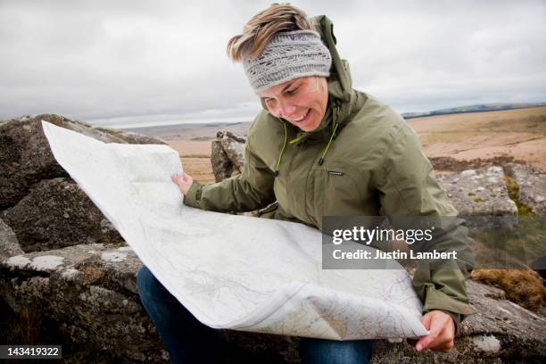
girl checks location on map on dartmoor - devon map stock pictures, royalty-free photos & imagesGIRL CHECKS LOCATION ON MAP ON DARTMOORUK, Only Women, 35-39 Years
two mixed race hikers on woodland path - devon map stock pictures, royalty-free photos & imagesTwo mixed race hikers on woodland pathHiking, UK, Red
old engraved map of plymouth, port city in south west england - devon map stock pictures, royalty-free photos & imagesOld engraved map of Plymouth, port city in South West EnglandPlymouth - England, England
old engraved map of plymouth harbour - devon map stock pictures, royalty-free photos & imagesOld engraved map of Plymouth Harbour
surgeon using stethoscope on globe - devon map stock pictures, royalty-free photos & imagessurgeon using stethoscope on globeHospital
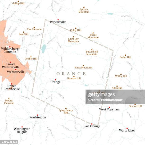
vt orange newbury vector road map - devon map stock illustrationsVT Orange Newbury Vector Road MapHaverhill - New Hampshire
Benjamin Donn Wall Map of Devonshire and Exeter, England.1765 Benjamin Donn Wall Map of Devonshire and ExeterExploration
Maps of the Spanish Armada , Two cards with the Spanish fleet in the Channel below the coast of Cornwall and Devon, within an ornamental frame. At...Maps of the Spanish Armada (16 and 21 July 1588), Two cards (I-II) with the Spanish fleet in the Channel below the coast of Cornwall and Devon, within an ornamental frame. At the top in the frame is a medallion with the portrait of Queen Elizabeth I, flan
Cornwall, Devon, Map of Cornwall and Devon in England, Fig. 18, p. 71, Gerhard Mercator, Jodocus Hondius, Jansson: Atlas minor Gerardi Mercatoris....England 4. Map : Cornwall
Guy Shrubsole, an environmental campaigner and author of The Lost Rainforests of Britain, checks the map on his phone as he walks through an area of...Britain's Lost RainforestMap, UK
Glassware - England - 20th century. Paperweight South Devon Exeter.Close-up of a paperweight, Exeter, England
Map of the World is projected onto a wall of water at Royal William Yard on November 27, 2019 in Plymouth, England. Illuminate is a free light...Mayflower 400 Launches With Illuminate 2019
An image of a map of the world is projected onto a wall of water during the light show at Royal William Yard on November 27, 2019 in Plymouth,...Mayflower 400 Launches With Illuminate 2019
An image of a map of the world is projected onto a wall of water during the light show at Royal William Yard on November 27, 2019 in Plymouth,...Mayflower 400 Launches With Illuminate 2019
An image of a map of the world is projected onto a wall of water during the light show at Royal William Yard on November 27, 2019 in Plymouth,...Mayflower 400 Launches With Illuminate 2019
Sophie Dingwall, one of of the 14 crew aboard S.V. TravelEdge at Sutton Harbour Marina, Plymouth, checks navigation maps at the helm, where an...Plastic Pollution research voyage
German captain Boris Herrmann looks at weather maps onboard the Malizia II sailing yacht at the Mayflower Marina in Plymouth, southwest England, on...BRITAIN-SWEDEN-ENVIRONMENT-CLIMATE-THUNBERG
Benjamin Donn Wall Map of Devonshire and Exeter, EnglandBenjamin Donn Wall Map of Devonshire and Exeter
Buglife's Vice President Nick Baker looks at a oil beetle as part of the first ever nationwide survey to map the location of the threatened and...The National Trust Conduct Their Oil Beetle Survey
Buglife's Vice President Nick Baker looks at a oil beetle as part of the first ever nationwide survey to map the location of the threatened and...The National Trust Conduct Their Oil Beetle Survey
People enjoy the fine weather on the coast at Wembury during the first ever nationwide survey to map the location of the threatened and creatures on...The National Trust Conduct Their Oil Beetle Survey
Oil beetle passes a path during the first ever nationwide survey to map the location of the threatened and creatures on March 24, 2011 in near...The National Trust Conduct Their Oil Beetle Survey
People enjoy the fine weather on the coast at Wembury during the first ever nationwide survey to map the location of the threatened and creatures on...The National Trust Conduct Their Oil Beetle Survey