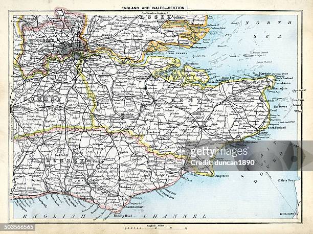
antique map of south east england - kent map stock illustrationsAntique map of South East EnglandMap, Kent - England, UK
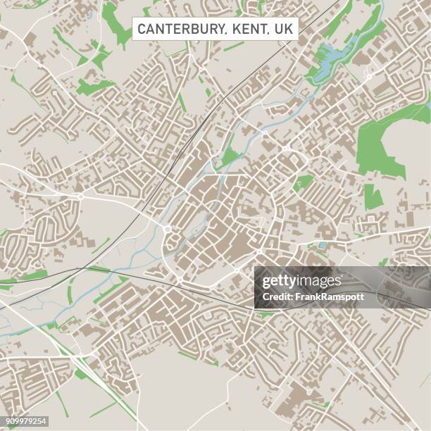
canterbury kent uk city street map - kent map stock illustrationsCanterbury Kent UK City Street MapKent - England, Map, Canterbury - England
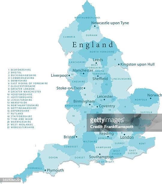
england vector map regions isolated - kent map stock illustrationsEngland Vector Map Regions IsolatedMap, England, UK
antique french map of channel tunnel projects - kent map stock illustrationsAntique French map of Channel Tunnel projectsMap, Retro Style, Old-fashioned
london - kent map stock pictures, royalty-free photos & imagesLondonMap, Essex - England, Kent - England
dover kent uk city street map - kent map stock illustrationsDover Kent UK City Street MapMap, Kent - England, Coastline
victorian plans for a channel tunnel between england and france, 1850s, 19th century - kent map stock illustrationsVictorian plans for a channel tunnel between England and France, 1850s, 19th CenturyMap, Dover - England, Channel Tunnel
antique map of the cinque ports in kent, england - 19th century - kent map stock illustrationsAntique Map of the Cinque Ports in Kent, England - 19th CenturyKent - England, Coastline, Map
map of kent and neighborhoods, england victorian engraving, 1840 - kent map stock illustrationsMap of Kent and Neighborhoods, England Victorian Engraving, 1840Map, Kent - England, UK
dover england 3d render aerial landscape view from south may 2019 - kent map stock pictures, royalty-free photos & imagesDover England 3D Render Aerial Landscape View From South May 2019Map, England, Rural Scene
map of the cinque ports (victorian engraving) - kent map stock illustrationsMap of the Cinque Ports (Victorian engraving)Kent - England, Map, Coastline
hand coloured antique map of sussex england - kent map stock illustrationsHand coloured antique map of Sussex EnglandMap, Brighton - England, Sussex
map of ramsgate and goodwin sands - kent map stock illustrationsMap of Ramsgate and Goodwin SandsMap, Kent - England, Retro Style
vt essex maidstone vector road map - kent map stock illustrationsVT Essex Maidstone Vector Road MapMap
ashford kent uk city street map - kent map stock illustrationsAshford Kent UK City Street MapKent - England, Map
ancient history, map of kent, england in roman times - kent map stock illustrationsAncient history, Map of Kent, England in Roman timesKent - England
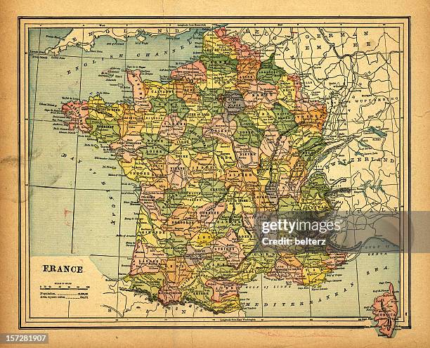
retro map of france - kent map stock pictures, royalty-free photos & imagesretro map of franceMap, France, Monaco
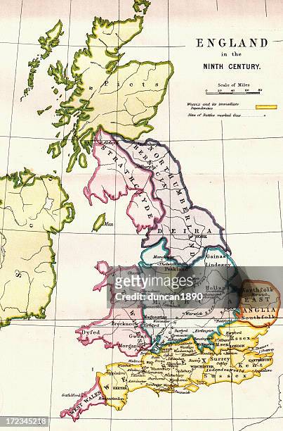
england in the ninth century - kent map stock illustrationsEngland in the Ninth CenturyMap, England, Medieval
British MP Winston Churchill in his study at Chartwell, his home near Westerham in Kent, late February 1939. Original Publication: Picture Post - 90...Churchill At Chartwell
ri kent coventry vector road map - kent map stock illustrationsRI Kent Coventry Vector Road MapMap, Kent - England
map of kent and neighborhoods, england victorian engraving, 1840 - kent map stock illustrationsMap of Kent and Neighborhoods, England Victorian Engraving, 1840Kent - England, Map
kent wa city vector road map blue horizontal - kent map stock illustrationsKent WA City Vector Road Map Blue Horizontal
oh portage county vector map green - kent map stock illustrationsOH Portage County Vector Map GreenKent - Ohio, Map
map of english channel and strait of dover showing maritime route between united kingdom, france. key shipping passage in north sea and celtic sea region. - kent map stock pictures, royalty-free photos & imagesMap of English Channel and Strait of Dover showing maritime route between United Kingdom, France. Key shipping passage in North Sea and Celtic Sea region.England, Map, UK
virginia roads and american foxhound - kent map stock illustrationsVirginia Roads and American FoxhoundVirginia - US State, Map, Williamsburg - Virginia
mi kent county vector map green - kent map stock illustrationsMI Kent County Vector Map GreenMichigan, Map, Kent County
Map outlining the Fox Project's coverage area hangs at their 'Den' office on September 06, 2024 in Paddock Wood, England. The Fox Project is a...The Emergency Service Rescuing UK's Bold And Beloved FoxesMap, UK, England
Napoleonic map. English Channel. Atlas de l'Histoire du Consulat et de l'Empire. History of the Consulate and the Empire of France under Napoleon by...English Channel.Map, English Channel, 19th Century
nh coos northumberland vector road map - kent map stock illustrationsNH Coos Northumberland Vector Road MapMap, Town, Northumberland
ancient history, map showing the straits of dover, coasts of gaul and britain, vintage illustration, - kent map stock illustrationsAncient history, Map showing the Straits of Dover, coasts of Gaul and Britain, Vintage illustration,
north dakota map with ladybug symbol - kent map stock illustrationsNorth Dakota Map with Ladybug SymbolMap, North Dakota, Insect
ct litchfield vector map green - kent map stock illustrationsCT Litchfield Vector Map GreenMap, Connecticut, Litchfield - Connecticut
map of the botanic gardens, christchurch - kent map stock pictures, royalty-free photos & imagesMap of the Botanic Gardens, ChristchurchCanterbury - England, Map, Canterbury Region New Zealand
north dakota travel map with cities and wildlife - kent map stock illustrationsNorth Dakota Travel Map with Cities and WildlifeMap, Cartoon, Western Meadowlark
Map showing the Heptarchy . The name applied to the Anglo-Saxon kingdoms of south, east, and central England during late antiquity and the early...Map showing the Heptarchy of Britain.Map, Anglo-saxon
Shields of Sussex, Kent and Essex from the Heptarchy; a collective name applied to the Anglo-Saxon kingdoms of south, east, and central England...Shields of Sussex, Kent and Essex from the Heptarchy; a collective name applied to the Anglo-Saxon kingdoms of south, east, and central England during late antiquity and the early Middle Ages
Map showing the Heptarchy . The name applied to the Anglo-Saxon kingdoms of south, east, and central England during late antiquity and the early...Map showing the Heptarchy (from the Greek hepta, seven). The name applied to the Anglo-Saxon kingdoms of south, east, and central EnglandAnglo-saxon, Map
virginia map with cowboy in covered wagon - kent map stock illustrationsVirginia Map with Cowboy in Covered WagonSymbol, USA, Fargo - North Dakota
north dakota map and american bison - kent map stock illustrationsNorth Dakota Map and American BisonMap, Cartoon
Rep. Madeleine Dean points to a map during the first hearing of the Task Force on the Attempted Assassination of Donald Trump in the Longworth House...House Task Force On Attempted Assassination Of Donald Trump Holds Capitol Hill HearingMap, Donald Trump - US President, Butler
Photograph taken on March 14, 2024 shows the map tracing the route that the Hybrid Ferry ship P&O Liberte took from its building site in China to the...BRITAIN-FRANCE-TRANSPORT-MARITIME-ENVIRONMENT-P&O
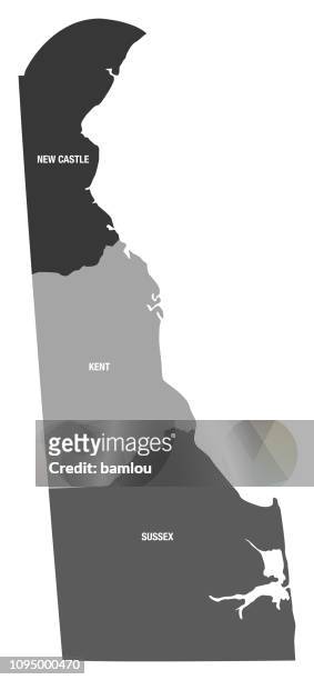
Political Map Of Delaware, Political Map Of The State Of Delaware Showing Counties, The State Capital, And County Seats.Political Map Of Delaware
kent wa city vector road map blue text - kent map stock illustrationsKent WA City Vector Road Map Blue TextWashington State, City
Fans use a map to find their way around the course during Day Two of The 149th Open at Royal St George’s Golf Club on July 16, 2021 in Sandwich,...The 149th Open - Day TwoMap, UK
People attend a rally out in front of the Supreme Court of the United States with the League of Women Voters on Wednesday, Dec. 7, 2022 in...Supreme Court Hears Oral Arguments In Moore v. HarperSupreme Court, U.S. Supreme Court
Landlord Sam Allen moves a barrel of beer outside the Halfway House pub in Brenchley, south east England, on April 9 ahead of the easing of...BRITAIN-HEALTH-VIRUSKent - England
detailed map of delaware state with county divisions - kent map stock illustrationsDetailed Map of Delaware State with County DivisionsMap, New Castle - Colorado, District
Political and physical map of the Levant, with colored sections marking the extent of Jewish territory in both the Persian and Greek periods,...Ancient Jewish LevantIsrael, Map
Plan of the coast of Kent from Ramsgate to Rye', 1740. Chart of the approaches to the Kent coast showing details of the coastal defences at Sandwich,...Plan Of The Coast Of Kent From Ramsgate To Rye,Sandwich, Ramsgate, England
Map of Canterbury, England, coloured engraving from De praecipuis totius universi urbibus, liber secundus by Georg Braun , Simon Novellanus and Franz...Map of Canterbury, England, colored engraving
Canterbury', circa 20th Century. [John Bartholomew & Son, Edinburgh]Artist John Bartholomew.CanterburyCanterbury - England, Map
Folkestone', circa 20th Century. [John Bartholomew & Son, Edinburgh]Artist John Bartholomew.Folkestone
folkestone kent uk city street map - kent map stock illustrationsFolkestone Kent UK City Street MapAerial View, Harbour, Folkestone
rochester kent uk city street map - kent map stock illustrationsRochester Kent UK City Street MapKent - England, UK
margate kent uk city street map - kent map stock illustrationsMargate Kent UK City Street MapMargate - England, Map