united kingdom topographic map isolated - orkney map stock pictures, royalty-free photos & imagesUnited Kingdom Topographic Map IsolatedMap, UK, England
united kingdom simple big map - orkney map stock illustrationsUnited Kingdom simple big mapMap, UK, England
antique map , sutherland, orkney, shetland islands, scotland, 19th century - orkney map stock illustrationsAntique Map , Sutherland, Orkney, Shetland Islands, Scotland, 19th CenturyMap, Orkney Islands, Scotland
Map showing the Scope of the Operations of the 10th Cruiser Squadron', First World War . Also known as the Northern Patrol, the squadron operated in...Map Showing The Scope Of The Operations Of The 10Th Cruiser Squadron1916Shetland Islands, Map, Faroe Islands
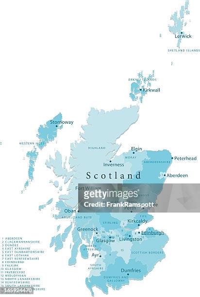
scotland vector map regions isolated - orkney map stock illustrationsScotland Vector Map Regions IsolatedScotland, Map, Shetland Islands
mid-victorian map of scotland - orkney map stock pictures, royalty-free photos & imagesMid-Victorian map of ScotlandMap, Scotland, Old-fashioned
uk map including north isles soft blue vector map illustration - orkney map stock illustrationsUk Map Including North Isles Soft Blue Vector Map IllustrationMap, UK, Physical Geography
Map of Scotland, 1902. Showing the various counties and islands including the Hebrides, the Shetlands and the Orkneys, and an inset of the rail...Map Of ScotlandMap, Shetland Islands, Scotland
antique map of shetland and orkney islands - orkney map stock illustrationsAntique map of Shetland and Orkney IslandsMap, Shetland Islands, Orkney Islands
South Orkney and South Shetlands Islands, Photograph of a map of the South Orkney and South Shetlands Islands. From "Voyage au Pole Sud et dans...South Orkney and South Shetlands Islands
The Kingdome of Scotland, engraved by Jodocus Hondius from 'Theatre of the Empire of Great Britain', pub. By John Sudbury and George Humble, 1610Private Collection
An 1826 map of Scotland shows district boundaries, settlements, roads, and topographical features. Also included are depictions of the Orkney Islands...Map of ScotlandScotland, Map
map from old french atlas: orkney and shetland - orkney map stock illustrationsMap from old French Atlas: Orkney and Shetland
map of scottish highlands and islands. - orkney map stock illustrationsMap of Scottish Highlands and Islands.Map, Scotland, Cairngorm Mountains
Map of the English and Scottish coast, from the Straits of Calais to Orkney, from the Recueil de Cartes Marines by Jean Baptiste Colbert, 1693.Map of the English and Scottish coastBook, Map
17th century map of the Orkney Islands. 'The Cheife Harbours in the Islands of Orkney'. Published by Greenvile Collins scale [1:63,360]17th Century Map Of The Orkney Islands
antique french cartography map of the british isles vintage engraving style decorative chart - orkney map stock pictures, royalty-free photos & imagesAntique French Cartography Map of the British Isles Vintage Engraving Style Decorative Chart
Map of Scotland, . Divided into counties, and also showing the Hebrides and Orkneys. Creator: John Cary.Map Of Scotland
uk map including north isles soft blue vector map illustration - orkney map stock illustrationsUk Map Including North Isles Soft Blue Vector Map IllustrationMap
Passport card from a part of the north east coast of Scotland and the Orkney Islands New Pascaert from the East Cust of Scotlandt Starting from...Passport card from a part of the north east coast of Scotland and the Orkney Islands New Pascaert from the East Cust of Scotlandt Starting from Barwyck to the Orcades Ylanden (title on object) part of the north east coast of Scotland and the Orkney IslandMap
Sea chart of part of north east coast of Scotland and the Orkney Islands, Jan Luyken, Johannes van Keulen I, unknown, 1681-1799.Sea chart of part of north east coast of Scotland and the Orkney IslandsOrkney Islands, God, Whale
Members of the Scottish community welcoming the stone Sydney.....Two of the stones.... A stone from Westray, in the Orkney isles. .Stone from the...Members of the Scottish community welcoming the stone Sydney.....Two of the stones.... A stone from Westray, in the Orkney isles. (as many rate callers informed us).Stone from the Hebrides carries map of islands on it.