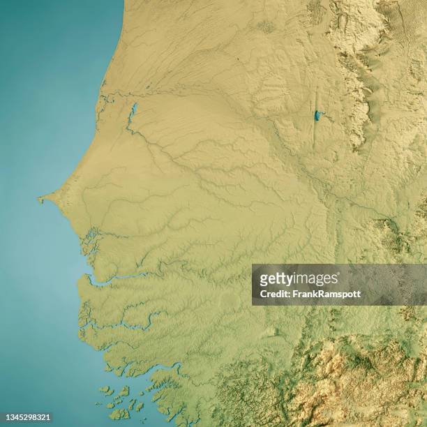
senegal 3d render topographic map color border - sahel map stock pictures, royalty-free photos & imagesSenegal 3D Render Topographic Map Color BorderMap, Sahel, Africa
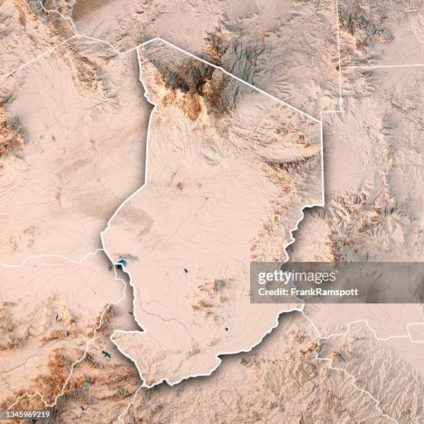
chad 3d render topographic map neutral border - sahel map stock pictures, royalty-free photos & imagesChad 3D Render Topographic Map Neutral BorderSahel, Map
Infographic with maps of the Sahel region in Africa showing the number of attacks or clashes involving jihadist groups in 2019 2023 and 2025SECURITY-JIHADIST-SAHEL-ATTACKS-AL QAEDA-ISLAMIC STATE-FATALITIES-GRAPHIC-MAPSSahel, Map, Africa
Terrorism remains a pressing issue globally, with the number of countries recording a terrorist incident increasing from 58 to 66 last year. Data...Mapped: The Deadliest Terrorist Attacks in 2024
Anti-France protests in Sahel do not stop" in Ankara, Turkiye on November 25, 2022. The protests in the Sahel region, organized occasionally since...Anti-France protests in Sahel do not stopBurkina Faso, Map
''Variations du Tchad; L'Ouest Africain', 1914. From "Grande Geographie Bong Illustree", 1914. Creator: Unknown.Variations Du Tchad; Louest Africain 19Map, 19th Century, Change
Infographic with a map of Mali and neighbouring countries showing the areas where Al-Qaeda, the Islamic State group, or jihadist groups affiliated...MALI-CONFLICT-JIHAD-AL-QAEDA-ISLAMIC STATE-BOKO HARAM-BURKINA FASO-GRAPHIC-MAPAl-Qaida, Sahel, Violence
''Zones de vegetation; L'Ouest Africain', 1914. From "Grande Geographie Bong Illustree", 1914. Creator: Unknown.Zones De Vegetation; Louest Africain 19Map, Africa, Sahel
senegal 3d render topographic map neutral - sahel map stock pictures, royalty-free photos & imagesSenegal 3D Render Topographic Map NeutralSenegal, Sahel, Map
Map showing the members of the Economic Community of West African States on January 29, after the exit of Mali, Niger and Burkina Faso, the three...MALI-BURKINA-NIGER-ECOWAS-TRADEMap, Mali, Nigeria
Infographic with map showing western and central Africa showing withdrawal of French military forces in the region, as of February 20, 2025ICOAST-FRANCE-DEFENCE-BASE-DIPLOMACY-SAHELMap, Africa, Côte d'Ivoire
Infographic with map of western and central Africa showing withdrawal of French military forces in the region, as of March 10SENEGAL-FRANCE-DEFENCE-BASE-DIPLOMACY-SAHEL-MAP-GRAPHICAfrica, French Military, Map
senegal 3d render topographic map color - sahel map stock pictures, royalty-free photos & imagesSenegal 3D Render Topographic Map ColorSenegal, Sahel, Topographic Map
Maps of Africa, Upper Guinea, and the Gold Coast, showing the site of the Ashantee War, 1873. 'The name of Guinea is applied to the whole of that...Maps Of AfricaMap, Ghana, Africa
Infographic with map of western and central Africa showing withdrawal of French military forces in the region, as of July 17, 2025SENEGAL-FRANCE-DEFENSE-BASE-DIPLOMACY-SAHEL-MAP-GRAPHICMap, French Military, Niamey
French President Emmanuel Macron sits next to a screen showing the flight plan and the African map as he arrives at Modibo Keita international...AFRICA-FRANCE-SAHEL-DEFENCE-JIHADISTSMap
Infographic with maps of the Sahel region in Africa showing the number of attacks or clashes involving jihadist groups in 2019 2023 and 2025MALI-JIHADISTS-KIDNAPPING-COUP-UNREST-MAP-GRAPHIC
An infographic titled "Mali's ancient city Timbuktu, known as pearl of desert, under siege again" created in Ankara, Turkiye on September 15, 2023....Mali's ancient city Timbuktu, known as pearl of desert, under siege again
Mansa Musa, King of Mali, holding a sceptre and a piece of gold as represented in the Catalan Atlas, by the Jewish illustrator Cresques Abraham, 1375.Spain/Catalonia: Mansa Musa, King of Mali, holding a sceptre and a piece of gold as represented in the Catalan Atlas, by the Jewish illustrator Cresques Abraham, 1375Mali, Catalonia
chad 3d render topographic map neutral - sahel map stock pictures, royalty-free photos & imagesChad 3D Render Topographic Map NeutralSahel, Lake Chad
This photograph shows a map of French army locations in Sahel, as French President delivers his speech after a meeting with leaders of the G5 Sahel,...FRANCE-AFRICA-POLITICS-SAHEL-G5Sahel, Map
French President Emmanuel Macron sits next to a screen showing the flight plan and the African map as he arrives at Modibo Keita international...AFRICA-FRANCE-SAHEL-DEFENCE-JIHADISTS
French President Francois Hollande flanked by French Defence Minister Jean-Yves Le Drian and French junior Minister for La Francophonie Annick...NIGER-FRANCE-DIPLOMACY
French President Francois Hollande flanked by French Defence Minister Jean-Yves Le Drian and French junior Minister for La Francophonie Annick...NIGER-FRANCE-DIPLOMACY
Infographic with a map of the operational areas of jihadist groups affiliated with Al-Qaeda or the Islamic State in the Sahel and around Lake Chad,...SAHEL-ISLAMIC STATE-TERRORISM-JIHADISM-WEST AFRICA-CONFLICT-AL QAEDA-INFOGRAPHICS
Map of the Sahel region. For a story moving late on Wednesday on how climate change could transform the Sahel into a wet region.SAHEL-SCIENCE-ENVIRONMENT-CLIMATE-WARMING-AFRICA-WATER-WEATHER
Map showing France and Algeria and the countries in the Sahel-Saharan region.ALGERIA-FRANCE-DIPLOMACY-MALÍ
Map of Sahel region showing zones and populations currently in food crisis,and projections for June to August 2021.EPIDEMIC-virus-HEALTH-SAHEL-FOOD-agriculture-diplomacy-aid-famine
Map of the "three-border" region which includes Mali, Niger and Burkina Faso, site of many violent attacks.MALI-Niger-BURKINA-SAHEL
Map showing the security situation in the Sahel, the French-led Operation Barkhane and international forcesNIGER-MALI-UNREST-BURKINA-MAURITANIA-CHAD-Sahel-France-MILITARY
Map of Mali locating Bounti, the village where the French army is accused by local villagers of attacking civilians.FRANCE-MALI-ATTACK-ARMY
Map locating command posts and deployments by the G5 Sahel Joint Force.Mali-Niger-Burkina-MAURITANIA-CHAD-France-CONFLICT-ARMY
Map of Sahel region showing zones and populations currently in food crisis,and projections for June to August 2020.EPIDEMIC-virus-HEALTH-SAHEL-FOOD
Map of Mali, Niger and Burkina Faso, locating the region where jihadist attacks have been intensifying.SAHEL-UNREST-DIPLOMACY-FRANCE-conflict-defence-politics
Carte localisant la région dite des "trois frontières", aux confins du Mali, du Niger et du Burkina FasoMALI-NIGER-BURKINA-CONFLICT-SAHEL-army-FRANCE
Map of Mali, Niger and Burkina Faso, locating deaths in fighting involving jihadists since Nov 1.MALI-NIGER-BURKINA-CONFLICT-SAHEL-FRANCE
Map of hunger-affected areas in West Africa, according to the Food Crisis Prevention Network . Situation at the end of 2019 and projections for 2020AFRICA-HUNGER-UNREST-SAHEL-FAMINE-FOOD
Map of Western and Central Africa showing foreign-operated mines in Mali, Burkina Faso and NigerSAHEL-MALI-NIGER-BURKINA-CANADA-MINES-GOLD-COUP-ARMY
Map of Western and Central Africa showing withdrawal of French military forces in the region, as of December 2, 2024SENEGAL-CHAD-FRANCE-SAHEL-DIPLOMACY-DEFENCE
Map of Africa showing the American and French military present in the Sahel region in 2023.NIGER-POLITICS-CHAD-MALI-BURKINA FASO
Map locating jihadist attacks attributed to the Islamic State group or other jihadist groups since 2021 to July 21, 2023 in the Sahel region.Niger-POLITICS-CONFLICT-France-JIHADIST-DIPLOMACY
Map of the central Sahel showing medium-term food security forecast for Burkina Faso, Mali and Niger, according to Fews net.AFRICA-MALNUTRITION-SAHEL-CHILDREN
Map of the central Sahel showing medium-term food security forecast for Burkina Faso, Mali and Niger, according to Fews net. Ten million children in...Unicef-SAHEL-children-aid
Infographic with a map of Mali and neighbouring countries showing the areas where Al-Qaeda, the Islamic State group, or jihadist groups affiliated...MALI-CONFLICT-JIHAD-AL-QAEDA-ISLAMICSTATE-BOKOHARAM-BURKINAFASO-GRAPHIC-MAP
An old map depicting the movement of troops is seen at the "Maison des combattants" next to the central market in N'Djamena on December 5, 2024....CHAD-FRANCE-DIPLOMACY
burkina faso - set of flags pin icons for map. flat collection. - sahel map stock illustrationsBurkina Faso - Set of flags pin icons for map. Flat collection.
''Races de l'Afrique occidentale; L'Ouest Africain', 1914. From "Grande Geographie Bong Illustree", 1914. Creator: Unknown.Races De Lafrique Occidentale; Louest Africain 191
''Le Sahel d'Alger et la Mitidja; Afrique du nord', 1914. From "Grande Geographie Bong Illustree", 1914. Creator: Unknown.Le Sahel Dalger Et La Mitidja; Afrique Du Nord 19
''La Sahel d'Oran et la Grande Sebkha; Afrique du nord', 1914. From "Grande Geographie Bong Illustree", 1914. Creator: Unknown.La Sahel Doran Et La Grande Sebkha; Afrique Du Nord 19
Tuaregs and Moorish tents as represented in the Catalan Atlas, by the Jewish illustrator Cresques Abraham, 1375.Spain/Catalonia: Tuaregs and Moorish tents as represented in the Catalan Atlas, by the Jewish illustrator Cresques Abraham, 1375Catalonia, Mali