plan of hisarlik (troy), wood engraving, published in 1880 - troy map stock illustrationsPlan of Hisarlik (Troy), wood engraving, published in 1880Map, Troy - Alabama, Heinrich Schliemann
troy mi city vector road map blue horizontal - troy map stock illustrationsTroy MI City Vector Road Map Blue HorizontalTroy - Michigan, Michigan
map of the archaeological excavations of troy, woodcut, published 1897 - troy map stock illustrationsMap of the archaeological excavations of Troy, woodcut, published 1897Heinrich Schliemann, Archaelogical Site of Troy, Map
Cartography, 19th century. Map of Troy, the acropolis of the second city, drawing by Heinrich Schliemann, 1882.Map of Troy, acropolis of second city, drawing by Heinrich Schliemann, 1882Archaeology, Heinrich Schliemann, Archaelogical Site of Troy
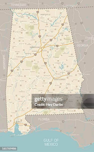
alabama state travel map - troy map stock illustrationsAlabama State Travel MapAlabama - US State, Map, Famous Place
alabama state travel map - troy map stock illustrationsAlabama State Travel MapAlabama - US State, Map, Cartoon
Cartography, 19th century. Map of Troy, the acropolis of the second city, excavations, 1871-1882. Drawing, 1883.Map of Troy, acropolis of second city, excavations, drawing, 1883Archaelogical Site of Troy, Archaeology, Map
pontiac mi area 120k vector road map blue - troy map stock illustrationsPontiac MI Area 120K Vector Road Map Blue
oakland county mi satellite topographic map 3d render color - troy map stock pictures, royalty-free photos & imagesOakland County MI Satellite Topographic Map 3D Render ColorMap
Map of the world according to Homer. From Cassell's Universal History, published 1888.Map of the world according to HomerAncient
Asia Minor: A View Of Troy & The Adjacent Country, pointing out the spots where the Various Battles were fought as mentioned in Homers Iliad.Map of Ancient TroyArt, Map
oakland county mi satellite topographic map 3d render isolated black color - troy map stock pictures, royalty-free photos & imagesOakland County MI Satellite Topographic Map 3D Render Isolated Black Color
oakland county mi satellite topographic map 3d render isolated color - troy map stock pictures, royalty-free photos & imagesOakland County MI Satellite Topographic Map 3D Render Isolated Color
archaeological plan of the citadel of troy (hisarlik), created based on the excavations of heinrich schliemann and his collaborator wilhelm dörpfeld - troy map stock illustrationsArchaeological plan of the citadel of Troy (Hisarlik), created based on the excavations of Heinrich Schliemann and his collaborator Wilhelm DörpfeldGreek Culture
tx bell county vector map green - troy map stock illustrationsTX Bell County Vector Map GreenMap, Texas
rensselaer county, new york maps for design. easily editable - troy map stock illustrationsRensselaer County, New York maps for design. Easily editable
doniphan county, kansas. map with blue and red people - troy map stock illustrationsDoniphan County, Kansas. Map with blue and red PeopleAmerican Culture, Map, People
Map showing new 100,000-square-foot science center building site at Hudson Valley Community College in Troy Thursday morning January 21, 2010.Albany Times UnionMap
An 1851 Sidney map of Albany, Troy and vicinity in the office of Colonie town historian Kevin Franklin Wednesday Jan. 14 in Colonie, NY.Albany Times Union
türkiye alphabet for children - troy map stock illustrationsTürkiye Alphabet for childrenPoster, Bursa - Turkey, Learning
Globe within a Globe makes Teaching Astronomy Easier The gazer at the exhibit at the National Association of Science Teachers convention in City...Denver Post Archives
Pupils Need Map in New School School administrators took the precaution of posting a relief map on a central bulletin' board when the new Lyn Knoll...Denver Post Archives
rensselaer county, new york map. round icon with long shadow on red or blue background - troy map stock illustrationsRensselaer County, New York map. Round icon with long shadow on red or blue background
pike county, alabama map. round icon with long shadow on red or blue background - troy map stock illustrationsPike County, Alabama map. Round icon with long shadow on red or blue background
miami county, ohio map. round icon with long shadow on red or blue background - troy map stock illustrationsMiami County, Ohio map. Round icon with long shadow on red or blue background
lincoln county, missouri map. round icon with long shadow on red or blue background - troy map stock illustrationsLincoln County, Missouri map. Round icon with long shadow on red or blue background
montgomery county, north carolina map. round icon with long shadow on red or blue background - troy map stock illustrationsMontgomery County, North Carolina map. Round icon with long shadow on red or blue background
doniphan county, kansas map. round icon with long shadow on red or blue background - troy map stock illustrationsDoniphan County, Kansas map. Round icon with long shadow on red or blue background
edwardsville il area 150k vector road map blue - troy map stock illustrationsEdwardsville IL Area 150K Vector Road Map Blue
edwardsville il area 150k vector road map beige - troy map stock illustrationsEdwardsville IL Area 150K Vector Road Map Beige
pontiac mi area 120k vector road map beige - troy map stock illustrationsPontiac MI Area 120K Vector Road Map Beige
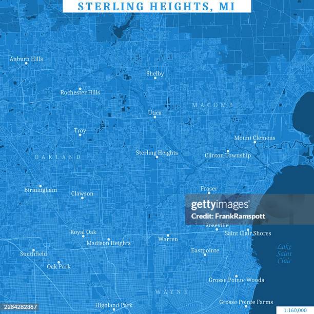
sterling heights mi area 160k vector road map blue - troy map stock illustrationsSterling Heights MI Area 160K Vector Road Map Blue
sterling heights mi area 160k vector road map beige - troy map stock illustrationsSterling Heights MI Area 160K Vector Road Map Beige
map from old french atlas: ancient greece details - troy map stock illustrationsMap from old French Atlas: Ancient Greece details
doniphan county, kansas map with location pins on white background - troy map stock illustrationsDoniphan County, Kansas Map with location pins on white Background
montgomery county, north carolina map with location pins on white background - troy map stock illustrationsMontgomery County, North Carolina Map with location pins on white Background
miami county, ohio map with location pins on white background - troy map stock illustrationsMiami County, Ohio Map with location pins on white Background
pike county, alabama map with location pins on white background - troy map stock illustrationsPike County, Alabama Map with location pins on white Background
rensselaer county, new york map with location pins on white background - troy map stock illustrationsRensselaer County, New York Map with location pins on white Background
lincoln county, missouri map with location pins on white background - troy map stock illustrationsLincoln County, Missouri Map with location pins on white Background
oakland county mi satellite topographic map 3d render color border - troy map stock pictures, royalty-free photos & imagesOakland County MI Satellite Topographic Map 3D Render Color BorderMichigan, Lake Orion - Michigan
oakland county mi satellite landscape view 3d render color - troy map stock pictures, royalty-free photos & imagesOakland County MI Satellite Landscape View 3D Render Color
lincoln county, missouri maps for design. easily editable - troy map stock illustrationsLincoln County, Missouri maps for design. Easily editable
pike county, alabama maps for design. easily editable - troy map stock illustrationsPike County, Alabama maps for design. Easily editable
miami county, ohio maps for design. easily editable - troy map stock illustrationsMiami County, Ohio maps for design. Easily editable
doniphan county, kansas maps for design. easily editable - troy map stock illustrationsDoniphan County, Kansas maps for design. Easily editable
montgomery county, north carolina maps for design. easily editable - troy map stock illustrationsMontgomery County, North Carolina maps for design. Easily editable
doniphan county, kansas. 3d map on gray background - troy map stock illustrationsDoniphan County, Kansas. 3D Map on gray background
miami county, ohio. 3d map on gray background - troy map stock illustrationsMiami County, Ohio. 3D Map on gray background
pike county, alabama. 3d map on gray background - troy map stock illustrationsPike County, Alabama. 3D Map on gray background
rensselaer county, new york. 3d map on gray background - troy map stock illustrationsRensselaer County, New York. 3D Map on gray background
montgomery county, north carolina. 3d map on gray background - troy map stock illustrationsMontgomery County, North Carolina. 3D Map on gray background
lincoln county, missouri. 3d map on gray background - troy map stock illustrationsLincoln County, Missouri. 3D Map on gray background