digital relief map of australia and asia with animated air and sea traffic light trails - flight paths map stock videos & royalty-free footage00:20Digital relief map of Australia and Asia with animated air and sea traffic light trailsMap, Pacific Ocean, Global Business
digital map of europe with animated air and sea traffic - flight paths map stock videos & royalty-free footage00:20Digital map of Europe with animated air and sea trafficMap, Europe, Country - Geographic Area
digital battlefield map of europe with nato military unit symbols and missile trails - flight paths map stock videos & royalty-free footage00:18Digital battlefield map of Europe with NATO military unit symbols and missile trailsMap, Allied Forces, World Map
digital battlefield infographic map of europe, with animated ballistic missile light trails - flight paths map stock videos & royalty-free footage00:18Digital battlefield infographic map of Europe, with animated ballistic missile light trailsWar, Military, Map
digital battlefield map of europe, with tactical military symbols and animated ballistic missile light trails - flight paths map stock videos & royalty-free footage00:20Digital battlefield map of Europe, with tactical military symbols and animated ballistic missile light trailsNuclear Weapon, Animated Video, Europe
strategic map of the united states, with animated ballistic missile light trails, pinned locations and radioactive infographic overlay - flight paths map stock videos & royalty-free footage00:20Strategic map of the United States, with animated ballistic missile light trails, pinned locations and radioactive infographic overlayNuclear Weapon, War, Apocalypse
digital traffic map of australia and asia with name tags, animated light trails and shipping routes - flight paths map stock videos & royalty-free footage00:20Digital traffic map of Australia and Asia with name tags, animated light trails and shipping routesMap, Global Positioning System, Digital Animation
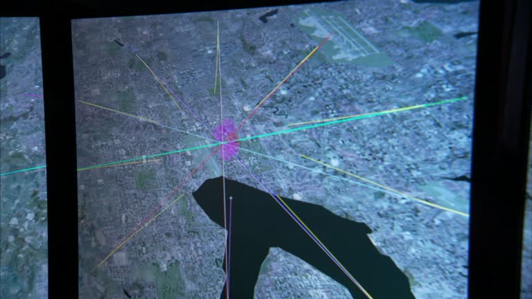
lines on a map show intersecting flight paths. - flight paths map stock videos & royalty-free footage00:22Lines on a map show intersecting flight paths.Map
lines on a map show intersecting flight paths. - flight paths map stock videos & royalty-free footage00:14Lines on a map show intersecting flight paths.Map
at an airbase in washington, d.c., several martin b-10 bomber airplanes are seen parked. followed by lieutenant colonel henry harley "hap" arnold... - flight paths map stock videos & royalty-free footage00:26Lieutenant Colonel Henry Harley Arnold instructs flightpath to U.S. Air Force pilots, Washington, D.C., U.S.A., 1934Henry H. Arnold, USA, Map
digital battlefield map focused on iran, with nato military unit symbols and animated ballistic missile launches - flight paths map stock videos & royalty-free footage00:20Digital battlefield map focused on Iran, with NATO military unit symbols and animated ballistic missile launchesIran, Map, Middle East
flight path tracking from north america to south east asia over the atlantic ocean. 3d animation - flight paths map stock videos & royalty-free footage00:11Flight path tracking from North America to South East Asia over the Atlantic Ocean. 3D animationAeroplane, Travel Destinations, Passenger
ballistic launch event over iran, with nato military unit symbols, animated missile paths and blinking crosshair - flight paths map stock videos & royalty-free footage00:20Ballistic launch event over Iran, with NATO military unit symbols, animated missile paths and blinking crosshairWar, Iran, Missile
digital map of iran with military tactical symbols and ballistic missile effects - flight paths map stock videos & royalty-free footage00:12Digital map of Iran with military tactical symbols and ballistic missile effectsIran, Map, Nuclear Weapon
digital map of iran with a crosshair effect and animated jet flight trails - flight paths map stock videos & royalty-free footage00:12Digital map of Iran with a crosshair effect and animated jet flight trailsIran, Nuclear Weapon, Missile
digital traffic map of the americas with animated air and sea paths and country names - flight paths map stock videos & royalty-free footage00:24Digital traffic map of the Americas with animated air and sea paths and country namesMap, World Map, Globe - Navigational Equipment
digital battlefield map of us - venezuela naval conflict, with a navy blockade and missile launches. - flight paths map stock videos & royalty-free footage00:12Digital battlefield map of US - Venezuela naval conflict, with a navy blockade and missile launches.Venezuela, Military Invasion, Map
digital traffic map of the world with country name tags, animated flight trails and shipping routes - flight paths map stock videos & royalty-free footage00:20Digital traffic map of the world with country name tags, animated flight trails and shipping routesGlobe - Navigational Equipment, World Map, Map
digital battlefield map of russia - ukraine conflict with national flags, military unit symbols and massive missile attack. - flight paths map stock videos & royalty-free footage00:20Digital battlefield map of Russia - Ukraine conflict with national flags, military unit symbols and massive missile attack.Ukraine, Military Invasion, Map
severe weather is expected to impact large portions of the united states this week, with violent thunderstorms forecast to sweep across the... - flight paths map stock videos & royalty-free footage00:14MOTION GRAPHIC - Severe storms to slam large parts of U.S.; tornadoes, hail and flooding possibleTornado, Map
strategic digital map of europe, with animated ballistic missile light trails and infographics overlay - flight paths map stock videos & royalty-free footage00:18Strategic digital map of Europe, with animated ballistic missile light trails and infographics overlayGlobe - Navigational Equipment, Politics, World Map
strategic map of europe, with animated ballistic missile light trails, pinned locations and infographic overlay - flight paths map stock videos & royalty-free footage00:18Strategic map of Europe, with animated ballistic missile light trails, pinned locations and infographic overlayMap, Animated Video, Europe
strategic digital map of north america, with animated ballistic missile light trails and radioactive warning - flight paths map stock videos & royalty-free footage00:18Strategic digital map of North America, with animated ballistic missile light trails and radioactive warningNuclear Weapon, Radioactive Contamination, Missile
sholto douglas, 1st baron douglas of kirtleside, and map showing the air routes of british airways / united kingdom - flight paths map stock videos & royalty-free footage00:111950 MONTAGE Sholto Douglas, 1st Baron Douglas of Kirtleside, and map showing the air routes of British Airways / United KingdomMap
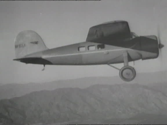
flashes over a map of amelia earhart's flight path across the pacific ocean. - flight paths map stock videos & royalty-free footage00:02SOS flashes over a map of Amelia Earhart's flight path across the Pacific Ocean.Amelia Earhart - Aviator, Map
ameila earhart flies across the pacific ocean. - flight paths map stock videos & royalty-free footage00:58Ameila Earhart flies across the Pacific Ocean.Amelia Earhart - Aviator, Map
map of world, showing brazil's strategic position, air routes. wwii - flight paths map stock videos & royalty-free footage00:07Map Brazil position air routeMap
flight path animation on a map in an industrial film for trans world airlines promoting the airline's operations, transatlantic flights and... - flight paths map stock videos & royalty-free footage00:06TWA Overseas Run, 81 of 152Map
battlefield animation of us navy carrier task force in conflict with the country of venezuela - flight paths map stock videos & royalty-free footage00:14Battlefield animation of US Navy carrier task force in conflict with the country of VenezuelaVenezuela, Caribbean Sea, Air Raid
strategic map of asia pacific, with animated ballistic missile light trails, pinned locations and radioactive infographic overlay - flight paths map stock videos & royalty-free footage00:20Strategic map of Asia Pacific, with animated ballistic missile light trails, pinned locations and radioactive infographic overlayMissile, Technology, Nuclear Weapon
migration of birds: the canada goose - part 2 of 18. illustrates the yearly cycle of this migrating bird, presenting facts and theories about the phenomenon of migration. follows a spring flight to southern canada, and closes the migration back to the mil - flight paths map stock videos & royalty-free footage00:31Migration of Birds: The Canada Goose - part 2 of 18. Illustrates the yearly cycle of this migrating bird, presenting facts and theories about the phenomenon of migration. Follows a spring flight to southern Canada, and closes the migration back to the milAnimal Migration, Bird, Canada
map of middle eastern sea and air routes as well as sources of oil / united kingdom - flight paths map stock videos & royalty-free footage00:16CGI Map of Middle Eastern sea and air routes as well as sources of oil / United KingdomStudio Shot, 1950-1959
airplane releasing anti-locust insecticide spray - flight paths map stock videos & royalty-free footage00:33MONTAGE Airplane releasing anti-locust insecticide spray
envelopes with addresses around the world, and maps showing air routes to asia and africa from london / england, united kingdom - flight paths map stock videos & royalty-free footage00:26B/W Envelopes with addresses around the world, and maps showing air routes to Asia and Africa from London / England, United Kingdom
strategists planning air raid on tokyo using large gridded map of japan, with colored threads representing flight paths being rearranged by plotting... - flight paths map stock videos & royalty-free footage01:00MONTAGE USAAF strategists planning air raid on Tokyo using large gridded map of Japan, with colored threads representing flight paths being rearranged by plotting officer / Mariana Islands
an animated map demonstrates the flight path of the us marines landing on iwo jima. - flight paths map stock videos & royalty-free footage00:08An animated map demonstrates the flight path of the US Marines landing on Iwo Jima.
air support routes marked from key cities calcutta chung king kunming. spoked flight areas covering asian coastline. - flight paths map stock videos & royalty-free footage00:08US Air Support mapCoastline
map of spain portugal & north africa. spanish morocco oran & algiers highlighted. - flight paths map stock videos & royalty-free footage00:11Map Spain and North Africa
twin engine bomber taxiing on runway. map: air routes from chicago over canada to london moscow tokyo vladivostok. - flight paths map stock videos & royalty-free footage00:16Air routes over Canada
british men looking at british map showing jarvis baker & howland islands as british property. tokyo: naval officers worried near their marshall... - flight paths map stock videos & royalty-free footage01:12British, Japanese, Australian menMarshall Islands, Japan, 1930-1939
an officer stands at attention / soldiers march down the street / a plane drops parachuters / parachuters fly though the air with their shoots... - flight paths map stock videos & royalty-free footage00:42Things That Happened In The year 1934
close-up of man's hands operating a drone remote controller displaying aerial navigation on screen - flight paths map stock videos & royalty-free footage00:08Close-Up of Man's Hands Operating a Drone Remote Controller Displaying Aerial Navigation on Screen
advanced white drone hovers steadily over a green field against a bright blue sky - flight paths map stock videos & royalty-free footage00:10Advanced White Drone Hovers Steadily Over a Green Field Against a Bright Blue Sky
hands measure the distance on a globe; low-pressure weather animation on a map in an industrial film for trans world airlines promoting the airline's... - flight paths map stock videos & royalty-free footage00:12TWA Overseas Run, 67 of 152
flight path animation on a map in an industrial film for trans world airlines promoting the airline's operations, transatlantic flights and... - flight paths map stock videos & royalty-free footage00:27TWA Overseas Run, 68 of 152
us navy submarine and technical ai warfare - flight paths map stock videos & royalty-free footage00:06US Navy Submarine and Technical AI WarfareFuturistic, Surveillance
. black and white footage shows an animated map of europe illustrating allied shuttle bombing routes into nazi germany, followed by command scenes... - flight paths map stock videos & royalty-free footage04:41World War II Operation Frantic Logistics Showing Allied Supply Routes Airbase Setup and Bomber Mission Planning
digital battlefield map of us - venezuela naval conflict with missile launches. - flight paths map stock videos & royalty-free footage00:10Digital battlefield map of US - Venezuela naval conflict with missile launches.Air Raid, Caribbean
massive missile attack by russia on ukraine - battlefield map - flight paths map stock videos & royalty-free footage00:14Massive missile attack by Russia on Ukraine - battlefield mapUkraine, Ballistic Missile, Europe
amelie sonnenleitner , a master’s student in geomorphology at the university of salzburg, monitors the semi-autonomous flight of a drone as robert... - flight paths map stock videos & royalty-free footage00:13Scientists Use Drones To Collect Detailed Data At Schmiedingerkees Glacier
"moscow hails airmen who flew arctic," paramount news at bottom / title card: "first pictures to reach us of 56-hour non-stop flight of russian... - flight paths map stock videos & royalty-free footage01:37Russian airmen Chkalov, Baydukov, Belyakov after transarctic flight; greeted by Soviet leader Stalin and given parade
people on ground seen through underside of airplane / pilot valery chkalov, co-pilot georgy baydukov and navigator alexander belyakov, people behind... - flight paths map stock videos & royalty-free footage02:01Russian airmen Chkalov, Baydukov, Belyakov after transarctic flight; greeted by Joseph Stalin and given parade in MoscowCigarette, Aeroplane, Joseph Stalin
digital relief map of the americas with animated air and sea traffic light trails - flight paths map stock videos & royalty-free footage00:24Digital relief map of the Americas with animated air and sea traffic light trails
digital battlefield map of north america, with animated ballistic missile light trails and infographic overlay - flight paths map stock videos & royalty-free footage00:18Digital battlefield map of North America, with animated ballistic missile light trails and infographic overlay
[part of the "wings of a continent" documentary from the "canada carries on" series; narration by lorne greene] / soldiers with searchlights, looking... - flight paths map stock videos & royalty-free footage00:55Canada envisions new air future during World War II; documentary narrated by Lorne GreeneGlobe - Navigational Equipment, War, Newsreel
"world plane crashes - new york-globe circling flight ends in crack-up. john henry mears and pilot brown discuss attempt to set new record" / john h.... - flight paths map stock videos & royalty-free footage01:47John Henry Mears details around-the-world flight; he and Brown take off from maybe Roosevelt Field
egyptian army reconstructs suez crossing; israel / egypt border: sinai:bv tanks deploying battle formation pull outgv as tanks fire l-r onto move... - flight paths map stock videos & royalty-free footage04:43Egyptian Army Reconstructs Suez CrossingEgypt, Missile, Israel
migration of birds: the canada goose - part 3 of 18. illustrates the yearly cycle of this migrating bird, presenting facts and theories about the phenomenon of migration. follows a spring flight to southern canada, and closes the migration back to the mil - flight paths map stock videos & royalty-free footage00:30Migration of Birds: The Canada Goose - part 3 of 18. Illustrates the yearly cycle of this migrating bird, presenting facts and theories about the phenomenon of migration. Follows a spring flight to southern Canada, and closes the migration back to the milMap, Bird, Animal Migration
alaska: the 49th state (2nd edition) - part 11 of 29. visualizing the natural beauty of alaska, and developments of the five geographic areas, showing the land, resources, the people and their work. surveys the rapidly growing cities, the homesteads, farm - flight paths map stock videos & royalty-free footage00:30Alaska: The 49th State (2nd edition) - part 11 of 29. Visualizing the natural beauty of Alaska, and developments of the five geographic areas, showing the land, resources, the people and their work. Surveys the rapidly growing cities, the homesteads, farmGlobe - Navigational Equipment, 1960-1969, Archival
president george w. bush hears a damage assessment following hurricane katrina. - flight paths map stock videos & royalty-free footage00:44President George W. Bush hears a damage assessment following Hurricane Katrina.Hurricane Katrina, Hurricane - Storm
dominic raab announces rescue flights for britons trapped abroad; england: london: westminster: downing street: 10 downing street:intgv dominic raab... - flight paths map stock videos & royalty-free footage00:36Coronavirus: Dominic Raab announces rescue flights for Britons trapped abroad
ukraine international airlines president yevhenii dykhne stands next to a screen with a map of ps-752 flight departure paths , during a... - flight paths map stock videos & royalty-free footage00:10Press Conference Of UIA About The Ukrainian Plane Crash In Iran
ukraine international airlines president yevhenii dykhne and vice-president for flight operations ihor sosnovskyi stand next to a screen with a map... - flight paths map stock videos & royalty-free footage00:18Press Conference Of UIA About The Ukrainian Plane Crash In Iran
screen with a map of ps-752 flight departure paths is seen , during a press-conference about the ukrainian boeing 737-800 plane crash in iran, at the... - flight paths map stock videos & royalty-free footage00:07Press Conference Of UIA About The Ukrainian Plane Crash In IranUkraine
ukraine international airlines president yevhenii dykhne and vice-president for flight operations ihor sosnovskyi stand next to a screen with a map... - flight paths map stock videos & royalty-free footage00:12Press Conference Of UIA About The Ukrainian Plane Crash In Iran
ukraine international airlines president yevhenii dykhne and vice-president for flight operations ihor sosnovskyi stand next to a screen with a map... - flight paths map stock videos & royalty-free footage00:14Press Conference Of UIA About The Ukrainian Plane Crash In Iran