digital battlefield map of europe with russia in red outline - fly over map stock videos & royalty-free footage00:20Digital battlefield map of Europe with Russia in red outlineMap, Russia, Europe
interstate highway in ohio - fly over map stock videos & royalty-free footage00:06Interstate highway in OhioCincinnati, Motorway Junction, Motorway
killarney, usa?; republic of ireland: county kerry: killarney:extcaptions: 'itn presents' and 'roving report' over tourists on horse-drawn carts and... - fly over map stock videos & royalty-free footage02:28ITN Roving Report: Killarney, USA?Map, Tunnel, USA
title card, "girl to fly ocean! new york - first woman to try hop across atlantic alone! ruth nichols tells plans in exclusive paramount news... - fly over map stock videos & royalty-free footage01:06Aviatrix Ruth Nichols discusses upcoming solo transatlantic flightMap
"total war?", "with an analysis by george fielding eliot" / squadrons of german warplanes fly over in formation / plane engine viewed from cockpit /... - fly over map stock videos & royalty-free footage02:21Hitler moves war to northern end of the Western Front, invading Belgium and the Netherlands during World War IINetherlands, World War II, France
serene highway with water reflections, coastal highway curve with peaceful water reflections at dusk - fly over map stock videos & royalty-free footage00:16Serene highway with water reflections, Coastal highway curve with peaceful water reflections at dusk
newspaper headline: " supremacy in air is hitler answer to british 'feeler'" / mcu nazi german chancellor adolf hitler and nazi military leader... - fly over map stock videos & royalty-free footage02:55A look at air power of US, Italy and Germany in 1930sNazism, Violence, 1930-1939
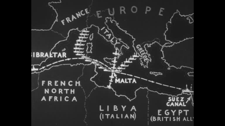
quick shot warship / map of africa, europe and the mediterranean sea with ship route map from gibraltar to suez canal over black then superimposed... - fly over map stock videos & royalty-free footage02:02Speculation of different countries' actions in the event of war between Italy and Ethiopia in 1935Suez Canal, Sea, UK
building on airfield marked "radio range," with tower in background / shaky flyover of that building and radio towers / men with chart; one uses a... - fly over map stock videos & royalty-free footage01:03Activity at air traffic control center, circa 1930Radio, USA
drone shot of young man looking at map, mountain and glacier view - fly over map stock videos & royalty-free footage00:12Drone shot of young man looking at map, mountain and glacier view
drone shot of young man looking at map, mountain and glacier view - fly over map stock videos & royalty-free footage00:11Drone shot of young man looking at map, mountain and glacier view
drone shot of young man looking at map, mountain and glacier view - fly over map stock videos & royalty-free footage00:11Drone shot of young man looking at map, mountain and glacier view
mt.fuji, sea and traffic on tomei expressway at dusk - fly over map stock videos & royalty-free footage00:07Mt.Fuji, sea and traffic on Tomei expressway at dusk
view of mt.fuji and tomei expressway at night time lapse - fly over map stock videos & royalty-free footage00:06View of Mt.Fuji and Tomei expressway at night time lapseTime Lapse, Japan
view of mt.fuji from satta-toge pass time lapse - fly over map stock videos & royalty-free footage00:12View of Mt.Fuji from Satta-toge pass time lapse
title cards and "asahi news" / flyover of shipping accident scene / animation map / boats crowded with people and capsized lifeboats / pan of people... - fly over map stock videos & royalty-free footage01:55Japanese shipping accidentShip
"christmas in the canal zone" superimposed over man dressed as santa claus handing out presents / vs ship coming through canal / two british patrol... - fly over map stock videos & royalty-free footage02:58British military patrolling Suez Canal zone in Egypt at Christmas time in 1950sSuez Canal, Egypt
"in 1926 began a series of daring flights breaking new aerial trails and changing our concept of time and space" / arctic explorer richard e. byrd,... - fly over map stock videos & royalty-free footage00:36Explorer Richard E. Byrd, pilot Floyd Bennett, and the "Josephine Ford" in 1926
jaguar squadron; scotland: lossiemouth:lms pan jaguars on tarmacms pilot in cockpitg/a two off r-lg/a one over r-lms pilot in cockpit zoom incs dials... - fly over map stock videos & royalty-free footage01:05Jaguar Squadron
low level training; cf tape no longer available for rushes see foot of fileengland, suffolk, honingtongv roofs of honington villagegv honington l-r... - fly over map stock videos & royalty-free footage03:36Focus on Britain: RAF low level training
"the national film board presents for the director of information" / turning globe with "canada carries on" / "in this issue, the strategy of metals"... - fly over map stock videos & royalty-free footage03:391940s Canadian wartime metals miningChild, Miner, Mining - Natural Resources
liberators fly low over fields from alexandria, egypt to the ploesti oil fields in romania. - fly over map stock videos & royalty-free footage00:16B24 Liberators fly low over fields from Alexandria, Egypt to the Ploesti oil fields in Romania.Egypt, Alexandria - Egypt
pointer traces route on map of south america to dakar / vs unid port; dock with boat passing; high angle view of coastline and palm trees / map... - fly over map stock videos & royalty-free footage00:55Mediterranean operations during World War IICoastline, Dakar
"kwajalein island" "...great combat pictures, by signal corps cameramen, of the invasion and capture of kwajalein island, in kwajalein atoll, the... - fly over map stock videos & royalty-free footage01:43US Marine Corps, Navy, and Army's Seventh Infantry attack as WWII battle begins against Japan in the Marshall IslandsKwajalein Atoll
"politics, ike, stevenson map campaigns" superimposed over figurines of elephant and donkey / mrs. india edwards, vice chairman of democratic... - fly over map stock videos & royalty-free footage01:23Stevenson in Chicago and Eisenhower in Colorado prepare for presidential campaign of 1952
"exclusive! the aussies over korea" superimposed over aerial korean terrain taken from airplane diving during korean war / vs ext house in japan, two... - fly over map stock videos & royalty-free footage02:26Australian Air Force pilot flies over KoreaAustralia, Landscape - Scenery, Japan
member of us air force walks out of building on airfield in korea carrying metal case / metal case with words on side saying "camera, aircraft type... - fly over map stock videos & royalty-free footage00:58US Air Force reconnaissance plane takes pictures during Korean War
plane fly over the earth - fly over map stock videos & royalty-free footage00:15Plane fly over the earth
sign 'briefing room.' dramatization: int man w/ stick pointing at map of caribbean sea pilots sitting fg. instructor 'nice long runway... some low... - fly over map stock videos & royalty-free footage00:20A.T.C. briefing
flying aerial drone close to austin texas capital hill skyline cityscape butler park highrise fly over - fly over map stock videos & royalty-free footage00:13Flying Aerial Drone Close to Austin Texas capital hill Skyline Cityscape Butler Park highrise Fly over
illustrated insects superimposed over usa 'mormon cricket grasshopper gutworm screw-worm fly armyworm boll weevil japanese beetle gypsy moth.' - fly over map stock videos & royalty-free footage00:12Map USA insectsMormonism, Cricket - Insect, Weevil
an officer stands at attention / soldiers march down the street / a plane drops parachuters / parachuters fly though the air with their shoots... - fly over map stock videos & royalty-free footage00:42Things That Happened In The year 1934
aerial view of tokyo / map of japan with arrows pointing to tokyo / aircraft carrier with planes and guns at sea / gun crews, including african... - fly over map stock videos & royalty-free footage02:07Carrier Based Planes Bomb TokyoWorld War II, 1945, Air Raid
group of us soldiers walking in front of kegon falls / soldier pointing / close up of falls / soldiers take pictures of japanese citizens in front of... - fly over map stock videos & royalty-free footage00:32Armistice Day Celebration Held For US Soldiers In JapanAeroplane, Stadium, Marching
map of europe, swastika explodes / adolf hitler and an officer stand, looking down at map on table / hitler moves among high command, shakes hands,... - fly over map stock videos & royalty-free footage01:26Beginning Of The End For The Axis In WWII - RetreatTojo Hideki, Nazi Swastika, Normandy
last hours of pantelleria's saturation bombing by allied strategic air force / map of island of pantelleria / aerial shot of the island / b-17... - fly over map stock videos & royalty-free footage00:34Final Air Assault On Island Of Pantelleria
paratroopers conditioning and sky graduation jumps in peru / map pinpointing peru / peruvian air force bomber flies over the countryside / soldiers... - fly over map stock videos & royalty-free footage00:46Paratroopers Training In PeruPeru, Aeroplane
map of aleutian islands, arrow on kiska, changes to include islands of attu and amchitka / line of curtiss p-40s on field / lockhead p-30... - fly over map stock videos & royalty-free footage00:41251st Air Raid Over KiskaWorld War II
the american air force hammers the final blow of the african conflict / a map of north african battlefields is shown / boston bombers fly in... - fly over map stock videos & royalty-free footage00:43Air Force Delivers Final Blow In Tunisia
american fighter planes fly over field in china / pilots holding chinese 'safe conduct' insignia with american flag flying in the background / pilot... - fly over map stock videos & royalty-free footage02:07Flying Tigers Join US Air Forces In China
map of pacific region with circle highlighting port moresby / japanese planes fly over ship with japanese flag / soldiers in control room overlooking... - fly over map stock videos & royalty-free footage01:24Japanese Air Raid On Port MoresbyPort Moresby, World War II, 1942
at navy headquarters men sitting and working in communications office / man working at wtj hawaii receives electronic communication and hands a paper... - fly over map stock videos & royalty-free footage01:21Navy Announces Victory at MidwayChester Nimitz
allied convoys set sail across atlantic and mediterranean sea to african coast / american and british navy forces head to french african coast /... - fly over map stock videos & royalty-free footage01:25US Navy Sets Sail to African Coast World War II
map of finland / soldiers march through wrecked city / prisoners of war are escorted by soldiers / wrecked tanks and artillery lay abandoned in a... - fly over map stock videos & royalty-free footage02:16Finland Fights Soviets For HankoFinland, Flamethrower, War
volunteer air observer badge / montage of skywatchers at a watch station scanning the skies, plane in sky, man calling in sighting, switchboard... - fly over map stock videos & royalty-free footage01:02Enemy Air Raid Drill at Mitchel Field
montage us b-29s fly over clouds / zoom in map of hiroshima with circle of light indicating zero point where bomb went off / mushroom cloud from... - fly over map stock videos & royalty-free footage00:29Atomic bomb mushroom cloud from 1945 Trinity test in New MexicoHiroshima Prefecture, Atomic Bombing Of Hiroshima, Bomb
crew member with explorer george h. wilkins's plane in fairbanks, ak / plane takes off / damaged plane with wheel off after test flight / byrd's ship... - fly over map stock videos & royalty-free footage00:33Explorers begin their 1926 quest to be the first to fly over the North PoleNorth Pole, Richard Byrd
world news titles (sting/intro) - fly over map stock videos & royalty-free footage00:30World News Titles (Sting/Intro)
world map blue glow low angle - fly over map stock videos & royalty-free footage00:13World Map Blue Glow Low Angle
invincible:; falklands : port stanley:airv ships and houses seenairv ship alongairv ships in harbourairv invincible at seaairv ditto zoomts harrier... - fly over map stock videos & royalty-free footage01:54Falklands: HMS Invincible:
romania - circa 1942-1945: . archival footage documents operation tidal wave during world war ii as the united states ninth air force prepares a... - fly over map stock videos & royalty-free footage02:17Operation Tidal Wave Showing Ploiesti Oil Field Bombing B24 Liberators and Strategic Air Raids
aerial mountain village forward flight over hillside settlement - fly over map stock videos & royalty-free footage00:22Aerial mountain village forward flight over hillside settlement
mountain landscape aerial forward motion over green valley and hills - fly over map stock videos & royalty-free footage00:13Mountain landscape aerial forward motion over green valley and hills
seoul, songpa-gu, aerial view of urban residential area with apartment complexes / south korea - fly over map stock videos & royalty-free footage00:21Seoul, Songpa-gu, aerial view of urban residential area with apartment complexes / South Korea
winter road intersection from above. aerial perspective showcasing wintry road junction among trees - fly over map stock videos & royalty-free footage00:09Winter road intersection from above. Aerial perspective showcasing wintry road junction among trees
winter scene with empty ramps. frozen landscape featuring vacant roads and snow drifts from above - fly over map stock videos & royalty-free footage00:23Winter scene with empty ramps. Frozen landscape featuring vacant roads and snow drifts from above
drone hovers above highway overpass and ramp, traffic flows beneath, urban development blocks and open land nearby, transport artery, infrastructure planning, commuter route, late afternoon light - fly over map stock videos & royalty-free footage00:07Drone hovers above highway overpass and ramp, traffic flows beneath, urban development blocks and open land nearby, transport artery, infrastructure planning, commuter route, late afternoon light
aerial drone cruises above major roadway, traffic moves both direction, industrial lot and suburb neighborhood below, wide horizon, infrastructure planning, mobility, construction, clear weather - fly over map stock videos & royalty-free footage00:23Aerial drone cruises above major roadway, traffic moves both direction, industrial lot and suburb neighborhood below, wide horizon, infrastructure planning, mobility, construction, clear weather
aerial drone flies above urban highway corridor, steady traffic streams toward city skyline, residential suburb blocks, commercial building, green zone, infrastructure planning, morning light - fly over map stock videos & royalty-free footage00:19Aerial drone flies above urban highway corridor, steady traffic streams toward city skyline, residential suburb blocks, commercial building, green zone, infrastructure planning, morning lightDrone
traffic moving on a snowy highway in the yenibosna district during dawn. - fly over map stock videos & royalty-free footage00:12Traffic moving on a snowy highway in the Yenibosna district during dawn.
overhead nighttime flight capturing focused lighting and monitoring highway infrastructure thoroughly - fly over map stock videos & royalty-free footage00:13Overhead nighttime flight capturing focused lighting and monitoring highway infrastructure thoroughly
capturing intricate design of highway with looping ramps and sparse greenery in warm evening light - fly over map stock videos & royalty-free footage00:15Capturing intricate design of highway with looping ramps and sparse greenery in warm evening light
elevated perspective showcasing complex highway ramps amidst sprawling residential and industrial areas - fly over map stock videos & royalty-free footage00:13Elevated perspective showcasing complex highway ramps amidst sprawling residential and industrial areas
high vantage point photograph showcasing urban traffic monitoring and safety infrastructure - fly over map stock videos & royalty-free footage00:22High vantage point photograph showcasing urban traffic monitoring and safety infrastructure
busy highway under winter skies, aerial shot of active street cutting through rural landscape - fly over map stock videos & royalty-free footage00:22Busy highway under winter skies, Aerial shot of active street cutting through rural landscape
shores of lake serre-ponçon, seen by drone - fly over map stock videos & royalty-free footage00:34Shores of Lake Serre-Ponçon, seen by drone
jeju-do, kbs broadcasting station / south korea - fly over map stock videos & royalty-free footage00:13Jeju-do, KBS broadcasting station / South Korea
jeju-do, kbs broadcasting station / south korea - fly over map stock videos & royalty-free footage00:29Jeju-do, KBS broadcasting station / South Korea
drone view of dhaka–mawa–bhanga expressway driving economic growth and trade connectivity - fly over map stock videos & royalty-free footage00:07Drone View of Dhaka–Mawa–Bhanga Expressway Driving Economic Growth and Trade Connectivity
drone view of dhaka–mawa–bhanga expressway – modern transport corridor of bangladesh - fly over map stock videos & royalty-free footage00:15Drone View of Dhaka–Mawa–Bhanga Expressway – Modern Transport Corridor of Bangladesh
4k footage time lapse tokyo cityscape at night. - fly over map stock videos & royalty-free footage00:134K footage Time lapse Tokyo Cityscape at Night.
4k footage time lapse tokyo cityscape at night. - fly over map stock videos & royalty-free footage00:144K footage Time lapse Tokyo Cityscape at Night.Skyscraper, Walking
vehicles were trapped under an overpass in houston, texas, as a deluge hammered the south of the city on sunday, august 31. the national weather... - fly over map stock videos & royalty-free footage02:25Cars Trapped Under Overpass as Deluge Hammers Houston
major roadway in southeastern tennessee was forced to close on tuesday, august 12, due to 'widespread flooding,' according to the state's... - fly over map stock videos & royalty-free footage00:30Whirlpool Forms on Southeastern Tennessee Interstate Amid Deadly Flash Flooding
drone equipped with ground penetrating radar launchse to fly over snow covering schmiedingerkees glacier at the kitzsteinhorn ski resort on june 11,... - fly over map stock videos & royalty-free footage00:21Scientists Use Drones To Collect Detailed Data At Schmiedingerkees Glacier
robert delleske, a geomorphologist and the unmanned aerial systems specialist at georesearch, stands on the visitor's platform at kitzsteinhorn... - fly over map stock videos & royalty-free footage00:08Scientists Use Drones To Collect Detailed Data At Schmiedingerkees Glacier
robert delleske , a geomorphologist and the unmanned aerial systems specialist at georesearch, amelie sonnenleitner , a master’s student in... - fly over map stock videos & royalty-free footage00:11Scientists Use Drones To Collect Detailed Data At Schmiedingerkees Glacier
family in washington and their pet dog were startled and intrigued when they spotted a bald eagle peering in the glass door of their lakeside home... - fly over map stock videos & royalty-free footage01:21What the Hell?': Family and Pet Dog Startled by Bald Eagle's Visit
"south sea explorers off in 14-ton plane" / title "san diego, calif." superimposed over pby-1 seaplane guba ii, owned by explorer richard archbold,... - fly over map stock videos & royalty-free footage02:51Millionaire zoologist Richard Archbold and members of expedition prepare seaplane in San Diego for flight to New Guinea