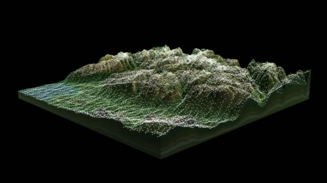
futuristic holographic terrain head up display, 3d landscape topography, futuristic user interface - geological mapping stock videos & royalty-free footage00:30Futuristic Holographic Terrain Head Up Display, 3D Landscape Topography, Futuristic User InterfaceGeology, 3D Animation, Surveyor
futuristic holographic terrain head up display, 3d landscape topography, futuristic user interface - geological mapping stock videos & royalty-free footage00:30Futuristic Holographic Terrain Head Up Display, 3D Landscape Topography, Futuristic User InterfaceSurveyor, Geology, Grid Pattern
[m] futuristic holographic terrain, 3d landscape topography, futuristic user interface - geological mapping stock videos & royalty-free footage00:16[M] Futuristic Holographic Terrain, 3D Landscape Topography, Futuristic User InterfaceGeology, Mountain, Black And White
[m] futuristic holographic terrain, 3d landscape topography, futuristic user interface - geological mapping stock videos & royalty-free footage00:16[M] Futuristic Holographic Terrain, 3D Landscape Topography, Futuristic User InterfaceTopography, 3D Animation, Three Dimensional
topography map hologram interface - geological mapping stock videos & royalty-free footage00:10Topography map hologram interfaceGeology, Topography, Map
topographic contour map, moving waves on black background - seamless loop background - 4k resolution - geological mapping stock videos & royalty-free footage00:51Topographic Contour Map, Moving Waves On Black Background - Seamless Loop Background - 4K ResolutionTopography, Topographic Map, Map
topography map interface - geological mapping stock videos & royalty-free footage00:10Topography map interfaceStriped, Topography, Topographic Map
earth satellite view of the usa and canada - geological mapping stock videos & royalty-free footage00:10Earth Satellite View of The USA and CanadaUSA, Geology, Map
pasadena, ca, u.s., dr. lucy jones explaining earthquake activity in southern californias, on thursday, july 4, 2019. - geological mapping stock videos & royalty-free footage00:39Dr. Lucy Jones explaining earthquake activity in Southern CaliforniaMap, Seismologist
3d landscape topography view - geological mapping stock videos & royalty-free footage00:153D Landscape topography ViewTopography, Digitally Generated Image, Landscape - Scenery
3d landscape topography view - geological mapping stock videos & royalty-free footage00:153D Landscape topography ViewMap, Physical Geography, Data
group of friends hiking in the mountains. sitting around a map and planning their journey - geological mapping stock videos & royalty-free footage00:10Group of friends hiking in the mountains. Sitting around a map and planning their journeyGeology, Map
continental drift: the theory of plate tectonics- part 6 of 39. here's a comprehensive exploration of continental drift and its effect on the shapes and location of landmasses. outstanding location footage as well as concise diagrams, maps, and animation - geological mapping stock videos & royalty-free footage00:33Continental Drift: The Theory of Plate Tectonics- part 6 of 39. Here's a comprehensive exploration of continental drift and its effect on the shapes and location of landmasses. Outstanding location footage as well as concise diagrams, maps, and animationTectonic, Africa, Geology
computer screen of the national earthquake early warning system shows the map of israel with an earthquake alert and warning siren at the... - geological mapping stock videos & royalty-free footage00:21Israel Sets Up An Earthquake Warning SystemMap, Geology, Order
highly detailed world map - night, global business - north and south america, europe, africa, asia - geological mapping stock videos & royalty-free footage00:30Highly Detailed World Map - Night, Global Business - North And South America, Europe, Africa, AsiaGlobe - Navigational Equipment, Africa, Sea
bandar khayran, muscat governorate, oman, arabian peninsula, middle east - geological mapping stock videos & royalty-free footage00:16Bandar Khayran, Muscat Governorate, Oman, Arabian Peninsula, Middle East
half year of the life of earth co2. from january to june. nasa public domain imagery - geological mapping stock videos & royalty-free footage00:29Half year of the life of Earth CO2. From January to June. Nasa Public Domain ImageryGlobe - Navigational Equipment, Climate, Heat - Temperature
animation of the wave heights of the 2004 indian ocean tsunami. - geological mapping stock videos & royalty-free footage00:17Animation of the wave heights of the 2004 Indian Ocean tsunami.Earthquake, Tsunami, Indian Ocean
hormozgan city map zoom 3d. iran provinces - geological mapping stock videos & royalty-free footage00:09Hormozgan City Map Zoom 3d. Iran provincesStrait Of Hormuz, Map
earth satellite view of southeast asia - geological mapping stock videos & royalty-free footage00:15Earth Satellite View of Southeast AsiaMap, Malaysia
continental drift: the theory of plate tectonics- part 37 of 39. here's a comprehensive exploration of continental drift and its effect on the shapes and location of landmasses. outstanding location footage as well as concise diagrams, maps, and animation - geological mapping stock videos & royalty-free footage00:36Continental Drift: The Theory of Plate Tectonics- part 37 of 39. Here's a comprehensive exploration of continental drift and its effect on the shapes and location of landmasses. Outstanding location footage as well as concise diagrams, maps, and animationMiddle East, Tectonic, Map
human impact on planet earth - geological mapping stock videos & royalty-free footage01:00Human impact on planet EarthGlobe - Navigational Equipment, Connection, Map
geologist inspecting a mine, explorers collect soil samples in search of aragonite minerals. - geological mapping stock videos & royalty-free footage00:26Geologist inspecting a mine, explorers collect soil samples in search of Aragonite minerals.Geology, Geologist, Examining
[m] futuristic holographic terrain, 3d landscape topography, futuristic user interface - geological mapping stock videos & royalty-free footage00:16[M] Futuristic Holographic Terrain, 3D Landscape Topography, Futuristic User InterfaceMap, Abstract, Data
digital topographic contour map with data coordinates - geological mapping stock videos & royalty-free footage00:12Digital Topographic Contour Map with Data CoordinatesMilitary, Data, Topography
indonesia witnessed flight cancellations on friday due to heightened activity from a volcano in the east nusa tenggara region.mt. lewotobi laki-laki,... - geological mapping stock videos & royalty-free footage00:09MOTION GRAPHIC - Volcano eruption affects air traffic in IndonesiaMap, Cancellation, Indonesia
futuristic holographic terrain head up display, 3d landscape topography, futuristic user interface - geological mapping stock videos & royalty-free footage00:30Futuristic Holographic Terrain Head Up Display, 3D Landscape Topography, Futuristic User InterfaceAugmented Reality, Artificial Intelligence, Three Dimensional
magnitude earthquake shook northern iran, the us geological survey said, as israel pounded the country with repeated waves of air strikes - geological mapping stock videos & royalty-free footage00:24CLEAN : MAP: 5.1-magnitude quake rattles northern Iran amid Israel warMap, Iran, Israel
highly detailed world map - blue, global business - north and south america, europe, africa, asia - geological mapping stock videos & royalty-free footage00:30Highly Detailed World Map - Blue, Global Business - North And South America, Europe, Africa, AsiaSea, Africa, Map
map showing the location of the 6.8 magnitude earthquakes that has hit burma . the us geological survey said the quake hit on wednesday afternoon and... - geological mapping stock videos & royalty-free footage00:14Map: 6.8 magnitude earthquakes hits BurmaMyanmar, Earthquake, Map
[m] futuristic holographic terrain, 3d landscape topography, futuristic user interface - geological mapping stock videos & royalty-free footage00:16[M] Futuristic Holographic Terrain, 3D Landscape Topography, Futuristic User InterfaceTopography, Map, Topographic Map
satellite view of iran in west asia - geological mapping stock videos & royalty-free footage00:12Satellite View of Iran in West AsiaStrait Of Hormuz, Satellite View, Caspian Sea
[m] futuristic holographic terrain, 3d landscape topography, futuristic user interface - geological mapping stock videos & royalty-free footage00:10[M] Futuristic Holographic Terrain, 3D Landscape Topography, Futuristic User InterfaceMap, Topography, Virtual Reality Simulator
continental drift: the theory of plate tectonics- part 14 of 39. here's a comprehensive exploration of continental drift and its effect on the shapes and location of landmasses. outstanding location footage as well as concise diagrams, maps, and animation - geological mapping stock videos & royalty-free footage00:29Continental Drift: The Theory of Plate Tectonics- part 14 of 39. Here's a comprehensive exploration of continental drift and its effect on the shapes and location of landmasses. Outstanding location footage as well as concise diagrams, maps, and animationTectonic, Map
animation of a seismic tremors recorder - geological mapping stock videos & royalty-free footage00:05animation of a seismic tremors recorderEarthquake, Seismograph, Geology
tech firm google officially changed the name of the gulf of mexico to the gulf of america in its maps app following a change instituted by us... - geological mapping stock videos & royalty-free footage00:24MOTION GRAPHICS - Google officially changes name of Gulf of Mexico to Gulf of America in Maps for US usersGulf of Mexico, Map, Google - Brand-name
topography of a crater or a lake with digital visualization - geological mapping stock videos & royalty-free footage00:09Topography of a crater or a lake with digital visualizationGeology, Animated Video, Creativity
[m] futuristic holographic terrain, 3d landscape topography, futuristic user interface - geological mapping stock videos & royalty-free footage00:16[M] Futuristic Holographic Terrain, 3D Landscape Topography, Futuristic User InterfaceMap, Heads Up Display - Video Game, Topographic Map
continental drift: the theory of plate tectonics- part 4 of 39. here's a comprehensive exploration of continental drift and its effect on the shapes and location of landmasses. outstanding location footage as well as concise diagrams, maps, and animation - geological mapping stock videos & royalty-free footage00:27Continental Drift: The Theory of Plate Tectonics- part 4 of 39. Here's a comprehensive exploration of continental drift and its effect on the shapes and location of landmasses. Outstanding location footage as well as concise diagrams, maps, and animationTectonic, Map, Colour Image
rotating green earth from usa to china - geological mapping stock videos & royalty-free footage00:10Rotating Green Earth from USA to ChinaUSA, Map
animation of a seismic tremors recorder - geological mapping stock videos & royalty-free footage00:05animation of a seismic tremors recorderSeismic Wave
geologist inspecting a mine, explorers collect soil samples in search of aragonite minerals. - geological mapping stock videos & royalty-free footage00:10Geologist inspecting a mine, explorers collect soil samples in search of Aragonite minerals.Geologist, Scientist, Examining
freezing earth - geological mapping stock videos & royalty-free footage00:12freezing earthGlobe - Navigational Equipment, Ice Age, Ice
3d us population map 3 - geological mapping stock videos & royalty-free footage00:283D US Population Map 3Map, USA, Rural Scene
dry soil and drought - geological mapping stock videos & royalty-free footage00:20Dry soil and droughtDrought, Arid Climate, Soil
earth surface seen from space. nasa public domain imagery - geological mapping stock videos & royalty-free footage00:10Earth surface seen from space. Nasa Public Domain ImageryContinent - Geographic Area, USA
[m] futuristic holographic terrain, 3d landscape topography, futuristic user interface - geological mapping stock videos & royalty-free footage00:10[M] Futuristic Holographic Terrain, 3D Landscape Topography, Futuristic User Interface
[m] futuristic holographic terrain, 3d landscape topography, futuristic user interface - geological mapping stock videos & royalty-free footage00:10[M] Futuristic Holographic Terrain, 3D Landscape Topography, Futuristic User InterfaceAbstract, Map, Data
[m] futuristic holographic terrain, 3d landscape topography, futuristic user interface - geological mapping stock videos & royalty-free footage00:10[M] Futuristic Holographic Terrain, 3D Landscape Topography, Futuristic User Interface3D Animation, Three Dimensional, Topography
animated signals over istanbul city in turkiye - geological mapping stock videos & royalty-free footage00:12Animated signals over Istanbul City in TurkiyeMap, Istanbul, Animated Video
earth's tectonic plates and boundaries - geological mapping stock videos & royalty-free footage00:40Earth's tectonic plates and boundariesTectonic, Plate Tectonics, Animated Video
united states and north america- earth natural disaster - fire - geological mapping stock videos & royalty-free footage00:29United States and North America- Earth Natural Disaster - FireUSA, Map, Volcano
earth zoom on new zealand and is cut out and placed in blue circle - geological mapping stock videos & royalty-free footage00:12Earth zoom on New Zealand and is cut out and placed in blue circleNew Zealand, Australia, Map
planet earth. northern america. nasa public domain imagery - geological mapping stock videos & royalty-free footage00:10Planet Earth. Northern America. Nasa Public Domain ImageryGlobe - Navigational Equipment, Planet - Space, Large
half year of the life of earth co2. from july to december. nasa public domain imagery - geological mapping stock videos & royalty-free footage00:29Half year of the life of Earth CO2. From July to December. Nasa Public Domain ImageryCarbon Dioxide, Globe - Navigational Equipment, Planet - Space
british businessman sets out to prove existence of ancient greek island of ithaca; greece: kefallonia:extgeneral view of kefallonia coastline against... - geological mapping stock videos & royalty-free footage00:43British businessman sets out to prove existence of Ancient Greek island of Ithaca
ethiopia pops up after earth zoom (with alpha matte) - geological mapping stock videos & royalty-free footage00:22Ethiopia pops up after earth zoom (with alpha matte)Ethiopia, Map, Tigray
[m] futuristic holographic terrain, 3d landscape topography, futuristic user interface - geological mapping stock videos & royalty-free footage00:10[M] Futuristic Holographic Terrain, 3D Landscape Topography, Futuristic User InterfaceMap, Black And White
earth satellite view of china, south korea, north korea and japan in east asia - geological mapping stock videos & royalty-free footage00:15Earth Satellite View of China, South Korea, North Korea and Japan in East AsiaMap, Pacific Ocean
earth satellite view of europe continent - geological mapping stock videos & royalty-free footage00:12Earth Satellite View of Europe ContinentNorth Atlantic Ocean, Map
earth satellite view of the middle east and north africa - geological mapping stock videos & royalty-free footage00:10Earth Satellite View of The Middle East and North AfricaStrait Of Hormuz, Planet - Space, Gulf Countries
abstract topographic map with smooth white relief lines minimalist, high-tech background. seamless, cyclical, 4k, 3d animation for corporate presentations and designs - geological mapping stock videos & royalty-free footage00:08Abstract Topographic Map with Smooth White Relief Lines Minimalist, high-tech background. Seamless, cyclical, 4K, 3D animation for corporate presentations and designsThree Dimensional, 3D Animation, Map
animation of a seismic tremors recorder - geological mapping stock videos & royalty-free footage00:05animation of a seismic tremors recorderSeismic Wave, Seismograph, Animated Video
topography animated lines - geological mapping stock videos & royalty-free footage00:15Topography animated linesMountain, Direction, Topographic Map
asian hikers are hiking in zhangjiajie national park - geological mapping stock videos & royalty-free footage00:16Asian hikers are hiking in Zhangjiajie National ParkMap, Tourist
pixelated texture of a geometric stylized rocky surface - geological mapping stock videos & royalty-free footage00:20Pixelated texture of a geometric stylized rocky surfaceAbstract, Topography, Map
geologist inspecting a mine, explorers collect soil samples in search of aragonite minerals. - geological mapping stock videos & royalty-free footage00:06Geologist inspecting a mine, explorers collect soil samples in search of Aragonite minerals.Examining, Geology
aerial view to the monegros desert or desierto de los monegros is a semi-desert in aragón, northeastern spain - geological mapping stock videos & royalty-free footage00:12Aerial view to the Monegros Desert or Desierto de los Monegros is a semi-desert in Aragón, northeastern SpainMap
animated expending circles over istanbul city in turkiye - geological mapping stock videos & royalty-free footage00:12Animated expending circles over Istanbul City in TurkiyeMap, Outline
animated expending circles over antalya city in turkiye - geological mapping stock videos & royalty-free footage00:12Animated expending circles over Antalya City in TurkiyeEarthquake, Turkish Culture, Animated Video
[m] futuristic holographic terrain, 3d landscape topography, futuristic user interface - geological mapping stock videos & royalty-free footage00:16[M] Futuristic Holographic Terrain, 3D Landscape Topography, Futuristic User InterfaceSurveyor, Land, Digitally Generated Image
[m] futuristic holographic terrain, 3d landscape topography, futuristic user interface - geological mapping stock videos & royalty-free footage00:16[M] Futuristic Holographic Terrain, 3D Landscape Topography, Futuristic User InterfaceTopography, Three Dimensional, 3D Animation
united states air force military personnel reading geological maps and plans - geological mapping stock videos & royalty-free footage00:12United States Air Force military personnel reading geological maps and plansMap
3d topographic world map - geological mapping stock videos & royalty-free footage00:303D Topographic World map
seismic recorder loop 05 - geological mapping stock videos & royalty-free footage00:05seismic recorder loop 05Earthquake, Animated Video, Lie Detector
3d us population map 1 - geological mapping stock videos & royalty-free footage00:293D US Population Map 1Map, Virginia - US State, South Carolina
4k video world map earthquake in turkey, with earthquake signal waves - geological mapping stock videos & royalty-free footage00:104K Video World Map Earthquake in Turkey, with Earthquake Signal WavesMap
4k video world map earthquake in turkey, with earthquake signal waves - geological mapping stock videos & royalty-free footage00:104K Video World Map Earthquake in Turkey, with Earthquake Signal WavesMap, Satellite View
4k video turkey kahramanmaras earthquake - geological mapping stock videos & royalty-free footage00:104K Video Turkey Kahramanmaras earthquake
the moon: a giant step in geology - part 4 of 41. documentation of the first lunar landing and rock samples brought back by astronauts have unlocked many mysteries of moon geology. this film shows scientists at houston's lunar receiving laboratory analyzi - geological mapping stock videos & royalty-free footage00:30The Moon: A Giant Step in Geology - part 4 of 41. Documentation of the first lunar landing and rock samples brought back by astronauts have unlocked many mysteries of moon geology. This film shows scientists at Houston's Lunar Receiving Laboratory analyziMoon, Steps, NASA