multiple strong explosions were heard on saturday in venezuela’s capital, caracas, amid rising tensions with the us, according to media... - gis map stock videos & royalty-free footage00:14MOTION GRAPHICS - Explosions heard in Venezuela’s capital amid US tensions: ReportsVenezuela, Caracas, Map
loopable aerial view of digital data line landscape - gis map stock videos & royalty-free footage00:16Loopable Aerial View of Digital Data Line LandscapeGeographic Information System, Map, Landscape - Scenery
global 360 degree in esg clean energy reduce temperature material earth cloud from nasa - gis map stock videos & royalty-free footage00:30Global 360 degree in ESG clean energy reduce temperature material earth cloud from NASAGlobe - Navigational Equipment, Spinning, Planet - Space
topographic contour map, moving waves on black background - seamless loop background - 4k resolution - gis map stock videos & royalty-free footage00:51Topographic Contour Map, Moving Waves On Black Background - Seamless Loop Background - 4K ResolutionTopography, Topographic Map, Map
map showing countries around arctic circle with thule airbase in greenland highlighted / note: exact day not known - gis map stock videos & royalty-free footage02:09Map showing locaton of USAF Thule Airbase in GreenlandGreenland, Arctic, Map
loopable aerial view of digital data line landscape - gis map stock videos & royalty-free footage00:16Loopable Aerial View of Digital Data Line LandscapeData, Map, Mountain
"paramount news" / card: "paramount news presents" fade to "1945" fade to "year of victory" fade to "and . . . 1946, the search for peace" fade to... - gis map stock videos & royalty-free footage02:11Scenes during World War II in US and Europe from 1945World War II, 1945, UK
"report from berlin-paris-europe's days of firmness and challenge" / arrival of gen. matthew ridgway, supreme allied commander in europe, followed by... - gis map stock videos & royalty-free footage02:22Ridgway greeted by Eisenhower with Pleven and Gruenther; NATO leaders sign European Defense Pact; Berlin scenes from 1948Cold War, Germany, Berlin
tactical battlefield map focused on venezuela, with military unit symbols, radar animation, us and venezuelan flags - gis map stock videos & royalty-free footage00:14Tactical battlefield map focused on Venezuela, with military unit symbols, radar animation, US and Venezuelan flagsVenezuela, Caribbean Sea, Venezuelan Flag
army personnel, idf personnel and other international officials monitor screens displaying maps and imagery of the gaza strip during a media tour... - gis map stock videos & royalty-free footage00:10Inside The US-Led Civil-Military Coordination Center In Kiryat GatGaza Strip, Israel, Israeli Military
measuring with gnss equipment - gis map stock videos & royalty-free footage00:11Measuring with GNSS EquipmentGeographic Information System, Global Positioning System, Surveyor
earth 360 or planet in space material earth cloud from nasa. - gis map stock videos & royalty-free footage00:30Earth 360 or Planet in Space material earth cloud from NASA.Globe - Navigational Equipment, Planet - Space, Spinning
map of japan, showing us forces surrounding country / us navy warplane landing on aircraft carrier/ plane exploding and burning on carrier / vs plane... - gis map stock videos & royalty-free footage01:15Final months of fighting in Pacific during World War II between US and Japanese forcesWorld War II, Hiroshima City, Potsdam Conference
officers look over maps spread on large table / col. william a. johnson and col. herbert b. loper, chief of intelligence branch, army corps of... - gis map stock videos & royalty-free footage01:15United States Army Map Service engineers turn out thousands of maps for use in battle planningWorld War II, Map
march 5, 2009 u.s. army officer briefing soldiers on various local sites on map / bagram, afghanistan - gis map stock videos & royalty-free footage00:21March 5, 2009 MS U.S. Army officer briefing soldiers on various local sites on map / Bagram, AfghanistanAfghanistan, Bagram, Map
man kneeling on map / hands moving colored strings / placing target marker - gis map stock videos & royalty-free footage00:191945 CU Man plots plan of attack on map / GuamGuam, Map
british tanks rolling down road in netherlands / close shot of road sign saying "eindhoven" / british tanks and trucks rolling down street in... - gis map stock videos & royalty-free footage00:46During World War II, Allied forces advancing against German forces in Netherlands and entering GermanyWorld War II, Netherlands, Germany
a newsreel highlights allied forces surrounding the third reich during world war ii. - gis map stock videos & royalty-free footage01:01A newsreel highlights Allied forces surrounding the Third Reich during World War II.World War II, Newsreel, Third Reich
north korean general nam ii, followed by aide, walks past camera, approach negotiation tent, salutes, jeep and other tents in bg / communist aides... - gis map stock videos & royalty-free footage00:25Armistice conference; North Korean General Nam II, US Adm. C. Turner Joy present; map signing about Military Demarcation LineKorean War, Map, North Korea
strait of gibraltar connecting mediterranean sea with atlantic ocean between spain, morocco, and gibraltar. critical maritime shipping route for european and global trade - gis map stock videos & royalty-free footage00:12Strait of Gibraltar connecting Mediterranean Sea with Atlantic Ocean between Spain, Morocco, and Gibraltar. Critical maritime shipping route for European and global tradeMap, Mediterranean Sea, Gibraltar
a newsreel highlights allied forces surrounding the third reich during world war ii. - gis map stock videos & royalty-free footage01:01A newsreel highlights Allied forces surrounding the Third Reich during World War II.World War II, Map, Eastern Front - World War II
"now - the story that affects the welfare and freedom of all the earth's people . . . the story of the east-west split!" / title card: "what was... - gis map stock videos & royalty-free footage03:28Scenes of prosperity in US, poverty elsewhere, Communism in Europe and Soviet Union, and growing conflict between US and Soviet UnionCold War, Communism, Joseph Stalin
army personnel, idf personnel and other international officials monitor screens displaying maps and imagery of the gaza strip during a media tour... - gis map stock videos & royalty-free footage00:18Inside The US-Led Civil-Military Coordination Center In Kiryat GatGaza Strip, Israel
screen showing "paramount news extra," then "the year's biggest story!" then showing from l to r soviet dictator joseph stalin, us pres. franklin d.... - gis map stock videos & royalty-free footage01:06Paramount News film of World War II in 1943 throughout the worldWorld War II, UK, Russia
cu large wall map with lights showing middle east. sign reads "defcon 3" - gis map stock videos & royalty-free footage00:22CU Large wall map with lights showing Middle East. Sign reads "DEFCON 3"Map
two shots of rep. martin dies sitting at desk getting ready to speak / shot of japanese magazine lying on his desk, hand piles up photos on top of... - gis map stock videos & royalty-free footage01:53During World War II, US Rep. Martin Dies speaks in Washington, DC, about Japanese war plansJapan, Map, World War II
"where is shangri-la" superimposed over drawing of island in ocean / map of soviet union, china, philippine islands, aleutian islands and japan,... - gis map stock videos & royalty-free footage00:25Animated map showing possible routes of attack on Tokyo by US bombers during World War IIJapan, World War II, Map
cursor hovering over interactive map of the united states - gis map stock videos & royalty-free footage00:16Cursor hovering over interactive map of the United States
reporter speaking / world map showing us maritime supply lines / shot from ship of depth charges dropping from plane into ocean / charges exploding /... - gis map stock videos & royalty-free footage03:29Paramount News film of World War II throughout the world features US military fighting Japanese forces and scenes of German militaryJapan, Guadalcanal Island, World War II
newspaper headline "reds declare war on japan" / two high overhead shots of soviet soldiers standing in formation in red square in moscow / soviet... - gis map stock videos & royalty-free footage01:08Scenes in Moscow during World War II as Soviet Union enters war against Japan; Japanese surrender on USS Missouri in Tokyo BayJapan, Former Soviet Union, World War II
soldier working at a desk and examining a map / france - gis map stock videos & royalty-free footage00:161918 MS soldier working at a desk and examining a map / FranceMap
two us halftracks, smoke in background during military action in korean war / us soldier firing machine gun from halftrack / us soldier fires machine... - gis map stock videos & royalty-free footage00:18North Korea proposes meeting with UN Forces during Korean WarKim Il-sung, 1950-1959, Korea
military politics budget funding department of defense government futuristic warfare - gis map stock videos & royalty-free footage00:06Military Politics Budget Funding Department of Defense Government Futuristic Warfare
army personnel, idf personnel and other international officials monitor screens displaying maps and imagery of the gaza strip during a media tour... - gis map stock videos & royalty-free footage00:13Inside The US-Led Civil-Military Coordination Center In Kiryat GatGaza Strip, Israeli Military
officers of the u.s. army general staff corps in meeting, sitting before world map from l. to r: : colonel st. clair streett, colonel arthur s.... - gis map stock videos & royalty-free footage01:00Army War Plans Division in session in Washington DCWorld War II, USA, Dwight Eisenhower
in this handout footage from the u.s. department of defense, a u.s. army soldier using handheld dronebuster 3b counter-uas on april 21, 2023 in pula,... - gis map stock videos & royalty-free footage00:04U.S. Army Paratroopers Use A Dronebuster 3B Counter-Unmanned Aerial System (C-UAS) To Disrupt Enemy DronesTechnology, Drone, Laser
title "farmers cross 38th parallel in korea" superimposed over farm buildings / united states army general carter negruder looks at map of proposed... - gis map stock videos & royalty-free footage00:4014,000 acres north of the 38th Parallel to be developed into farmsMap, War, 1950-1959
4th may 2005 montage us soldiers going about day to day activities / fob speicher, iraq / audio - gis map stock videos & royalty-free footage00:214th May 2005 MONTAGE US Soldiers going about day to day activities / FOB Speicher, Iraq / AUDIOIraq, 2005
1960s wide shot joint chiefs of staff sitting at large, shiny conference table with map in background - gis map stock videos & royalty-free footage00:051960s wide shot Joint Chiefs of Staff sitting at large, shiny conference table with map in backgroundGeneral - Military Rank, Map, Military
general george patton and another officer looking at map / two close ups of patton looking through binoculars / us general dwight eisenhower /... - gis map stock videos & royalty-free footage01:04Allied generals in Tunisia during World War IIGeorge Smith Patton, Map, Saluting
general frank e. lowe standing over map w/ commander of x corps & major general edward almond at table. us commander 8th army walton 'johnnie' walker... - gis map stock videos & royalty-free footage00:141950: KOREAN CONFLICT (WAR)
us navy submarine and technical ai warfare - gis map stock videos & royalty-free footage00:06US Navy Submarine and Technical AI WarfareFuturistic, Surveillance
soldiers look at a map during training exercises at lightning academy at schofield barracks in honolulu, hawaii, us on monday, november 10, 2025. the... - gis map stock videos & royalty-free footage00:14Soldiers Look At A Map During Training Exercises At Lightning Academy At Schofield Barracks In Honolulu, Hawaii, USMilitary Base, USA, Military Training
army personnel, idf personnel and other international officials monitor screens displaying maps and imagery of the gaza strip during a media tour... - gis map stock videos & royalty-free footage00:11Inside The US-Led Civil-Military Coordination Center In Kiryat GatGaza Strip
troops in a field review map with a pencil - gis map stock videos & royalty-free footage00:08Troops Review Map 1970
troops gather around looking at a map of the region - gis map stock videos & royalty-free footage00:11Troops Review Map Chau Duc
officer on radio points out positions on the map - gis map stock videos & royalty-free footage00:17Officer Reviews Maps Dong Tam 1969
troops sit around map of the area - gis map stock videos & royalty-free footage00:12Troops Seated Around Map Quang Tin 1965
troops crowd around map of the area - gis map stock videos & royalty-free footage00:17Troops Gather Around Map in Field 1965
cg scene of battleships from us, uk and russia sailing to josun on map / south korea - gis map stock videos & royalty-free footage00:03CG scene of battleships from US, UK and Russia sailing to Josun on map / South KoreaMap
war world economy. - gis map stock videos & royalty-free footage00:15War world economy.Military, Stock Market, War
'operation restore hope': lieutenant colonel mike cox interview and infantry gvs; somalia:extgvs us military personnel in conversation sot / zoom in... - gis map stock videos & royalty-free footage01:53RUSHES: 'Operation Restore Hope': Lieutenant Colonel Mike Cox interview and infantry GVs
in this handout footage from the u.s. department of defense, a u.s. army soldier aiming handheld dronebuster 3b counter-umanned aerial system on... - gis map stock videos & royalty-free footage00:04U.S. Army Paratroopers Use A Dronebuster 3B Counter-Unmanned Aerial System (C-UAS) To Disrupt Enemy DronesLaser, Military, Technology
operations inside the strategic air command headquarters and canadian and us military airplanes, nebraska, us, 1959. strategic air command was a... - gis map stock videos & royalty-free footage00:24Operations inside the Strategic Air Command (SAC) headquarters and Canadian and US military airplanes, Nebraska, USCold War, Map, General - Military Rank
operations inside a norad facility and streets scenes, us, 1959. north american aerospace defense command is a combined organization of the united... - gis map stock videos & royalty-free footage00:21Operations inside a NORAD facility and streets scenes, USCold War, Map, City
in this handout footage provided by the u.s. department of defense, u.s. military tactical re-supply unmanned aircraft system takes off and flies on... - gis map stock videos & royalty-free footage00:12U.S. Marines Testing A Tactical Re-Supply Unmanned Aircraft System (TRUAS) At Twentynine Palms, CaliforniaDrone, Flying
"niagara falls face lifting - canada-u.s. launch program" superimposed over niagara falls / high angle buses drive around curve to overlook / goat... - gis map stock videos & royalty-free footage01:25Canada's Ontario Hydro-Electric Power Commission and the US Army Corps of Engineers launch $17.5 million project to stop soil erosion on Niagara FallsMap, Ontario - Canada, Canada
abstract modern detailed red globe planet earth news stock video - gis map stock videos & royalty-free footage00:10Abstract Modern detailed red globe planet earth news stock videoRed, Map, Global
room with leaders of belligerent parties of korean war seated in front of standing flags of us, un, south korea, and republic of china army, map... - gis map stock videos & royalty-free footage03:05Representatives of US, UN, Republic of China, and South Korea at signings for prisoner release at the 8th Army Headquarters in Korea1950-1959, Map, Paper
sign "45th infantry division school of standards" with logo on top / another sign says "45th infantry division school of standards, school... - gis map stock videos & royalty-free footage03:09Soldiers of 45th Infantry receive telegraph transmitter training at "45th Infantry Division School of Standards" in KoreaTelegraph Machine, 1950-1959, Map
man loads mailbags into plane compartment, men by truck, one with clipboard, another handing up bags / man loading bags; he closes and latches nose... - gis map stock videos & royalty-free footage02:17US Senate's Black Committee looks into air mail processes and possible corruptionMoon, Aeroplane, Map
gen. john pershing, with officers, standing on stones of ruins at montfaucon, looking out / group including civilians walk down from ruins / group in... - gis map stock videos & royalty-free footage01:27Gen. John Pershing walks through sites of WWI battles during 1919 tour in France
donald trump puts measures in place to halt migrant caravan as midterm elections draw near; mexico, oaxaca; various of migrants sheltering and... - gis map stock videos & royalty-free footage01:20Donald Trump puts measures in place to halt migrant caravan as midterm elections draw nearHonduras, Refugee, Mexico
march 5, 2009 u.s. army officer briefing soldiers regarding communications / bagram, afghanistan - gis map stock videos & royalty-free footage00:13March 5, 2009 PAN U.S. Army officer briefing soldiers regarding communications / Bagram, AfghanistanBagram, Map
4th may 2005 montage nightly aviator meeting for ah64 apache crews / fob speicher, iraq / audio - gis map stock videos & royalty-free footage00:524th May 2005 MONTAGE Nightly aviator meeting for AH64 Apache crews / FOB Speicher, Iraq / AUDIO
. - gis map stock videos & royalty-free footage00:122004 Medium shot zoom in airman in cockpit of helicopter reading map / Afghanistan / AUDIOMap
october 2004 romanian military embedded training team officers and afghan national army officers going over intelligence with us military officer in... - gis map stock videos & royalty-free footage00:08October 2004 Romanian military Embedded Training Team (ETT) officers and Afghan National Army officers going over intelligence with US military officer in charge of joint patrol operation in days leading up to first national election / Kandahar, AfghanistAfghanistan
maj. gen. hobart r. gay of rockport and commander rear adm. john doyle examine a shipboard map / doyle / gay / man in helmet and protected rotating... - gis map stock videos & royalty-free footage00:54General Doyle and Admiral Gay examine maps during Korean War
soldiers conferring on map and mpving out from landing zone / cambodia - gis map stock videos & royalty-free footage00:121970 MONTAGE US soldiers conferring on map and mpving out from landing zone / Cambodia Cambodia, War, 1970
soldiers conferring and studying map during the early escalation of the vietnam war / south vietnam - gis map stock videos & royalty-free footage00:081961 B/W MONTAGE US soldiers conferring and studying map during the early escalation of the Vietnam War / South VietnamVietnam War, Armed Forces, Army Soldier
"official us army signal corps motion pictures" / title: "eto nazi atrocities" superimposed over map of western europe / us soldiers looking at... - gis map stock videos & royalty-free footage01:49US troops discover bodies of dead prisoners in Nazi concentration camp liberated at end of World War IIConcentration Camp, World War II, Dwight Eisenhower
"eniwetok atom bomb explosions!" superimposed over atom bomb explosion / title card: "top-secret until now, these films remind the world of its... - gis map stock videos & royalty-free footage01:17Preparations for US atomic bomb tests on Eniwetok Atoll in Marshall IslandsNight, Eniwetok, Robot
hunt for saddam hussein; itn iraq: baghdad: ext helicopter taking off from airbase bv us tank along cbv soldier looking thru sighter on gun bv us... - gis map stock videos & royalty-free footage01:43Hunt for Saddam HusseinSaddam Hussein, Iraq, Sitting
pacific strategy conference july 26, 1944 pearl harbor, hawaii: presidential flag flies from ship mast / united states navy sailors salute as... - gis map stock videos & royalty-free footage00:44Franklin Roosevelt at Yalta, Pearl Harbor, Quebec conferencesWorld War II, Franklin Roosevelt, Yalta Conference
pipe-smoking us gen. hanford macnider examines a map with other men / army doctors scrub up outside while wearing surgical masks; leaving the... - gis map stock videos & royalty-free footage00:56Army doctors provide medical treatment in New Guinea during World War IIPapua New Guinea, Hospital
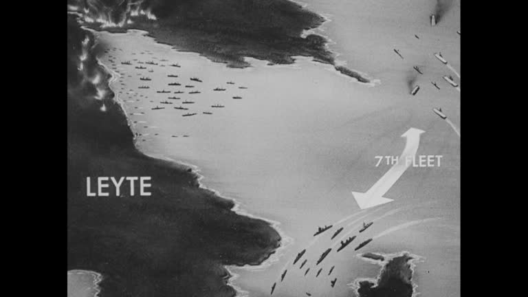
animated map shows us 7th fleet dividing into two sections to thwart japanese attack near samar island, joined by task force from us 3rd fleet - gis map stock videos & royalty-free footage00:40Map shows action of the US Navy in WWII Second Battle of the Philippine Sea, also known as the Battle of Leyte GulfJapan, Philippines, USA
animated map shows pacific islands conquered by united states / united states navy ships at sea / night: flares from artillery shells in jungle /... - gis map stock videos & royalty-free footage00:45United States defeats Japan in the 2nd Battle of the Philippine Sea (the Battle of Leyte Gulf) during World War IILeyte Island, Night, Japan
map shows united states seventh fleet in leyte gulf, split in direction: some ships toward surigao strait and others toward samar island to engage... - gis map stock videos & royalty-free footage00:37Animation depicts US movement in the Second Battle of the Philippine Sea, also known as the Battle of Leyte Gulf, in World War IIMap
aerial through clouds ships on sea / vs animation maps show united states fleets 3 & 7 off leyte island with japanese ships coming between islands /... - gis map stock videos & royalty-free footage01:44Battle action between US and Japan in WWII Second Battle of the Philippine Sea, also known as the Battle of Leyte GulfLeyte Island, World War II, Battle
world war ii / pacific theater / animated map of philippines showing positions of us navy / ships firing and being fired upon / pilot, capt. david... - gis map stock videos & royalty-free footage00:57World War II: Battle of Leyte GulfPhilippines, Air Raid, Map