marshall islands - zoom on world map. animated shape vector map of the marshall islands. 4k video footage. motion graphics - marshall islands map stock videos & royalty-free footage00:08Marshall Islands - Zoom on World Map. Animated Shape Vector Map of the Marshall Islands. 4K Video Footage. Motion GraphicsMap
new york herald tribune newspaper with headline "one h-bomb could cripple whole metropolitan area, a.e.c. chief tells nation" is placed on top of... - marshall islands map stock videos & royalty-free footage01:42H-bomb headlines in 1954 from various newspapers and illustrations in newspapers that show bomb's devastating effectsIvy Mike, Hydrogen Bomb, Newspaper
the united states conducts first h-bomb test at enewetak atoll in the mid-pacific ocean. - marshall islands map stock videos & royalty-free footage02:58Universal Newsreel: The United States conducts first H-bomb test at Enewetak Atoll in the mid-Pacific Ocean.Ivy Mike, Marshall Islands, Eniwetok
cooperation between marshall islands and usa in front of world map. the concept of america, handshake, business agreement, politics, meeting, country flags, celebrate, international friendship relations, diplomats shaking hands, peace trade policy - marshall islands map stock videos & royalty-free footage00:08Cooperation between Marshall Islands and USA in front of world map. The concept of America, handshake, business agreement, politics, meeting, country flags, celebrate, international friendship relations, diplomats shaking hands, peace trade policyMarshall Islands
british men looking at british map showing jarvis baker & howland islands as british property. tokyo: naval officers worried near their marshall... - marshall islands map stock videos & royalty-free footage01:12British, Japanese, Australian menMarshall Islands, Japan, 1930-1939
united states navy in the pacific ready for action against the japanese / planes a carrier deck / reporter joe rucker shown on deck of aircraft... - marshall islands map stock videos & royalty-free footage01:06US Navy Begins Marshall Islands CampaignMarshall Islands
"eniwetok atom bomb explosions!" superimposed over atom bomb explosion / title card: "top-secret until now, these films remind the world of its... - marshall islands map stock videos & royalty-free footage01:17Preparations for US atomic bomb tests on Eniwetok Atoll in Marshall IslandsNight, Eniwetok, Robot
marshall islands - zoom on world map. animated shape vector map of the marshall islands. 4k video footage. motion graphics - marshall islands map stock videos & royalty-free footage00:08Marshall Islands - Zoom on World Map. Animated Shape Vector Map of the Marshall Islands. 4K Video Footage. Motion Graphics
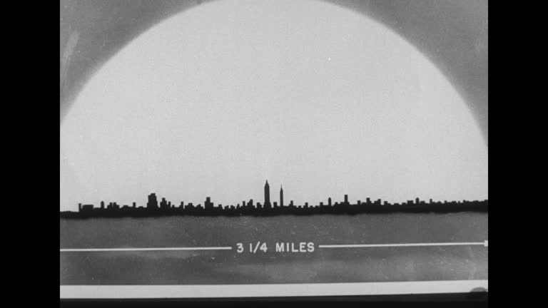
[films released by the federal civil defense administration] graphic illustration of a bomb explosion reaching 25 miles across and 100 miles up,... - marshall islands map stock videos & royalty-free footage01:10Federal Civil Defense Administration presentation regarding possible effects of a hydrogen bomb blast on Washington, DCThe Pentagon, Pentagon - Shape, Nuclear Weapon
plane flies route from kwajalein to eniwetok over bikini atoll, drops bomb over bikini island, mushroom cloud rises - marshall islands map stock videos & royalty-free footage00:20Graphic animation of route to drop first test atomic bomb on Bikini Atoll in Operation CrossroadsAtomic Bomb
officers standing around us flag on small hill / soldiers resting on beach, palm trees stripped of foliage in background / group of soldiers sitting... - marshall islands map stock videos & royalty-free footage00:48US troops relaxing on Kwajalein Atoll in Marshall Islands during World War IIKwajalein Atoll
rows of sailors on board ship saluting, officer appears at top of steps saluting in return / same officer walks between rows of sailors followed by... - marshall islands map stock videos & royalty-free footage00:49US military officers on board ship heading towards Bikini Atoll for Operation Crossroads US atomic bomb testAtomic Bomb
hand pointing at map / three shots of pilots and navy officers standing around for briefing looking at map / officer squatting next to map and... - marshall islands map stock videos & royalty-free footage01:18Pilots prepare for mission aboard US aircraft carrier "Saidor" in South Pacific near Kwajalein Island
"kwajalein island" "...great combat pictures, by signal corps cameramen, of the invasion and capture of kwajalein island, in kwajalein atoll, the... - marshall islands map stock videos & royalty-free footage01:43US Marine Corps, Navy, and Army's Seventh Infantry attack as WWII battle begins against Japan in the Marshall IslandsKwajalein Atoll
4th marine division on deck of u.s. navy transport ships studying map of roi-namur island. vs battleships firing cannons, bombing roi-namur, marines... - marshall islands map stock videos & royalty-free footage00:381944: BATTLE OF KWAJALEIN: VS U.S. 4th Marine Division on deck of U.S. Navy transport ships studying map of Roi-Namur island. VS Battleships firing cannons, bombing Roi-Namur, Marines climbing down nets to amphibious landing crafts. WWIIBoat Deck, US Marine Corps, 1940-1949
united states navy fleet admiral william 'bull' halsey, jr. aka 'bill' & other two naval officers looking over map inside ship. world war ii, wwii,... - marshall islands map stock videos & royalty-free footage00:061942: ADMIRAL WILLIAM HALSEY, JR.: VS United States Navy Fleet Admiral William 'Bull' Halsey, Jr. aka 'Bill' (1882-1959) & other two naval officers looking over map inside ship. World War II, WWII, Pacific Front, strategy, planning, attackBull - Animal
vought sikorsky os2u-1 kingfisher takes flight from an aircraft carrier towards a japanese base in saipan / map of the pacific islands is shown,... - marshall islands map stock videos & royalty-free footage00:25Pacific Air Battle - Aircraft Heads To SaipanBattle, Saipan
map showing attack front on areas to the east and west of rabaul / battleships at sea firing rounds / admiral thomas kinkaid and general douglas... - marshall islands map stock videos & royalty-free footage00:41General Douglas MacArthur Heads Los Negros Island Attack
three soldiers discussing strategy, close-up of soldier pointing with pencil on map / troops advancing across rubble field / troops searching through... - marshall islands map stock videos & royalty-free footage00:51Troops Continue Fight Into The Heart Of Kwajalein
montage of japanese prisoners being stripped and blindfolded before questioning, japanese prisoners being questioned / japanese prisoner with arm in... - marshall islands map stock videos & royalty-free footage00:44Japanese Prisoners Captured at Kwajalein LagoonPrisoner
shot of a map of marshall islands showing battle sites, close-up map of kwajalein lagoon / montage of war ships streaming across the ocean firing... - marshall islands map stock videos & royalty-free footage00:52US Forces Battle Japanese At Kwajalein LagoonKwajalein Atoll
wide shot of us battleships at sea with soldiers on the stern of a ship looking through binoculars / wide shot of battleships moving along the water... - marshall islands map stock videos & royalty-free footage00:57Invasion Of The Marshall Islands
enewetak atoll, marshall islands archival footage showing preparations for the mike thermonuclear test as joint task force 132 personnel coordinate... - marshall islands map stock videos & royalty-free footage05:04Operation Ivy Mike Preparations Showing Thermonuclear Test Planning and Enewetak Atoll Test Sites in 1952
enewetak atoll, marshall islands archival footage showing the detonation and aftermath of the mike thermonuclear test in the pacific. a massive... - marshall islands map stock videos & royalty-free footage05:00Operation Ivy Mike Thermonuclear Test Showing Detonation Mushroom Cloud and Scientific Survey of Enewetak Atoll in 1952
enewetak atoll, marshall islands archival footage showing the destructive effects of the mike thermonuclear test and illustrating the scale of the... - marshall islands map stock videos & royalty-free footage05:08Operation Ivy Mike Aftermath Showing Enewetak Crater Destruction and Val Peterson Discussing Civil Defense in 1952
cooperation between marshall islands and china in front of world map. the concept of chinese, handshake, business agreement, politics, meeting, country flags, international friendship relations, diplomats shaking hands, businessman, peace trade policy - marshall islands map stock videos & royalty-free footage00:08Cooperation between Marshall Islands and China in front of world map. The concept of Chinese, handshake, business agreement, politics, meeting, country flags, international friendship relations, diplomats shaking hands, businessman, peace trade policy
cooperation between usa and marshall islands in front of world map. the concept of america, handshake, politics, country flags, celebrate, international friendship relations, diplomats shaking hands, businessman, armed forces agreement, war and peace - marshall islands map stock videos & royalty-free footage00:08Cooperation between USA and MARSHALL ISLANDS in front of world map. The concept of America, handshake, politics, country flags, celebrate, international friendship relations, diplomats shaking hands, businessman, armed forces agreement, war and peace
dramatic footage has captured huge waves crashing into a united states military building in the marshall islands on saturday, january 20. us army... - marshall islands map stock videos & royalty-free footage01:04Huge Waves Crash Into US Military Base in Marshall IslandsMarshall Islands
zoom in on monochrome map of marshall islands, 4k, high quality, dark theme, simple world map, monochrome style, night, highlighted country and cities, satellite and aerial view of provinces, state, city, - marshall islands map stock videos & royalty-free footage00:12Zoom in on monochrome map of Marshall Islands, 4K, high quality, dark theme, simple world map, monochrome style, night, highlighted country and cities, satellite and aerial view of provinces, state, city,
marines emblem / title card: "the battle for the marianas" / map of pacific theater islands / united states marine corps stationed on guadalcanal,... - marshall islands map stock videos & royalty-free footage01:32World War II: US Marines in the Pacific Theater, circa 1944Guadalcanal Island, Tinian, Japan
cooperation between marshall islands and russia in front of dark world map. the concept of war, peace, handshake, business agreement, politics, meeting, country flags, celebrate, international friendship relations, diplomats shaking hands, trade policy, - marshall islands map stock videos & royalty-free footage00:08Cooperation between Marshall Islands and Russia in front of dark world map. The concept of war, peace, handshake, business agreement, politics, meeting, country flags, celebrate, international friendship relations, diplomats shaking hands, trade policy,
marshall islands on world map - marshall islands map stock videos & royalty-free footage00:09Marshall Islands on World Map
cooperation between china and marshall islands in front of world map. the concept of chinese, handshake, business agreement, politics, meeting, country flags, international friendship relations, diplomats shaking hands, peace trade policy - marshall islands map stock videos & royalty-free footage00:08Cooperation between China and Marshall Islands in front of world map. The concept of Chinese, handshake, business agreement, politics, meeting, country flags, international friendship relations, diplomats shaking hands, peace trade policy
cooperation between marshall islands and european union in front of world map. the concept of handshake, business agreement, politics, meeting, country flags, celebrate, international friendship relations, diplomats shaking hands, peace trade policy - marshall islands map stock videos & royalty-free footage00:08Cooperation between Marshall Islands and European Union in front of world map. The concept of handshake, business agreement, politics, meeting, country flags, celebrate, international friendship relations, diplomats shaking hands, peace trade policyStrategy
cooperation between marshall islands and usa in front of world map. the concept of america, handshake, business agreement, politics, meeting, country flags, celebrate, international friendship relations, diplomats shaking hands, peace trade policy - marshall islands map stock videos & royalty-free footage00:08Cooperation between Marshall Islands and USA in front of world map. The concept of America, handshake, business agreement, politics, meeting, country flags, celebrate, international friendship relations, diplomats shaking hands, peace trade policy
isometric flag of marshall islands - marshall islands map stock videos & royalty-free footage00:15Isometric flag of Marshall Islands
marshall islands tittle road sign over the blue cloudy sky - stock video - marshall islands map stock videos & royalty-free footage00:20Marshall Islands tittle road sign over the blue cloudy sky - Stock video
majuro capital city of marshall islands road sign over the blue cloudy sky - stock video - marshall islands map stock videos & royalty-free footage00:20Majuro capital city of Marshall Islands road sign over the blue cloudy sky - Stock video
bikini atoll map zoom - marshall islands map stock videos & royalty-free footage00:08Bikini Atoll map zoom
a map of the marshall islands highlights the atomic bomb testing sites for operation crossroads. - marshall islands map stock videos & royalty-free footage00:24A map of the Marshall Islands highlights the atomic bomb testing sites for Operation Crossroads.
a map of the marshall islands highlights the atomic bomb testing sites for operation crossroads. - marshall islands map stock videos & royalty-free footage00:24A map of the Marshall Islands highlights the atomic bomb testing sites for Operation Crossroads.
ship at sea / navy flagship plaque for uss mount mckinley / uss mount mckinley / bikini atoll map / target / us air force plane in flight / aerial... - marshall islands map stock videos & royalty-free footage02:16Hydrogen bomb mushroom cloud from seaAtomic Bomb Testing, Nuclear Weapon, Map