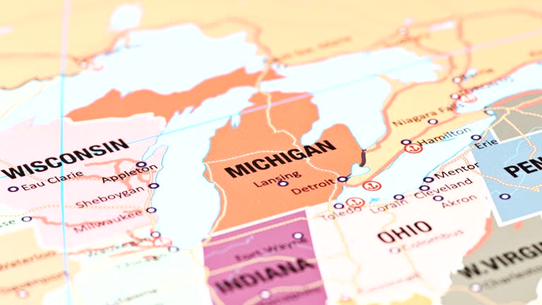
michigan from usa states - michigan state map stock videos & royalty-free footage00:12Michigan from USA StatesMichigan, Map, USA
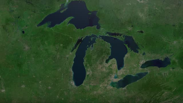
zoom in to michigan, us from earth. satellite view of the united states of america. cinematic world map animation from outer space to territories. the concept of usa, highlight, globe, aerial view, tourism, travel, journey, cityscape - michigan state map stock videos & royalty-free footage00:16Zoom in to Michigan, US from Earth. Satellite view of the United States of America. Cinematic world map animation from outer space to territories. The concept of USA, highlight, globe, aerial view, tourism, travel, journey, cityscapeMichigan, Map, Travel
map of michigan united states america usa, 3d animation - michigan state map stock videos & royalty-free footage00:10Map of MICHIGAN United States America USA, 3D AnimationMichigan, Map, USA
michigan map usa - earth zoom - michigan state map stock videos & royalty-free footage00:11MICHIGAN Map USA - Earth ZoomMichigan, Map, World Map
zoom in to detroit, michigan, united states from earth. satellite view of the usa. cinematic world map animation from outer space to territories. the concept of highlight the cities, globe, tourism, travel, aerial view of country - michigan state map stock videos & royalty-free footage00:16Zoom in to Detroit, Michigan, United States from Earth. Satellite view of the USA. Cinematic world map animation from outer space to territories. The concept of highlight the cities, globe, tourism, travel, aerial view of countryMichigan, Map, USA
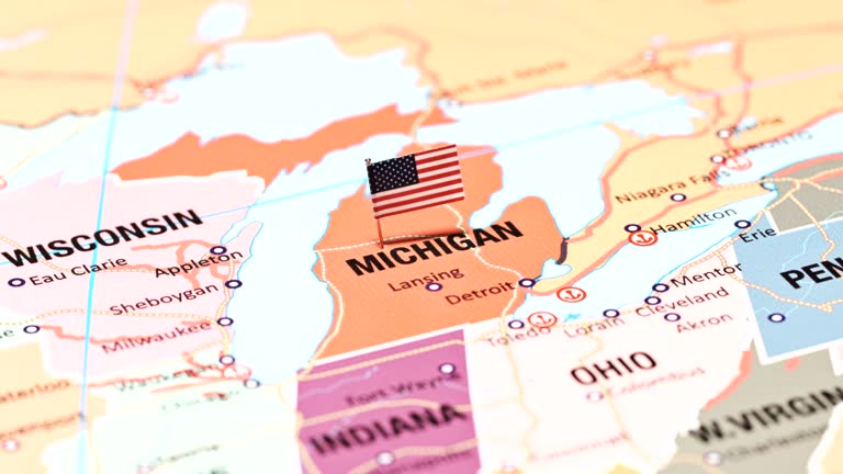
michigan from usa states - michigan state map stock videos & royalty-free footage00:14Michigan from USA StatesMichigan, Map, Flag
zoom in to michigan, us from earth. satellite view of the united states of america. cinematic world map animation from outer space to territories. the concept of usa, highlight, globe, aerial view, tourism, travel, journey, cityscape - michigan state map stock videos & royalty-free footage00:16Zoom in to Michigan, US from Earth. Satellite view of the United States of America. Cinematic world map animation from outer space to territories. The concept of USA, highlight, globe, aerial view, tourism, travel, journey, cityscapeMichigan, Map
michigan from usa states - michigan state map stock videos & royalty-free footage00:13Michigan from USA StatesMap, Michigan, USA
michigan from usa states - michigan state map stock videos & royalty-free footage00:15Michigan from USA States
midwest: heartland of the nation - part 30 of 44. an examination of the many factors responsible for the wealth of the midwest. fertile soil and good climate provide an unrivaled agricultural output. iron ore pours out of the mesabi range and low cost sh - michigan state map stock videos & royalty-free footage00:31Midwest: Heartland of the Nation - part 30 of 44. An examination of the many factors responsible for the wealth of the Midwest. Fertile soil and good climate provide an unrivaled agricultural output. Iron ore pours out of the Mesabi range and low cost shFactory, Metal, Michigan
"this vast northwest territory from which the british were expelled by clark and his heroic men became a part of the american republic -- and from it... - michigan state map stock videos & royalty-free footage00:57Map showing the states George Rogers Clark conquered, 1920s ReenactmentMap, Explorer, Michigan
the french and indian war - seven years' war in america - part 7 of 27. recreates events in the struggle between the french and english. explains differences between french and english colonial policies, ways of living, and methods of conducting military - michigan state map stock videos & royalty-free footage00:31The French and Indian War - Seven Years' War in America - part 7 of 27. Recreates events in the struggle between the French and English. Explains differences between French and English colonial policies, ways of living, and methods of conducting militaryVirginia - US State, Colony - Group of Animals, USA
the middle states (2nd edition) - part 5 of 19. reveals the balance of agriculture and industry which exists in the region of the eight middle states. shows the four distinct economic belts; interdependence of the middle states with the other states; the - michigan state map stock videos & royalty-free footage00:30The Middle States (2nd edition) - part 5 of 19. Reveals the balance of agriculture and industry which exists in the region of the eight middle states. Shows the four distinct economic belts; interdependence of the middle states with the other states; theWisconsin, 1950-1959, Minnesota
ha ws boy and girl on playground filling in states with different colors on outline map of us/ michigan - michigan state map stock videos & royalty-free footage00:30HA WS boy and girl on playground filling in states with different colors on outline map of US/ MichiganMichigan, Map
map of michigan united states america usa, 3d animation - michigan state map stock videos & royalty-free footage00:17Map of MICHIGAN United States America USA, 3D AnimationMichigan, Map
zoom in to michigan, us from earth. satellite view of the united states of america. cinematic world map animation from outer space to territories. the concept of usa, highlight, globe, aerial view, tourism, travel, journey, cityscape - michigan state map stock videos & royalty-free footage00:16Zoom in to Michigan, US from Earth. Satellite view of the United States of America. Cinematic world map animation from outer space to territories. The concept of USA, highlight, globe, aerial view, tourism, travel, journey, cityscape
night time shot of stars & the milky way reflecting in the water - michigan state map stock videos & royalty-free footage00:08Night time shot of stars & the milky way reflecting in the waterStar - Space, Michigan, Landscape - Scenery
usa map by states (4 of 8) mi, mn, ms, mo, mt, ne. loopable. - michigan state map stock videos & royalty-free footage00:54USA map by states (4 of 8) MI, MN, MS, MO, MT, NE. Loopable.Michigan, Map, Physical Geography
the middle states (2nd edition) - part 3 of 19. reveals the balance of agriculture and industry which exists in the region of the eight middle states. shows the four distinct economic belts; interdependence of the middle states with the other states; the - michigan state map stock videos & royalty-free footage00:33The Middle States (2nd edition) - part 3 of 19. Reveals the balance of agriculture and industry which exists in the region of the eight middle states. Shows the four distinct economic belts; interdependence of the middle states with the other states; theMichigan, 1950-1959, Wisconsin
zoom in to michigan, us from earth. satellite view of the united states of america. cinematic world map animation from outer space to territories. the concept of highlight the state, globe, tourism, travel, journey, aerial view of country, usa - michigan state map stock videos & royalty-free footage00:16Zoom in to Michigan, US from Earth. Satellite view of the United States of America. Cinematic world map animation from outer space to territories. The concept of highlight the state, globe, tourism, travel, journey, aerial view of country, USAMackinac Island, Map, USA
3d us population map 3 - michigan state map stock videos & royalty-free footage00:283D US Population Map 3Map, USA, Rural Scene
usa, state of michigan - michigan state map stock videos & royalty-free footage00:08USA, State of Michigan
zoom in to detroit, michigan, united states from earth. satellite view of the usa. cinematic world map animation from outer space to territories. the concept of highlight the cities, globe, tourism, travel, aerial view of country - michigan state map stock videos & royalty-free footage00:16Zoom in to Detroit, Michigan, United States from Earth. Satellite view of the USA. Cinematic world map animation from outer space to territories. The concept of highlight the cities, globe, tourism, travel, aerial view of countryMap
waves smashed lake michigan's southeastern shoreline on wednesday, september 3, as the national weather service warned of a... - michigan state map stock videos & royalty-free footage00:46Waves Batter Lake Michigan Shore Amid Cold FrontMichigan, Coastline
aerial views of traffic on freeways depicting an in-car radio audience, a map of the wjr radio coverage area including michigan, indiana, ohio and... - michigan state map stock videos & royalty-free footage00:26Aerial views of traffic on freeways and a map of the WJR Radio coverage area, Detroit, MI, USAMap, Traffic, Pennsylvania
the french and indian war - seven years' war in america - part 6 of 27. recreates events in the struggle between the french and english. explains differences between french and english colonial policies, ways of living, and methods of conducting military - michigan state map stock videos & royalty-free footage00:23The French and Indian War - Seven Years' War in America - part 6 of 27. Recreates events in the struggle between the French and English. Explains differences between French and English colonial policies, ways of living, and methods of conducting militaryMichigan, Map, 1960-1969
usa, state of michigan - michigan state map stock videos & royalty-free footage00:07USA, State of MichiganMichigan, Map, Animated Video
weather map animation - north-eastern usa - michigan state map stock videos & royalty-free footage00:28Weather map animation - north-eastern USAWeather, New York City, Map
zoom in to detroit, michigan, united states from earth. satellite view of the usa. cinematic world map animation from outer space to territories. the concept of highlight the cities, globe, tourism, travel, aerial view of country - michigan state map stock videos & royalty-free footage00:16Zoom in to Detroit, Michigan, United States from Earth. Satellite view of the USA. Cinematic world map animation from outer space to territories. The concept of highlight the cities, globe, tourism, travel, aerial view of countryGlobe - Navigational Equipment, USA, Outer Space
timelapse footage captured large ice sheets drifting along the shores of lake michigan on the morning of february 24, as... - michigan state map stock videos & royalty-free footage00:27Huge Ice Sheets Drift Atop Lake Michigan Amid Warming TemperaturesLake Michigan, Snow, Michigan
drone photographer witnessed a remarkable sight when he captured ice covering lake michigan "as far as the eye can see" on wednesday, february 19.... - michigan state map stock videos & royalty-free footage01:22'Frozen as Far as the Eye Can See': Ice Covers Lake MichiganMichigan
the frozen st joseph north pier inner lighthouse on lake michigan was battered by waves on thursday, february 13, in the wake of a... - michigan state map stock videos & royalty-free footage00:52Waves Slam Frozen Lighthouse on Lake Michigan Ahead of Arctic BlastSnow, Michigan
ice cover on lake michigan has been increasing lately after a slow start, and is now nearing the... - michigan state map stock videos & royalty-free footage00:23Frozen Expanse Stretches Across Lake Michigan as Ice Cover GrowsUSA, Michigan
scenes from polling station in lansing, michigan, us, on thursday, august 1, 2024. three federal judges on friday approved a new michigan senate map... - michigan state map stock videos & royalty-free footage00:48Scenes from polling station in LansingUSA, Election, Voting
voters casting ballots at polling place in lansing michigan, us, on thursday, august 1, 2024. three federal judges on friday approved a new michigan... - michigan state map stock videos & royalty-free footage00:10Voters Casting Ballots At Polling Place In LansingUSA, Michigan
montage: construction of gm proving grounds in 1924 - michigan state map stock videos & royalty-free footage01:11Montage: construction of GM Proving Grounds in 1924General Motors, Construction Worker, 1920-1929
sizeable block of ice broke off from the frozen bank of lake michigan in st joseph, michigan, as temperatures... - michigan state map stock videos & royalty-free footage02:47Thawing Lake Michigan Produces Giant Floating Ice BlockSnow, Michigan, Lake
operations in a wjr radio newsroom, detroit, mi, usa, 1966. a promotional film produced by wjr radio, detroit, to lure advertisers. many shots with... - michigan state map stock videos & royalty-free footage00:26A WJR Radio newsroom, Detroit, MI, USAMap, Radio
3d world map zoom usa 3 - michigan state map stock videos & royalty-free footage00:293D World Map Zoom USA 3Map, San Diego
3d us population map 1 - michigan state map stock videos & royalty-free footage00:293D US Population Map 1Map, Virginia - US State, South Carolina
the french and indian war - seven years' war in america - part 5 of 27. recreates events in the struggle between the french and english. explains differences between french and english colonial policies, ways of living, and methods of conducting military - michigan state map stock videos & royalty-free footage00:26The French and Indian War - Seven Years' War in America - part 5 of 27. Recreates events in the struggle between the French and English. Explains differences between French and English colonial policies, ways of living, and methods of conducting militaryUSA, Map, Archival
the french and indian war - seven years' war in america - part 4 of 27. recreates events in the struggle between the french and english. explains differences between french and english colonial policies, ways of living, and methods of conducting military - michigan state map stock videos & royalty-free footage00:27The French and Indian War - Seven Years' War in America - part 4 of 27. Recreates events in the struggle between the French and English. Explains differences between French and English colonial policies, ways of living, and methods of conducting militaryMichigan, War, 1960-1969
us regions: contrasts of land and people - part 25 of 53. using both animation and live-action photography, this film enables viewers to tour a richly diverse country that can be divided into eight regions: new england, the middle atlantic, the south, the - michigan state map stock videos & royalty-free footage00:29US Regions: Contrasts of Land and People - part 25 of 53. Using both animation and live-action photography, this film enables viewers to tour a richly diverse country that can be divided into eight regions: New England, the Middle Atlantic, the South, theChicago - Illinois
westward movement i - settlers of the old northwest territory - part 24 of 26. describes the colonization of the old northwest territory during the post-revolutionary war period. explains the political and economic effects of the northwest ordinance and - michigan state map stock videos & royalty-free footage00:31Westward Movement I - Settlers of the Old Northwest Territory - part 24 of 26. Describes the colonization of the Old Northwest Territory during the post-Revolutionary War period. Explains the political and economic effects of the Northwest Ordinance andCleveland - Ohio, Wisconsin, Chicago - Illinois
the middle states (2nd edition) - part 17 of 19. reveals the balance of agriculture and industry which exists in the region of the eight middle states. shows the four distinct economic belts; interdependence of the middle states with the other states; th - michigan state map stock videos & royalty-free footage00:30The Middle States (2nd edition) - part 17 of 19. Reveals the balance of agriculture and industry which exists in the region of the eight middle states. Shows the four distinct economic belts; interdependence of the middle states with the other states; thWisconsin, Missouri, Michigan
"paramount news sports feature-1952 all-american" over us map like football field / stadium crowd / marching band spells usa / man looking at racks... - michigan state map stock videos & royalty-free footage03:53All-American football players on campuses; Bischoff, Stolhandske, Modzelewski, Kraemer, Willhoite, Chickillo, Tamburo, Vessels, McAuliffe, Cameron, OlszewskiAmerican Football - Ball, University of Southern California, Campus
ha ws boy on playground filling in states with different colors on outline map of us/ boy leaving/ michigan - michigan state map stock videos & royalty-free footage00:36HA WS boy on playground filling in states with different colors on outline map of US/ boy leaving/ MichiganMap, USA
ha ws children on playground filling in states with different colors on outline map of us/ michigan - michigan state map stock videos & royalty-free footage00:14HA WS children on playground filling in states with different colors on outline map of US/ MichiganGirls, Summer, Michigan
ha ws children on playground filling states in with different colors on outline map of us/ michigan - michigan state map stock videos & royalty-free footage00:19HA WS children on playground filling states in with different colors on outline map of US/ MichiganMichigan, Education
ha ws man on playground blacktop painting outline of us states map/ children filling in states with different colors/ children standing on map and jumping up and down/ michigan - michigan state map stock videos & royalty-free footage00:24HA WS man on playground blacktop painting outline of US states map/ children filling in states with different colors/ children standing on map and jumping up and down/ Michigan
night time video of stars & the milky way galaxy - michigan state map stock videos & royalty-free footage00:08Night time video of stars & the milky way galaxyStar - Space, Michigan, Night
stars in the night sky - michigan state map stock videos & royalty-free footage00:21Stars in the night skyNight, Michigan
"politics, ike, stevenson map campaigns" superimposed over figurines of elephant and donkey / mrs. india edwards, vice chairman of democratic... - michigan state map stock videos & royalty-free footage01:23Stevenson in Chicago and Eisenhower in Colorado prepare for presidential campaign of 1952
plotter tracking course of airplane on table map. hand w/ pen approaching 'target.' int vs dial reading zero pilot bill horton 'bombs away.' int... - michigan state map stock videos & royalty-free footage00:19US Mobile Radar Unit plotter
radar men in radar truck looking over map radioman '...roger your information clear on run... turn your tone on 15 seconds before bombs away over.'... - michigan state map stock videos & royalty-free footage00:20US Mobile Radar Unit go-ahead
village town . parked radio truck w/ antenna. int radar men looking over map. man sitting reading radar on screen turning dial. military target - michigan state map stock videos & royalty-free footage00:15US Mobile Radar Unit
weather station two air force officers standing w/ us map checking weather hand pointing to rings on map. colonel david schilling seated at table in... - michigan state map stock videos & royalty-free footage00:32Officer getting weather staff meeting
air force male into building. door sign: selfridge afb weather station 102 weather group contiental weather wing air weather service. int officer... - michigan state map stock videos & royalty-free footage00:21Weather service on base
map of great lakes, surrounding major cities. - michigan state map stock videos & royalty-free footage00:101936: MAP: Map of Great Lakes, surrounding major cities.Map
3d us population map 2 - michigan state map stock videos & royalty-free footage00:283D US Population Map 2Minnesota, Geology
usa map red - michigan state map stock videos & royalty-free footage00:10USA map redVirginia - US State, New Jersey, Texas
3d michigan state usa zoom - michigan state map stock videos & royalty-free footage00:103D Michigan State USA Zoom
map of the trail stands in a section of the lansing river trail near the michigan ave. bridge on october 22, 2026 in lansing, michigan. police are... - michigan state map stock videos & royalty-free footage00:14Police Suspect Serial Killer Killing Homeless People On Lansing's River Trail
map of the trail stands in a section of the lansing river trail near the michigan ave. bridge on october 22, 2026 in lansing, michigan. police are... - michigan state map stock videos & royalty-free footage00:14Police Suspect Serial Killer Killing Homeless People On Lansing's River Trail
template for vote counting in the state of michigan - michigan state map stock videos & royalty-free footage00:12Template for vote counting in the state of Michigan
thick smoke from wildfires raging across canada descended over the eastern united states, shrouding new york city on july 15. as of july 15, the... - michigan state map stock videos & royalty-free footage01:53Canadian Wildfire Smoke Blankets New York in Hazy Shroud
close up of michigan on a political usa map - michigan state map stock videos & royalty-free footage00:14Close Up of Michigan on a Political USA Map
thick smoke from wildfires raging across canada descended over the eastern united states on july 16, with hazardous air conditions forecast for the... - michigan state map stock videos & royalty-free footage00:51Aerial Footage Shows 'Hazardous' Smoke Cover Michigan
new york residents woke up to a hazy morning on july 16 after smoke from wildfires raging across canada descended over the eastern united states.... - michigan state map stock videos & royalty-free footage00:26Canadian Wildfire Smoke Clouds Buffalo Skies
new york residents woke to a hazy morning on july 16 after smoke from wildfires raging across canada descended over the eastern united states. drone... - michigan state map stock videos & royalty-free footage05:10Drone Footage Captures 'Intense' Wildfire Smoke Over Buffalo
smoke from hundreds of wildfires burning across canada spread across the us midwest and east coast, worsening air quality in new york, detroit,... - michigan state map stock videos & royalty-free footage00:22MOTION GRAPHICS - Canadian wildfire smoke spreads across northeastern US
zoom in to the map of michigan state - michigan state map stock videos & royalty-free footage00:09Zoom in to the map of Michigan state
democratic nomination: michigan grass roots; usa: michigan: flint:int/last weekcms floyd clack intvw sof"jackson had continued -- around here"clack... - michigan state map stock videos & royalty-free footage03:05Democratic nomination: Michigan grass roots
zoom in to detroit, michigan, united states from earth. satellite view of the usa. cinematic world map animation from outer space to territories. the concept of highlight the cities, globe, tourism, travel, aerial view of country - michigan state map stock videos & royalty-free footage00:16Zoom in to Detroit, Michigan, United States from Earth. Satellite view of the USA. Cinematic world map animation from outer space to territories. The concept of highlight the cities, globe, tourism, travel, aerial view of country
pancake ice was seen near a frosty lighthouse in grand haven, michigan, on sunday, december 21. this footage captured by nathan voytovick of nate's... - michigan state map stock videos & royalty-free footage01:22Pancake Ice Seen Near Frozen Michigan Lighthouse
vibrant fall foliage was seen along the tahquamenon river recently, as https://www.explorefall.com/fall-foliage-map foliage trackers estimated leaves... - michigan state map stock videos & royalty-free footage00:49Vibrant Fall Foliage Lines Tahquamenon River as Leaves Reach Peak Color
field crews worked to restore a water main break that flooded streets and prompted https://x.com/oaklandroads/status/1971206306146156568 road... - michigan state map stock videos & royalty-free footage02:00Water Main Break Affects Multiple Detroit Suburbs
the grand river was seen at... - michigan state map stock videos & royalty-free footage01:29Grand River Runs Low as West Michigan Faces Worst Drought in Over a Decade