cinematic realistic rotating earth in space - north atlantic ocean map stock videos & royalty-free footage00:20Cinematic Realistic Rotating Earth in SpaceMap, Satellite View, North Atlantic Ocean
cgi, view from space, zo, london, england, planet earth spinning - north atlantic ocean map stock videos & royalty-free footage00:23CGI, VIEW FROM SPACE, ZO, London, England, Planet Earth spinningUK, Satellite View, Map
earth satellite view of europe continent - north atlantic ocean map stock videos & royalty-free footage00:12Earth Satellite View of Europe ContinentNorth Atlantic Ocean, Map
map of massachussets united states america usa, 3d animation - north atlantic ocean map stock videos & royalty-free footage00:17Map of MASSACHUSSETS United States America USA, 3D AnimationMap, USA, Massachusetts
4k venezuela map - red color - north atlantic ocean map stock videos & royalty-free footage00:154K Venezuela Map - Red colorCrude Oil, USA, Map
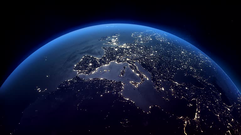
cinematic realistic rotating night earth in space - north atlantic ocean map stock videos & royalty-free footage00:20Cinematic Realistic Rotating Night Earth in SpaceGlobe - Navigational Equipment, Map, World Map
flight path tracking from north america to south east asia over the atlantic ocean. 3d animation - north atlantic ocean map stock videos & royalty-free footage00:11Flight path tracking from North America to South East Asia over the Atlantic Ocean. 3D animationAeroplane, Travel Destinations, Passenger
strait of gibraltar connecting mediterranean sea with atlantic ocean between spain, morocco, and gibraltar. critical maritime shipping route for european and global trade - north atlantic ocean map stock videos & royalty-free footage00:12Strait of Gibraltar connecting Mediterranean Sea with Atlantic Ocean between Spain, Morocco, and Gibraltar. Critical maritime shipping route for European and global tradeMap, Mediterranean Sea, Gibraltar
discovery and exploration - part 2 of 18. surveys the period of discovery and exploration in north america between 1492 and 1700. analyzes three motives for this exploration--to find a new trade route to the far east, to search for riches, and to find bea - north atlantic ocean map stock videos & royalty-free footage00:33Discovery and Exploration - part 2 of 18. Surveys the period of discovery and exploration in North America between 1492 and 1700. Analyzes three motives for this exploration--to find a new trade route to the Far East, to search for riches, and to find beaChristopher Columbus - Explorer, Atlantic Ocean, Circa 15th Century
map of atlantic ocean greenland north atlantic shipping lane. - north atlantic ocean map stock videos & royalty-free footage00:06Map North Atlantic shipping laneGreenland, Map, Atlantic Ocean
pilgrims sail for america - north atlantic ocean map stock videos & royalty-free footage00:25Pilgrims sail for AmericaCartoon, Immigrant, USA
map of massachussets united states america usa, 3d animation - north atlantic ocean map stock videos & royalty-free footage00:10Map of MASSACHUSSETS United States America USA, 3D AnimationMassachusetts, Map
cruise ship tour of the coast of norway - north atlantic ocean map stock videos & royalty-free footage00:36Cruise Ship Tour of the Coast of NorwayNorway, Russian People, Cruise Ship
map of the north atlantic ocean & bordering contienents. airplane in circle marking european base. animated airplane circles on iceland, england &... - north atlantic ocean map stock videos & royalty-free footage00:261951: MAP: Map of the North Atlantic Ocean & bordering contienents. Airplane in circle marking European base. Animated airplane circles on Iceland, England & French North Africa. MAP: French Morocco.
animated united states map arrows indicating vulnerable points of country alaska through canada north atlantic into st. lawrence valley from west... - north atlantic ocean map stock videos & royalty-free footage00:30Vulnerablity map
earth top q2 africa europe atlantic ocean north america - north atlantic ocean map stock videos & royalty-free footage00:30Earth Top Q2 Africa Europe Atlantic Ocean North America
woman in orange beach, alabama, wasn't sure what she saw out at sea from her balcony recently. but she knew one thing: "that sucker's huge." debbie... - north atlantic ocean map stock videos & royalty-free footage01:36'That Sucker's Huge': Endangered Whales Seen Off Alabama CoastGulf of Mexico, USA, Animal Wildlife
the french and indian war - seven years' war in america - part 5 of 27. recreates events in the struggle between the french and english. explains differences between french and english colonial policies, ways of living, and methods of conducting military - north atlantic ocean map stock videos & royalty-free footage00:26The French and Indian War - Seven Years' War in America - part 5 of 27. Recreates events in the struggle between the French and English. Explains differences between French and English colonial policies, ways of living, and methods of conducting militaryUSA, Map, Archival
cruise ship tour of the coast of norway - north atlantic ocean map stock videos & royalty-free footage01:00Cruise Ship Tour of the Coast of NorwayCruise Ship, 1930-1939, Ocean Liner
cruise ship tour of the coast of norway - north atlantic ocean map stock videos & royalty-free footage00:49Cruise Ship Tour of the Coast of NorwayNorway, 1930-1939
cruise ship tour of the coast of norway - north atlantic ocean map stock videos & royalty-free footage00:40Cruise Ship Tour of the Coast of Norway
members in meeting large wall map. vs american & english army officers at table talking. vs man at map members at table looking. europe - north atlantic ocean map stock videos & royalty-free footage00:18NATO Army officials meeting
animated graphic of line extending from newfoundland to iceland / marine file down pier onto waiting battleships / montage of battleships at sea /... - north atlantic ocean map stock videos & royalty-free footage01:10Allied Military Occupies IcelandGreenland, Iceland, World War II
green globe. loop - north atlantic ocean map stock videos & royalty-free footage00:10Green globe. LoopSpinning
english channel and strait of dover connecting united kingdom and france. panning and tilting camera movement across european relief map. - north atlantic ocean map stock videos & royalty-free footage00:16English Channel and Strait of Dover connecting United Kingdom and France. Panning and tilting camera movement across European relief map.
4k venezuela map - north atlantic ocean map stock videos & royalty-free footage00:204K Venezuela MapCaracas, Helicopter
4k venezuela map - red color - north atlantic ocean map stock videos & royalty-free footage00:154K Venezuela Map - Red color
ocean overwash brought by hurricane erin entered beachside homes in buxton, north carolina, on thursday, august 21, dramatic footage shows. the... - north atlantic ocean map stock videos & royalty-free footage01:54Seawater Floods Beachside Homes as Hurricane Erin Wreaks Havoc
ocean swells was seen cascading onto the shore of fire island, new york, on wednesday, august 20, as hurricane erin... - north atlantic ocean map stock videos & royalty-free footage05:15Ocean Swells Roll Over NY Barrier Island as Hurricane Erin Moves Along East Coast
the pilgrims - part 21 of 40. authentic sets and period costumes bring alive the pilgrims, their religious persecution in england, their poverty in holland, the north atlantic crossing, the signing of the mayflower compact, and the first thanksgiving - north atlantic ocean map stock videos & royalty-free footage00:38The Pilgrims - part 21 of 40. Authentic sets and period costumes bring alive the Pilgrims, their religious persecution in England, their poverty in Holland, the North Atlantic crossing, the signing of the Mayflower Compact, and the first ThanksgivingNight, Archival, Sleeping
eisenhower seated at desk signing st lawrence seaway bill while surrounded by various dignitaries and members of the government / three men sit down... - north atlantic ocean map stock videos & royalty-free footage00:47President Eisenhower signs St. Lawrence Seaway BillDwight Eisenhower, Signing