dark aerial surveillance footage of metropolitan area at night with hud overlay - remote sensing technology stock videos & royalty-free footage00:09Dark Aerial Surveillance Footage of Metropolitan Area at Night with HUD OverlayAerial Remote Sensing
satellite technology to monitor farm subsidies; b)nao englandairv countryside airv fields of yellow cropairv green fieldsinthants: national remote... - remote sensing technology stock videos & royalty-free footage00:28Satellite technology to monitor farm subsidiesSatellite View, Map, Agriculture
remote sensing: global environmental monitoring and data analysis - remote sensing technology stock videos & royalty-free footage00:11Remote Sensing: Global Environmental Monitoring and Data Analysis
modified long march-6 carrier rocket with satellites of yaogan-40 04 group on board lasts off, ascends from taiyuan satellite launch center on... - remote sensing technology stock videos & royalty-free footage00:25China Launches New Remote Sensing Satellite GroupSatellite
drone pilot collecting geospatial data for land mapping - remote sensing technology stock videos & royalty-free footage00:10Drone Pilot Collecting Geospatial Data for Land Mapping
long march-4b carrier rocket carrying the satellites of the yaogan-53 and yaogan-56 groups blasts off from the jiuquan satellite launch center on... - remote sensing technology stock videos & royalty-free footage00:47China Launches New Remote Sensing Satellite Groups
the death toll from flash floods and mudslides in the himalayas rose above 1,019 on tuesday, a week after the disaster struck the border region... - remote sensing technology stock videos & royalty-free footage02:47Nepal-China flash floods death toll at 1,019 with 4,462 others missingNepal, Flood, Destruction
the death toll from flash floods and mudslides in the himalayas jumped above 1,000 on tuesday, a week after the natural disaster struck the border... - remote sensing technology stock videos & royalty-free footage04:33Nepal-China flash floods death toll tops 1,000 after 84 more fatalities; 4,462 missingNepal, Flood
valkyrie uav launched by ukrainian servicemen flies during aerial reconnaissance on april 19, 2026 in donetsk oblast, ukraine. ukrainian military... - remote sensing technology stock videos & royalty-free footage00:06Ukrainian Drone Reconnaissance In Donetsk OblastDrone, Ukraine, War
valkyrie uav launched by ukrainian servicemen flies during aerial reconnaissance on april 19, 2026 in donetsk oblast, ukraine. ukrainian military... - remote sensing technology stock videos & royalty-free footage00:22Ukrainian Drone Reconnaissance In Donetsk OblastDrone, Ukraine, War
ukrainian drone detector “chuyka” stands on display during 'talent arsenal' job fair on march 14, 2026 in kyiv, ukraine. over 80 companies and nearly... - remote sensing technology stock videos & royalty-free footage00:05Largest Defense-Sector Job Fair 'Talent Arsenal' Held In Kyiv
ukrainian drone detector “chuyka” stands on display during 'talent arsenal' job fair on march 14, 2026 in kyiv, ukraine. over 80 companies and nearly... - remote sensing technology stock videos & royalty-free footage00:07Largest Defense-Sector Job Fair 'Talent Arsenal' Held In Kyiv
solar system collapse. astronomy, science & theory of relativity - remote sensing technology stock videos & royalty-free footage00:12Solar System Collapse. Astronomy, Science & Theory Of RelativityGalaxy, Stop Motion Animation
the solar system. space exploration science & astronomy - remote sensing technology stock videos & royalty-free footage00:08The Solar System. Space Exploration Science & Astronomy
international space station orbiting the earth. space exploration - remote sensing technology stock videos & royalty-free footage00:09International Space Station Orbiting The Earth. Space ExplorationScience, Research
satellite yaogan-47 aboard long march-4b carrier rocket blasts off, ascends from jiuquan satellite launch center on december 9, 2025 in northwest... - remote sensing technology stock videos & royalty-free footage00:26China Launches New Remote Sensing Satellite
colorful woodland with water features, high perspective capturing seasonal diversity and aquatic - remote sensing technology stock videos & royalty-free footage00:15Colorful woodland with water features, High perspective capturing seasonal diversity and aquatic
skyward forest scene, realtime drone footage showing peaceful forest clearing with vibrant seasonal - remote sensing technology stock videos & royalty-free footage00:25Skyward forest scene, Realtime drone footage showing peaceful forest clearing with vibrant seasonal
agricultural engineer checking tablet for crop monitoring, tracking plant development inside high-tech greenhouse environment - remote sensing technology stock videos & royalty-free footage00:27Agricultural engineer checking tablet for crop monitoring, tracking plant development inside high-tech greenhouse environment
farmer using a digital tablet in a greenhouse, implementing modern technology for smart agriculture - remote sensing technology stock videos & royalty-free footage00:20Farmer using a digital tablet in a greenhouse, implementing modern technology for smart agricultureSmall Business, Smart Farming, Artificial Intelligence
dark aerial surveillance footage of metropolitan area at night with hud overlay - remote sensing technology stock videos & royalty-free footage00:23Dark Aerial Surveillance Footage of Metropolitan Area at Night with HUD OverlayNight, Thermal Image, Drone
dark aerial surveillance footage of metropolitan area at night with hud overlay - remote sensing technology stock videos & royalty-free footage00:39Dark Aerial Surveillance Footage of Metropolitan Area at Night with HUD OverlayDrone, Military, Surveillance
dark aerial surveillance footage of metropolitan area at night with hud overlay - remote sensing technology stock videos & royalty-free footage00:21Dark Aerial Surveillance Footage of Metropolitan Area at Night with HUD Overlay
dark aerial surveillance footage of metropolitan area at night with hud overlay - remote sensing technology stock videos & royalty-free footage00:20Dark Aerial Surveillance Footage of Metropolitan Area at Night with HUD OverlayNight Vision, Night Vision Goggles
dark aerial surveillance footage of metropolitan area at night with hud overlay - remote sensing technology stock videos & royalty-free footage00:12Dark Aerial Surveillance Footage of Metropolitan Area at Night with HUD Overlay
dark aerial surveillance footage of metropolitan area at night with hud overlay - remote sensing technology stock videos & royalty-free footage00:14Dark Aerial Surveillance Footage of Metropolitan Area at Night with HUD OverlayDrone, Police Force, Helicopter
dark aerial surveillance footage of metropolitan area at night with hud overlay - remote sensing technology stock videos & royalty-free footage00:16Dark Aerial Surveillance Footage of Metropolitan Area at Night with HUD OverlayDystopia - Concept
dark aerial surveillance footage of metropolitan area at night with hud overlay - remote sensing technology stock videos & royalty-free footage00:07Dark Aerial Surveillance Footage of Metropolitan Area at Night with HUD OverlayNight, City, Illuminated
dark aerial surveillance footage of metropolitan area at night with hud overlay - remote sensing technology stock videos & royalty-free footage00:17Dark Aerial Surveillance Footage of Metropolitan Area at Night with HUD Overlay
dark aerial surveillance footage of metropolitan area at night with hud overlay - remote sensing technology stock videos & royalty-free footage00:13Dark Aerial Surveillance Footage of Metropolitan Area at Night with HUD OverlayMilitary, Night, Night Vision Goggles
dark aerial surveillance footage of metropolitan area at night with hud overlay - remote sensing technology stock videos & royalty-free footage00:12Dark Aerial Surveillance Footage of Metropolitan Area at Night with HUD Overlay
dark aerial surveillance footage of metropolitan area at night with hud overlay - remote sensing technology stock videos & royalty-free footage00:18Dark Aerial Surveillance Footage of Metropolitan Area at Night with HUD OverlayThermal Image, Digitally Generated Image, Aerial View
dark aerial surveillance footage of metropolitan area at night with hud overlay - remote sensing technology stock videos & royalty-free footage00:29Dark Aerial Surveillance Footage of Metropolitan Area at Night with HUD Overlay
dark aerial surveillance footage of metropolitan area at night with hud overlay - remote sensing technology stock videos & royalty-free footage00:14Dark Aerial Surveillance Footage of Metropolitan Area at Night with HUD Overlay
dark aerial surveillance footage of metropolitan area at night with hud overlay - remote sensing technology stock videos & royalty-free footage00:12Dark Aerial Surveillance Footage of Metropolitan Area at Night with HUD OverlayDrone, Night, Military
dark aerial surveillance footage of metropolitan area at night with hud overlay - remote sensing technology stock videos & royalty-free footage00:12Dark Aerial Surveillance Footage of Metropolitan Area at Night with HUD OverlayDrone, Illuminated, City
dark aerial surveillance footage of metropolitan area at night with hud overlay - remote sensing technology stock videos & royalty-free footage00:08Dark Aerial Surveillance Footage of Metropolitan Area at Night with HUD Overlay
dark aerial surveillance footage of metropolitan area at night with hud overlay - remote sensing technology stock videos & royalty-free footage00:08Dark Aerial Surveillance Footage of Metropolitan Area at Night with HUD Overlay
dark aerial surveillance footage of metropolitan area at night with hud overlay - remote sensing technology stock videos & royalty-free footage00:12Dark Aerial Surveillance Footage of Metropolitan Area at Night with HUD OverlayMilitary, Night
dark aerial surveillance footage of metropolitan area at night with hud overlay - remote sensing technology stock videos & royalty-free footage00:08Dark Aerial Surveillance Footage of Metropolitan Area at Night with HUD Overlay
the tunnel connecting the forests for wildlife to cross between two forests, tap lan tunnel is located in tap lan national park, prachin buri province, thailand, asia. 4k - remote sensing technology stock videos & royalty-free footage00:22The tunnel connecting the forests for wildlife to cross between two forests, Tap Lan Tunnel is located in Tap Lan National Park, Prachin Buri Province, Thailand, Asia. 4K
the tunnel connecting the forests for wildlife to cross between two forests, tap lan tunnel is located in tap lan national park, prachin buri province, thailand, asia. 4k - remote sensing technology stock videos & royalty-free footage00:18The tunnel connecting the forests for wildlife to cross between two forests, Tap Lan Tunnel is located in Tap Lan National Park, Prachin Buri Province, Thailand, Asia. 4K
the tunnel connecting the forests for wildlife to cross between two forests, tap lan tunnel is located in tap lan national park, prachin buri province, thailand, asia. 4k - remote sensing technology stock videos & royalty-free footage00:12The tunnel connecting the forests for wildlife to cross between two forests, Tap Lan Tunnel is located in Tap Lan National Park, Prachin Buri Province, Thailand, Asia. 4K
the tunnel connecting the forests for wildlife to cross between two forests, tap lan tunnel is located in tap lan national park, prachin buri province, thailand, asia. 4k - remote sensing technology stock videos & royalty-free footage00:13The tunnel connecting the forests for wildlife to cross between two forests, Tap Lan Tunnel is located in Tap Lan National Park, Prachin Buri Province, Thailand, Asia. 4K
the tunnel connecting the forests for wildlife to cross between two forests, tap lan tunnel is located in tap lan national park, prachin buri province, thailand, asia. 4k - remote sensing technology stock videos & royalty-free footage00:11The tunnel connecting the forests for wildlife to cross between two forests, Tap Lan Tunnel is located in Tap Lan National Park, Prachin Buri Province, Thailand, Asia. 4K
aerial view of the colored toxic water of germana lake, romania, europe - remote sensing technology stock videos & royalty-free footage00:27Aerial view of the colored toxic water of Germana Lake, Romania, Europe
turkish scientists argue world’s enigmatic future may be decoded through analysis of arctic glacier changes and movements. 8th national arctic... - remote sensing technology stock videos & royalty-free footage02:42Turkish scientists seek clues in Arctic glaciers to counteract future problemsScientist, Arctic
a solar powered remote sensing unit that records, tides, coastal currents and coastal erosion on walney island, cumbria, uk. - remote sensing technology stock videos & royalty-free footage00:07A solar powered remote sensing unit that records, tides, coastal currents and coastal erosion on Walney Island, Cumbria, UK.
a solar powered remote sensing unit that records, tides, coastal currents and coastal erosion on walney island, cumbria, uk. - remote sensing technology stock videos & royalty-free footage00:08A solar powered remote sensing unit that records, tides, coastal currents and coastal erosion on Walney Island, Cumbria, UK.UK
a solar powered remote sensing unit that records, tides, coastal currents and coastal erosion on walney island, cumbria, uk. - remote sensing technology stock videos & royalty-free footage00:10A solar powered remote sensing unit that records, tides, coastal currents and coastal erosion on Walney Island, Cumbria, UK.
a solar powered remote sensing unit that records, tides, coastal currents and coastal erosion on walney island, cumbria, uk. - remote sensing technology stock videos & royalty-free footage00:10A solar powered remote sensing unit that records, tides, coastal currents and coastal erosion on Walney Island, Cumbria, UK.
a solar powered remote sensing unit that records, tides, coastal currents and coastal erosion on walney island, cumbria, uk. - remote sensing technology stock videos & royalty-free footage00:07A solar powered remote sensing unit that records, tides, coastal currents and coastal erosion on Walney Island, Cumbria, UK.
a solar powered remote sensing unit that records, tides, coastal currents and coastal erosion on walney island, cumbria, uk. - remote sensing technology stock videos & royalty-free footage00:10A solar powered remote sensing unit that records, tides, coastal currents and coastal erosion on Walney Island, Cumbria, UK.
long march-5 y6 carrier rocket carrying the yaogan-41, a high-orbit optical remote sensing satellite, blasts off from the wenchang spacecraft launch... - remote sensing technology stock videos & royalty-free footage00:12China Launches New Remote Sensing Satellite
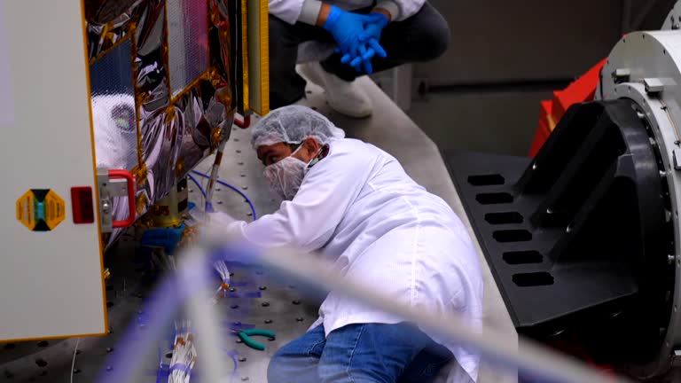
türkiye's new high-resolution observation satellite imece will be launched this week, president recep tayyip erdogan announced on sunday."imece, our... - remote sensing technology stock videos & royalty-free footage04:55Türkiye to launch new observation satellite on TuesdayStarlink - SpaceX, Satellite, Türkiye - Country
yaogan-34 03 satellite is launched at jiuquan satellite launch center on november 15, 2022 in jiuquan, gansu, china. china successfully sent a new... - remote sensing technology stock videos & royalty-free footage00:25China Launches Yaogan-34 Remote Sensing Satellite
long march-4c carrier rocket carrying the yaogan-33 02 remote sensing satellite blasts off from the jiuquan satellite launch center on september 3,... - remote sensing technology stock videos & royalty-free footage00:39China Launches New Remote Sensing Satellite
long march-2c rocket blasts off at xichang satellite launch center on march 5, 2022 in xichang, sichuan province of china. china launched a long... - remote sensing technology stock videos & royalty-free footage00:09China Sends Seven Satellites Into Orbit In Single Launch
rocket is transported and installed for launch at xichang satellite launch center on march 5, 2022 in xichang, sichuan province of china. china... - remote sensing technology stock videos & royalty-free footage00:18China Sends Seven Satellites Into Orbit In Single LaunchLaunch Event, Taking Off - Activity, Preparation
engineer gives instruction for launching three new remote sensing satellites on november 6, 2021 in xichang, sichuan province of china. the... - remote sensing technology stock videos & royalty-free footage00:07China Launches New Remote Sensing Satellites
long march-2d rocket carrying three new remote sensing satellites blasts off on november 6, 2021 in xichang, sichuan province of china. the... - remote sensing technology stock videos & royalty-free footage00:26China Launches New Remote Sensing Satellites
river integrated data logging system at upper kananaskis lake - remote sensing technology stock videos & royalty-free footage00:14River Integrated Data Logging System at Upper Kananaskis LakeWater, Canada, Instrument of Measurement
river integrated data logging system at upper kananaskis lake - remote sensing technology stock videos & royalty-free footage00:15River Integrated Data Logging System at Upper Kananaskis Lake
river integrated data logging system at upper kananaskis lake - remote sensing technology stock videos & royalty-free footage00:10River Integrated Data Logging System at Upper Kananaskis LakeCanada, Instrument of Measurement, Water
river integrated data logging system at upper kananaskis lake - remote sensing technology stock videos & royalty-free footage00:11River Integrated Data Logging System at Upper Kananaskis LakeCanada, Data, Water
satellite earth observation line drawing & ink splatter reveal animation with alpha - remote sensing technology stock videos & royalty-free footage00:10Satellite Earth Observation Line Drawing & Ink Splatter Reveal Animation with AlphaIcon Symbol, Satellite, Aerial Remote Sensing