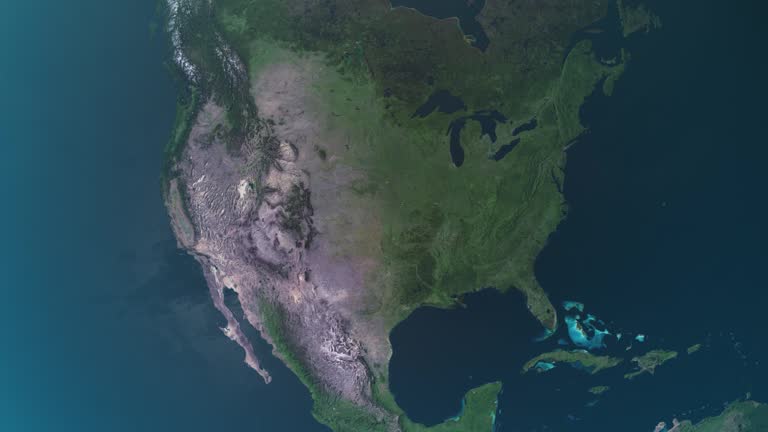
zoom in to texas, us from earth. satellite view of the united states of america. cinematic world map animation from outer space to territories. the concept of usa, highlight, globe, aerial view, tourism, travel, journey, cityscape - texas elevation map stock videos & royalty-free footage00:16Zoom in to Texas, US from Earth. Satellite view of the United States of America. Cinematic world map animation from outer space to territories. The concept of USA, highlight, globe, aerial view, tourism, travel, journey, cityscapeTexas, Map, Globe - Navigational Equipment
zoom in to texas, us from earth. satellite view of the united states of america. cinematic world map animation from outer space to territories. the concept of usa, highlight, globe, aerial view, tourism, travel, journey, cityscape - texas elevation map stock videos & royalty-free footage00:16Zoom in to Texas, US from Earth. Satellite view of the United States of America. Cinematic world map animation from outer space to territories. The concept of USA, highlight, globe, aerial view, tourism, travel, journey, cityscapeTexas, Map, Globe - Navigational Equipment
zoom from earth to texas - mexico border. satellite view of usa, epic photo real 4k resolution, realistic globe zoom-in from outer space to the city. the concept of highlighting the country in aerial view, tourism, journey, cityscape, border, barrier - texas elevation map stock videos & royalty-free footage00:20Zoom from Earth to Texas - Mexico border. Satellite view of USA, Epic photo real 4K resolution, Realistic globe zoom-in from outer space to the city. The concept of highlighting the country in aerial view, tourism, journey, cityscape, border, barrierMap, USA, Texas
texas map - texas elevation map stock videos & royalty-free footage00:10TEXAS MAPTexas, Map, Physical Geography
united states map, zooming in from the space through a 4k photo real animated globe, with a panoramic view consisting of africa, west europe and usa. epic spinning world animation, realistic planet earth, highlight, satellite, aerial, - texas elevation map stock videos & royalty-free footage00:14United States map, zooming in from the space through a 4K photo real animated globe, with a panoramic view consisting of Africa, West Europe and USA. Epic spinning world animation, Realistic planet earth, highlight, satellite, aerial,Globe - Navigational Equipment, Map, USA
zoom in to texas, us from earth. satellite view of the united states of america. cinematic world map animation from outer space to territories. the concept of usa, highlight, globe, aerial view, tourism, travel, journey, cityscape - texas elevation map stock videos & royalty-free footage00:16Zoom in to Texas, US from Earth. Satellite view of the United States of America. Cinematic world map animation from outer space to territories. The concept of USA, highlight, globe, aerial view, tourism, travel, journey, cityscapeTexas, Map, Outer Space
usa map highlighted with border and country name, zooming in from the space through a 4k photo real animated globe, with a panoramic view consisting of africa, west europe and usa. realistic epic spinning world animation, united states of america, - texas elevation map stock videos & royalty-free footage00:16USA map highlighted with border and country name, zooming in from the space through a 4K photo real animated globe, with a panoramic view consisting of Africa, West Europe and USA. Realistic epic spinning world animation, United States of America,USA, Globe - Navigational Equipment, Map
zoom in to texas, us from earth. satellite view of the united states of america. cinematic world map animation from outer space to territories. the concept of highlight the state, globe, tourism, travel, journey, aerial view of country, usa - texas elevation map stock videos & royalty-free footage00:16Zoom in to Texas, US from Earth. Satellite view of the United States of America. Cinematic world map animation from outer space to territories. The concept of highlight the state, globe, tourism, travel, journey, aerial view of country, USATexas, Map, Dallas - Texas
zoom in to united states from earth. highlighted us state abbreviations, satellite view of the us of america. cinematic world map animation from outer space to territories. the concept of usa, highlight, globe, aerial view, - texas elevation map stock videos & royalty-free footage00:20Zoom in to United States from Earth. Highlighted US State Abbreviations, Satellite view of the US of America. Cinematic world map animation from outer space to territories. The concept of USA, highlight, globe, aerial view,USA, Map, Globe - Navigational Equipment
highlighted united states map, zooming in from the space through a 4k photo real animated globe, with a panoramic view consisting of africa, west europe and usa. epic spinning world animation, realistic planet earth, highlight, satellite, aerial - texas elevation map stock videos & royalty-free footage00:16Highlighted United States map, zooming in from the space through a 4K photo real animated globe, with a panoramic view consisting of Africa, West Europe and USA. Epic spinning world animation, Realistic planet earth, highlight, satellite, aerialUSA, Map, Globe - Navigational Equipment
texas flag and map of texas zoomed to earth from space, real-time photo-animation. - texas elevation map stock videos & royalty-free footage00:21Texas flag and map of Texas zoomed to earth from space, real-time photo-animation.Texas, Map, Globe - Navigational Equipment
zoom in to houston, texas, united states from earth. satellite view of the usa. cinematic world map animation from outer space to territories. the concept of highlight the cities, globe, tourism, travel, aerial view of country - texas elevation map stock videos & royalty-free footage00:16Zoom in to Houston, Texas, United States from Earth. Satellite view of the USA. Cinematic world map animation from outer space to territories. The concept of highlight the cities, globe, tourism, travel, aerial view of countryHouston, Satellite View, Texas
zoom in to dallas, texas, united states from earth. satellite view of the usa. cinematic world map animation from outer space to territories. the concept of highlight the cities, globe, tourism, travel, aerial view of country - texas elevation map stock videos & royalty-free footage00:16Zoom in to Dallas, Texas, United States from Earth. Satellite view of the USA. Cinematic world map animation from outer space to territories. The concept of highlight the cities, globe, tourism, travel, aerial view of countryMap, Dallas - Texas, Texas
zoom in to texas, us from earth. satellite view of the united states of america. cinematic world map animation from outer space to territories. the concept of usa, highlight, globe, aerial view, tourism, travel, journey, cityscape - texas elevation map stock videos & royalty-free footage00:16Zoom in to Texas, US from Earth. Satellite view of the United States of America. Cinematic world map animation from outer space to territories. The concept of USA, highlight, globe, aerial view, tourism, travel, journey, cityscapeMap, Houston, Satellite View
zoom in to united states from earth. highlighted us state abbreviations, satellite view of the us of america. cinematic world map animation from outer space to territories. the concept of usa, highlight, globe, aerial view, - texas elevation map stock videos & royalty-free footage00:20Zoom in to United States from Earth. Highlighted US State Abbreviations, Satellite view of the US of America. Cinematic world map animation from outer space to territories. The concept of USA, highlight, globe, aerial view,Map, USA, Texas
zoom from earth to texas - mexico border. satellite view of usa, epic photo real 4k resolution, realistic globe zoom-in from outer space to the city. the concept of highlighting the country in aerial view, tourism, journey, cityscape, border, barrier - texas elevation map stock videos & royalty-free footage00:20Zoom from Earth to Texas - Mexico border. Satellite view of USA, Epic photo real 4K resolution, Realistic globe zoom-in from outer space to the city. The concept of highlighting the country in aerial view, tourism, journey, cityscape, border, barrierUSA, Map, American Culture
usa topographic map space view - texas elevation map stock videos & royalty-free footage00:08USA topographic map Space viewOuter Space, Texas, Map
north america map, zooming out into the space through a 4k photo real animated globe, with a panoramic view consisting of africa, west europe and usa. epic spinning world animation, realistic planet earth, highlight, satellite, aerial, - texas elevation map stock videos & royalty-free footage00:09North America map, zooming out into the space through a 4K photo real animated globe, with a panoramic view consisting of Africa, West Europe and USA. Epic spinning world animation, Realistic planet earth, highlight, satellite, aerial,USA, Map, Globe - Navigational Equipment
north america map, zooming in from the space through a 4k photo real animated globe, with a panoramic view consisting of africa, west europe and usa. epic spinning world animation, realistic planet earth, highlight, satellite, aerial, - texas elevation map stock videos & royalty-free footage00:14North America map, zooming in from the space through a 4K photo real animated globe, with a panoramic view consisting of Africa, West Europe and USA. Epic spinning world animation, Realistic planet earth, highlight, satellite, aerial,Globe - Navigational Equipment, Planet - Space, North America
texas map usa - earth zoom - texas elevation map stock videos & royalty-free footage00:11TEXAS Map USA - Earth ZoomTexas, Satellite View, World Map
weather map animation - south-eastern usa - texas elevation map stock videos & royalty-free footage00:28Weather map animation - south-eastern USAWeather Map, South Carolina, Wind
north america map, zooming out into the space through a 4k photo real animated globe, with a panoramic view consisting of africa, west europe and usa. epic spinning world animation, realistic planet earth, highlight, satellite, aerial, - texas elevation map stock videos & royalty-free footage00:09North America map, zooming out into the space through a 4K photo real animated globe, with a panoramic view consisting of Africa, West Europe and USA. Epic spinning world animation, Realistic planet earth, highlight, satellite, aerial,Globe - Navigational Equipment, Zoom Out, USA
zoom in to houston, texas, united states from earth. satellite view of the usa. cinematic world map animation from outer space to territories. the concept of highlight the cities, globe, tourism, travel, aerial view of country - texas elevation map stock videos & royalty-free footage00:16Zoom in to Houston, Texas, United States from Earth. Satellite view of the USA. Cinematic world map animation from outer space to territories. The concept of highlight the cities, globe, tourism, travel, aerial view of countryHouston, Globe - Navigational Equipment
zoom in to dallas, texas, united states from earth. satellite view of the usa. cinematic world map animation from outer space to territories. the concept of highlight the cities, globe, tourism, travel, aerial view of country - texas elevation map stock videos & royalty-free footage00:16Zoom in to Dallas, Texas, United States from Earth. Satellite view of the USA. Cinematic world map animation from outer space to territories. The concept of highlight the cities, globe, tourism, travel, aerial view of countryDallas - Texas, Globe - Navigational Equipment, Planet - Space
zoom in to kentucky, us from earth. satellite view of the united states of america. cinematic world map animation from outer space to territories. the concept of highlight the state, globe, tourism, travel, journey, aerial view of country, usa - texas elevation map stock videos & royalty-free footage00:16Zoom in to Kentucky, US from Earth. Satellite view of the United States of America. Cinematic world map animation from outer space to territories. The concept of highlight the state, globe, tourism, travel, journey, aerial view of country, USAMap
the united states of america (usa map from space showing topography. world map showing usa geography. - texas elevation map stock videos & royalty-free footage00:08The United States of America (USA Map from space showing topography. World map showing USA geography.Globe - Navigational Equipment, Satellite View, Planet - Space
3d representation of the united states with colorful state boundaries and elevations showcased in a visual display. 3d animation - texas elevation map stock videos & royalty-free footage00:083D representation of the United States with colorful state boundaries and elevations showcased in a visual display. 3D animationUSA, Map, American Culture
highlighted dark map of united states, zooming in from the space through a 4k photo real animated globe, with a panoramic view consisting of africa, north and south america. epic spinning world animation, realistic planet earth, highlight, satellite, - texas elevation map stock videos & royalty-free footage00:16Highlighted dark map of United States, zooming in from the space through a 4K photo real animated globe, with a panoramic view consisting of Africa, North and South America. Epic spinning world animation, Realistic planet earth, highlight, satellite,Map, USA, Dark
zoom in to austin, texas, united states from earth. satellite view of the usa. cinematic world map animation from outer space to territories. the concept of highlight the cities, globe, tourism, travel, aerial view of country - texas elevation map stock videos & royalty-free footage00:16Zoom in to Austin, Texas, United States from Earth. Satellite view of the USA. Cinematic world map animation from outer space to territories. The concept of highlight the cities, globe, tourism, travel, aerial view of countryAustin - Texas, Map, Globe - Navigational Equipment
mexico alter border" / man standing at map on wall using pointer to show altered course of rio grande river / aerial shot of altered course of river... - texas elevation map stock videos & royalty-free footage02:39Course of Rio Grande is altered, changing the border between US and MexicoMexico, Farmer, Texas
zoom in to san antonio, texas, united states from earth. satellite view of the usa. cinematic world map animation from outer space to territories. the concept of highlight the cities, globe, tourism, travel, aerial view of country - texas elevation map stock videos & royalty-free footage00:16Zoom in to San Antonio, Texas, United States from Earth. Satellite view of the USA. Cinematic world map animation from outer space to territories. The concept of highlight the cities, globe, tourism, travel, aerial view of countryMap
"paramount news sports feature-1952 all-american" over us map like football field / stadium crowd / marching band spells usa / man looking at racks... - texas elevation map stock videos & royalty-free footage03:53All-American football players on campuses; Bischoff, Stolhandske, Modzelewski, Kraemer, Willhoite, Chickillo, Tamburo, Vessels, McAuliffe, Cameron, OlszewskiAmerican Football - Ball, University of Southern California, Campus
4k, digital glitch intro world map with united states - texas elevation map stock videos & royalty-free footage00:124K, Digital Glitch Intro World Map with United StatesMap, Outline, Direction
zoom in to houston, texas, united states from earth. satellite view of the usa. cinematic world map animation from outer space to territories. the concept of highlight the cities, globe, tourism, travel, aerial view of country - texas elevation map stock videos & royalty-free footage00:16Zoom in to Houston, Texas, United States from Earth. Satellite view of the USA. Cinematic world map animation from outer space to territories. The concept of highlight the cities, globe, tourism, travel, aerial view of countryGlobe - Navigational Equipment, Houston, Planet - Space
zoom in to austin, texas, united states from earth. satellite view of the usa. cinematic world map animation from outer space to territories. the concept of highlight the cities, globe, tourism, travel, aerial view of country - texas elevation map stock videos & royalty-free footage00:16Zoom in to Austin, Texas, United States from Earth. Satellite view of the USA. Cinematic world map animation from outer space to territories. The concept of highlight the cities, globe, tourism, travel, aerial view of countrySatellite, Texas, Satellite View
north america map, zooming in from the space through a 4k photo real animated globe, with a panoramic view consisting of africa, west europe and usa. epic spinning world animation, realistic planet earth, highlight, satellite, aerial, - texas elevation map stock videos & royalty-free footage00:14North America map, zooming in from the space through a 4K photo real animated globe, with a panoramic view consisting of Africa, West Europe and USA. Epic spinning world animation, Realistic planet earth, highlight, satellite, aerial,Globe - Navigational Equipment, Map, Satellite View
air quality in texas, usa, 2005-2014 - texas elevation map stock videos & royalty-free footage00:15Air quality in Texas, USA, 2005-2014Map, Wind, Texas
bosnian peace talks fail/ sarajevo shelled; 22.35 bosnia herzegovina: sarjevotgv city skyline with smoke rising as shelling takes placebv people... - texas elevation map stock videos & royalty-free footage01:50Bosnian peace talks fail/ Sarajevo shelledBosnia and Herzegovina, Sarajevo, David Owen
royal navy: r.n.v.r. annual exercise; scotland: cromarty and moray firth:extms minesweeper along / sailor signalling /lamp signalling / skipper reads... - texas elevation map stock videos & royalty-free footage00:59ARMED FORCES / DEFENCE: Royal Navy: R.N.V.R. annual exerciseScotland
flying aerial drone close to austin texas capital hill skyline cityscape butler park highrise fly over - texas elevation map stock videos & royalty-free footage00:13Flying Aerial Drone Close to Austin Texas capital hill Skyline Cityscape Butler Park highrise Fly over
aerial austin texas black and white monochrome downtown skyline capital hill at butler park 2016 - texas elevation map stock videos & royalty-free footage00:12Aerial Austin Texas Black and white Monochrome Downtown Skyline Capital Hill at Butler Park 2016
congress avenue historic district with modern high-rises. austin texas downtown at sunset. drone vertical tilt shot revealing street grid below. - texas elevation map stock videos & royalty-free footage00:16Congress Avenue historic district with modern high-rises. Austin Texas downtown at sunset. Drone vertical tilt shot revealing street grid below.
zoom in to san antonio, texas, united states from earth. satellite view of the usa. cinematic world map animation from outer space to territories. the concept of highlight the cities, globe, tourism, travel, aerial view of country - texas elevation map stock videos & royalty-free footage00:16Zoom in to San Antonio, Texas, United States from Earth. Satellite view of the USA. Cinematic world map animation from outer space to territories. The concept of highlight the cities, globe, tourism, travel, aerial view of country
zoom in to san antonio, texas, united states from earth. satellite view of the usa. cinematic world map animation from outer space to territories. the concept of highlight the cities, globe, tourism, travel, aerial view of country - texas elevation map stock videos & royalty-free footage00:16Zoom in to San Antonio, Texas, United States from Earth. Satellite view of the USA. Cinematic world map animation from outer space to territories. The concept of highlight the cities, globe, tourism, travel, aerial view of country
zoom in to san antonio, texas, united states from earth. satellite view of the usa. cinematic world map animation from outer space to territories. the concept of highlight the cities, globe, tourism, travel, aerial view of country - texas elevation map stock videos & royalty-free footage00:16Zoom in to San Antonio, Texas, United States from Earth. Satellite view of the USA. Cinematic world map animation from outer space to territories. The concept of highlight the cities, globe, tourism, travel, aerial view of country
zoom in to houston, texas, united states from earth. satellite view of the usa. cinematic world map animation from outer space to territories. the concept of highlight the cities, globe, tourism, travel, aerial view of country - texas elevation map stock videos & royalty-free footage00:16Zoom in to Houston, Texas, United States from Earth. Satellite view of the USA. Cinematic world map animation from outer space to territories. The concept of highlight the cities, globe, tourism, travel, aerial view of countryGlobe - Navigational Equipment, Houston, Planet - Space
zoom in to dallas, texas, united states from earth. satellite view of the usa. cinematic world map animation from outer space to territories. the concept of highlight the cities, globe, tourism, travel, aerial view of country - texas elevation map stock videos & royalty-free footage00:16Zoom in to Dallas, Texas, United States from Earth. Satellite view of the USA. Cinematic world map animation from outer space to territories. The concept of highlight the cities, globe, tourism, travel, aerial view of country
zoom in to dallas, texas, united states from earth. satellite view of the usa. cinematic world map animation from outer space to territories. the concept of highlight the cities, globe, tourism, travel, aerial view of country - texas elevation map stock videos & royalty-free footage00:16Zoom in to Dallas, Texas, United States from Earth. Satellite view of the USA. Cinematic world map animation from outer space to territories. The concept of highlight the cities, globe, tourism, travel, aerial view of countryDallas - Texas
zoom in to austin, texas, united states from earth. satellite view of the usa. cinematic world map animation from outer space to territories. the concept of highlight the cities, globe, tourism, travel, aerial view of country - texas elevation map stock videos & royalty-free footage00:16Zoom in to Austin, Texas, United States from Earth. Satellite view of the USA. Cinematic world map animation from outer space to territories. The concept of highlight the cities, globe, tourism, travel, aerial view of country
zoom in to austin, texas, united states from earth. satellite view of the usa. cinematic world map animation from outer space to territories. the concept of highlight the cities, globe, tourism, travel, aerial view of country - texas elevation map stock videos & royalty-free footage00:16Zoom in to Austin, Texas, United States from Earth. Satellite view of the USA. Cinematic world map animation from outer space to territories. The concept of highlight the cities, globe, tourism, travel, aerial view of country
passengers on a united airlines flight from houston to new york city were https://x.com/houstonfire/status/1886082902976270680 forced to deplane in... - texas elevation map stock videos & royalty-free footage00:41Scary Moment Plane Catches Fire During Takeoff, Forcing Passengers to EvacuateAeroplane
//x.com/nwsfortworth/status/1884832659576439219 national weather service issued a flash flood warning for parts of dallas county, texas, on the... - texas elevation map stock videos & royalty-free footage00:14Texas Freeway Floods After Storms Bring Record-Breaking Rainfall
debris coming from https://www.spacex.com/vehicles/starship/ spacex starship's launch in south texas damaged a car on thursday, april 20. footage... - texas elevation map stock videos & royalty-free footage01:58Car Gets Hit by Debris During SpaceX LaunchSpaceX Starship, SpaceX, Boca Chica - Texas
southwest airlines flight departing from houston, texas, was returned to the airport after the aircraft's engine experienced a... - texas elevation map stock videos & royalty-free footage01:01Flames Shoot From Jetliner Engine Over HoustonAeroplane, Taking Off - Activity
"dems close ranks behind nominees" superimposed over democratic convention / high angle convention floor at the international amphitheatre / vs vp... - texas elevation map stock videos & royalty-free footage01:59Democratic National Convention in Chicago; delegates and candidates arrive for Republican National Convention in San Francisco; 1956Election, Confetti, Chicago - Illinois
pan right to left from footage of astronauts in spaceship to trajectory map. could be monitor or screen. could be mission control for space launch - texas elevation map stock videos & royalty-free footage00:14PAN RIGHT TO LEFT FROM FOOTAGE OF ASTRONAUTS IN SPACESHIP TO TRAJECTORY MAP. COULD BE MONITOR OR SCREEN. COULD BE MISSION CONTROL FOR SPACE LAUNCHNight
pan left to right from trajectory map projected on wall, monitor, or screen to footage of astronauts in spaceship. camera pans back to map. could be mission control for space launch - texas elevation map stock videos & royalty-free footage00:27PAN LEFT TO RIGHT FROM TRAJECTORY MAP PROJECTED ON WALL, MONITOR, OR SCREEN TO FOOTAGE OF ASTRONAUTS IN SPACESHIP. CAMERA PANS BACK TO MAP. COULD BE MISSION CONTROL FOR SPACE LAUNCH
united states (usa) map, zooming out into the space through a 4k photo real animated globe, with a panoramic view consisting of africa, west europe and usa. epic spinning world animation, america, realistic planet earth, highlight, satellite, aerial, - texas elevation map stock videos & royalty-free footage00:09United States (USA) map, zooming out into the space through a 4K photo real animated globe, with a panoramic view consisting of Africa, West Europe and USA. Epic spinning world animation, America, Realistic planet earth, highlight, satellite, aerial,
low angle governor john fine, pennsylvania; governor daniel thornton, colorado; and governor allan shivers, texas stand in military receiving line... - texas elevation map stock videos & royalty-free footage02:02Governors John Fine, Daniel Thornton, and Allan Shivers visit South Korea front line and orphanage in 1954
close up view of the texas border, state line marker coming from anthony, new mexico entering el paso county, el paso, texas, drone view - texas elevation map stock videos & royalty-free footage00:08Close Up View Of The Texas Border, State Line Marker Coming From Anthony, New Mexico Entering El Paso County, El Paso, Texas, Drone ViewHouston, Road
aerial top view of map by people at park on sunny day, drone ascending over grass - austin, texas - texas elevation map stock videos & royalty-free footage00:07Aerial top view of map by people at park on sunny day, drone ascending over grass - Austin, TexasArt, Austin - Texas