3d representation of the united states with colorful state boundaries and elevations showcased in a visual display. 3d animation - us map regions stock videos & royalty-free footage00:083D representation of the United States with colorful state boundaries and elevations showcased in a visual display. 3D animationUSA, Map, American Culture
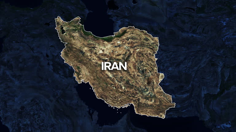
iran map animation - us map regions stock videos & royalty-free footage00:12Iran Map AnimationMap, USA, Physical Geography
usa map with usa flag, zoom in to usa terrain map from wide perspective view - us map regions stock videos & royalty-free footage00:13USA Map with USA Flag, zoom in to USA terrain map from wide perspective viewUSA, Map, American Culture
united states presidential election 2020 - us map regions stock videos & royalty-free footage00:15United States Presidential Election 2020Election, USA, American Culture
brazil map with regions against blue animated background 4k uhd - us map regions stock videos & royalty-free footage00:29Brazil Map with regions against blue animated background 4k UHDMap, Connection, Video
the westward movement iv - texas and the mexican war - part 27 of 31. the film reviews the causes of the texas settlers' revolt, which led to independence for texas; ties the annexation of texas to issues of slavery and territorial expansion. it points o - us map regions stock videos & royalty-free footage00:35The Westward Movement IV - Texas and the Mexican War - part 27 of 31. The film reviews the causes of the Texas settlers' revolt, which led to independence for Texas; ties the annexation of Texas to issues of slavery and territorial expansion. It points oMap, War
us regions: contrasts of land and people - part 2 of 53. using both animation and live-action photography, this film enables viewers to tour a richly diverse country that can be divided into eight regions: new england, the middle atlantic, the south, the - us map regions stock videos & royalty-free footage00:30US Regions: Contrasts of Land and People - part 2 of 53. Using both animation and live-action photography, this film enables viewers to tour a richly diverse country that can be divided into eight regions: New England, the Middle Atlantic, the South, theUSA, Map, Colours
us regions: contrasts of land and people - part 4 of 53. using both animation and live-action photography, this film enables viewers to tour a richly diverse country that can be divided into eight regions: new england, the middle atlantic, the south, the - us map regions stock videos & royalty-free footage00:31US Regions: Contrasts of Land and People - part 4 of 53. Using both animation and live-action photography, this film enables viewers to tour a richly diverse country that can be divided into eight regions: New England, the Middle Atlantic, the South, theUSA, Map, Empire
the westward movement iv - texas and the mexican war - part 29 of 31. the film reviews the causes of the texas settlers' revolt, which led to independence for texas; ties the annexation of texas to issues of slavery and territorial expansion. it points o - us map regions stock videos & royalty-free footage00:28The Westward Movement IV - Texas and the Mexican War - part 29 of 31. The film reviews the causes of the Texas settlers' revolt, which led to independence for Texas; ties the annexation of Texas to issues of slavery and territorial expansion. It points o
iran map animation - us map regions stock videos & royalty-free footage00:12Iran Map AnimationUSA, Aerial View, Map
us regions: contrasts of land and people - part 3 of 53. using both animation and live-action photography, this film enables viewers to tour a richly diverse country that can be divided into eight regions: new england, the middle atlantic, the south, the - us map regions stock videos & royalty-free footage00:30US Regions: Contrasts of Land and People - part 3 of 53. Using both animation and live-action photography, this film enables viewers to tour a richly diverse country that can be divided into eight regions: New England, the Middle Atlantic, the South, theMap, USA
the westward movement iv - texas and the mexican war - part 2 of 31. the film reviews the causes of the texas settlers' revolt, which led to independence for texas; ties the annexation of texas to issues of slavery and territorial expansion. it points ou - us map regions stock videos & royalty-free footage00:32The Westward Movement IV - Texas and the Mexican War - part 2 of 31. The film reviews the causes of the Texas settlers' revolt, which led to independence for Texas; ties the annexation of Texas to issues of slavery and territorial expansion. It points ouTexas, Map, Landscape - Scenery
the coniferous forest biome - part 1 of 27. the coniferous forest is a biome in which there are relatively few niches and therefore relatively few species of plants and animals. this film identifies the large coniferous forest areas of the world, and exam - us map regions stock videos & royalty-free footage00:35The Coniferous Forest Biome - part 1 of 27. The coniferous forest is a biome in which there are relatively few niches and therefore relatively few species of plants and animals. This film identifies the large coniferous forest areas of the world, and examMap, USA, Africa
iran map animation: tehran zoom-in - us map regions stock videos & royalty-free footage00:15Iran Map Animation: Tehran Zoom-inUSA, Globe - Navigational Equipment, Tehran
severe weather is expected to impact large portions of the united states this week, with violent thunderstorms forecast to sweep across the... - us map regions stock videos & royalty-free footage00:14MOTION GRAPHIC - Severe storms to slam large parts of U.S.; tornadoes, hail and flooding possibleTornado, Map
us regions: contrasts of land and people - part 42 of 53. using both animation and live-action photography, this film enables viewers to tour a richly diverse country that can be divided into eight regions: new england, the middle atlantic, the south, the - us map regions stock videos & royalty-free footage00:29US Regions: Contrasts of Land and People - part 42 of 53. Using both animation and live-action photography, this film enables viewers to tour a richly diverse country that can be divided into eight regions: New England, the Middle Atlantic, the South, theMap, 1980-1989, USA
midwest: heartland of the nation - part 30 of 44. an examination of the many factors responsible for the wealth of the midwest. fertile soil and good climate provide an unrivaled agricultural output. iron ore pours out of the mesabi range and low cost sh - us map regions stock videos & royalty-free footage00:31Midwest: Heartland of the Nation - part 30 of 44. An examination of the many factors responsible for the wealth of the Midwest. Fertile soil and good climate provide an unrivaled agricultural output. Iron ore pours out of the Mesabi range and low cost shFactory, Metal, Michigan
usa map with states - us map regions stock videos & royalty-free footage00:05USA map with statesUSA, Digitally Generated Image, Three Dimensional
usa map with states - us map regions stock videos & royalty-free footage00:05USA map with statesUSA, Map
map of united states of america - various regions are filled in by different color shingles. - us map regions stock videos & royalty-free footage00:20According to Plan: The Story of Modern Sidewalls, part 18 of 34USA, 1950-1959, Map
iran map animation - us map regions stock videos & royalty-free footage00:10Iran Map AnimationUSA, War, Persian Culture
us regions: contrasts of land and people - part 45 of 53. using both animation and live-action photography, this film enables viewers to tour a richly diverse country that can be divided into eight regions: new england, the middle atlantic, the south, the - us map regions stock videos & royalty-free footage00:33US Regions: Contrasts of Land and People - part 45 of 53. Using both animation and live-action photography, this film enables viewers to tour a richly diverse country that can be divided into eight regions: New England, the Middle Atlantic, the South, theCrude Oil, 1980-1989, Map
iran map animation - us map regions stock videos & royalty-free footage00:10Iran Map AnimationUSA, War
the sudanese army has expanded its control and military gains against the rapid support forces paramilitary group while the clashes continue in some... - us map regions stock videos & royalty-free footage00:31MOTION GRAPHICS - Sudanese army expands military gains against rebel factionSudan, Map, Military
nagorno-karabakh region is disputed by azerbaijan and armenia. - us map regions stock videos & royalty-free footage00:30Nagorno-Karabakh region is disputed by Azerbaijan and Armenia.Caspian Sea, Map, Country - Geographic Area
chile map with regions against blue animated background 4k uhd - us map regions stock videos & royalty-free footage00:29Chile Map with regions against blue animated background 4k UHDChile, Map, Connection
peru map with regions against blue animated background 4k uhd - us map regions stock videos & royalty-free footage00:29Peru Map with regions against blue animated background 4k UHDPeru, Map, Technology
the westward movement iv - texas and the mexican war - part 20 of 31. the film reviews the causes of the texas settlers' revolt, which led to independence for texas; ties the annexation of texas to issues of slavery and territorial expansion. it points o - us map regions stock videos & royalty-free footage00:29The Westward Movement IV - Texas and the Mexican War - part 20 of 31. The film reviews the causes of the Texas settlers' revolt, which led to independence for Texas; ties the annexation of Texas to issues of slavery and territorial expansion. It points o
southeastern states (2nd edition) - part 2 of 19. an overview of the geography, resources, and cultural patterns of the southeastern states. analyzes geographical features of the region; describes population trends; and shows the interdependence of the s - us map regions stock videos & royalty-free footage00:33Southeastern States (2nd edition) - part 2 of 19. An overview of the geography, resources, and cultural patterns of the Southeastern States. Analyzes geographical features of the region; describes population trends; and shows the interdependence of the SMap, Virginia - US State, Mississippi
map graphic showing where iran's top general qassem soleimani was killed following united states airstrikes in baghdad.the targeted killing of... - us map regions stock videos & royalty-free footage00:30US kills Iran’s most senior general in Baghdad airstrike - Map graphicMap, Syria, Iraq
us regions: contrasts of land and people - part 37 of 53. using both animation and live-action photography, this film enables viewers to tour a richly diverse country that can be divided into eight regions: new england, the middle atlantic, the south, the - us map regions stock videos & royalty-free footage00:37US Regions: Contrasts of Land and People - part 37 of 53. Using both animation and live-action photography, this film enables viewers to tour a richly diverse country that can be divided into eight regions: New England, the Middle Atlantic, the South, theCalifornia, Old-fashioned, USA
us regions: contrasts of land and people - part 16 of 53. using both animation and live-action photography, this film enables viewers to tour a richly diverse country that can be divided into eight regions: new england, the middle atlantic, the south, the - us map regions stock videos & royalty-free footage00:25US Regions: Contrasts of Land and People - part 16 of 53. Using both animation and live-action photography, this film enables viewers to tour a richly diverse country that can be divided into eight regions: New England, the Middle Atlantic, the South, theMiami, 1980-1989, Map
the star-spangled banner of the usa and the maple leaf of canada fly on flag poles next to the flags of alaska, british columbia and the yukon territory on the border between these regions. - us map regions stock videos & royalty-free footage00:04The Star-Spangled Banner of the USA and the Maple Leaf of Canada fly on flag poles next to the flags of Alaska, British Columbia and the Yukon Territory on the border between these regions.Canada, USA, National Border
minimal blue political map of europe and asia - us map regions stock videos & royalty-free footage00:15Minimal Blue Political Map of Europe and AsiaWorld Map, Global
us regions: contrasts of land and people - part 47 of 53. using both animation and live-action photography, this film enables viewers to tour a richly diverse country that can be divided into eight regions: new england, the middle atlantic, the south, the - us map regions stock videos & royalty-free footage00:31US Regions: Contrasts of Land and People - part 47 of 53. Using both animation and live-action photography, this film enables viewers to tour a richly diverse country that can be divided into eight regions: New England, the Middle Atlantic, the South, theMap, Aeroplane, Archival
southeastern states (2nd edition) - part 16 of 19. an overview of the geography, resources, and cultural patterns of the southeastern states. analyzes geographical features of the region; describes population trends; and shows the interdependence of the - us map regions stock videos & royalty-free footage00:32Southeastern States (2nd edition) - part 16 of 19. An overview of the geography, resources, and cultural patterns of the Southeastern States. Analyzes geographical features of the region; describes population trends; and shows the interdependence of theUSA
crowded commodity exchange; traders on floor / vs man writes with chalk on tote board noting different canadian regions; board showing commodity... - us map regions stock videos & royalty-free footage02:00Nazi Germany's World War II need for raw materials from around the worldGermany, Factory, Industry
points out that the central lowlands produce more automobiles, farm machinery and industrial and electrical equipment and grow more corn and oats... - us map regions stock videos & royalty-free footage00:291960s: Map of Central Lowlands. Cars drive onto trailer. Workers assemble carUSA, 1960-1969
us regions: contrasts of land and people - part 21 of 53. using both animation and live-action photography, this film enables viewers to tour a richly diverse country that can be divided into eight regions: new england, the middle atlantic, the south, the - us map regions stock videos & royalty-free footage00:27US Regions: Contrasts of Land and People - part 21 of 53. Using both animation and live-action photography, this film enables viewers to tour a richly diverse country that can be divided into eight regions: New England, the Middle Atlantic, the South, the1980-1989, Philadelphia - Pennsylvania, New York City
nagorno-karabakh region is disputed by azerbaijan and armenia. - us map regions stock videos & royalty-free footage00:29Nagorno-Karabakh region is disputed by Azerbaijan and Armenia.War, Conflict, Map
professor preobrajensky, director of drilling works, w/ government committee in the urals mountains, they examine map. vice-chairman vsnkh kossior,... - us map regions stock videos & royalty-free footage01:271928 B/W MONTAGE Professor Preobrajensky, director of drilling works, w/ government committee in the Urals mountains, they examine map. Vice-chairman VSNKh Kossior, on the boat/Population, local community of Chusovoy region welcomes committee / RussiaFormer Soviet Union
italy map with italian flag, zoom in to italy terrain map from wide perspective view - us map regions stock videos & royalty-free footage00:13Italy Map with Italian Flag, zoom in to Italy terrain map from wide perspective view
shia pilgrims killed by suicide bombers; intus troops looking at map of region in makeshift comman centre unidentified us soldier speaking sot ' they... - us map regions stock videos & royalty-free footage00:31150 Shia pilgrims killed by suicide bombers
/ animated map of the tax regions / workers sorting returns into slots / enveloped tax returns coming off the sorting machine. irs regional service... - us map regions stock videos & royalty-free footage00:36IRS regional service centersInternal Revenue Service
recounts the history of texas and the southwest from the sixteenth to the mid-nineteenth century - us map regions stock videos & royalty-free footage00:371950s: Map of Texas Republic. Close up, hand signing documentConfederate States of America, Map, Texas
during this period, the largest frontier region of the west was settled. development by early miners, cattle ranchers, farmers and homesteaders is... - us map regions stock videos & royalty-free footage00:331960s: Men panning for gold, look at nugget. Map of western United States, labelWild West
the scenes depict boys looking at books, studying maps, writing and pointing to regions on the maps. there are also scenes of farm equipment in... - us map regions stock videos & royalty-free footage00:371960s: Apartment buildings by highway. High angle of city streetUSA
gymnosperms - part 5 of 29. demonstrates that gymnosperms are seed plants which bear their seeds on cones. animation and time-lapse sequence trace the life cycle of the pine through the growth of the pollen and seed cones, pollination, fertilization, and - us map regions stock videos & royalty-free footage00:29Gymnosperms - part 5 of 29. Demonstrates that gymnosperms are seed plants which bear their seeds on cones. Animation and time-lapse sequence trace the life cycle of the pine through the growth of the pollen and seed cones, pollination, fertilization, andMap
us regions: contrasts of land and people - part 41 of 53. using both animation and live-action photography, this film enables viewers to tour a richly diverse country that can be divided into eight regions: new england, the middle atlantic, the south, the - us map regions stock videos & royalty-free footage00:32US Regions: Contrasts of Land and People - part 41 of 53. Using both animation and live-action photography, this film enables viewers to tour a richly diverse country that can be divided into eight regions: New England, the Middle Atlantic, the South, the1980-1989, Snow, Town
us regions: contrasts of land and people - part 25 of 53. using both animation and live-action photography, this film enables viewers to tour a richly diverse country that can be divided into eight regions: new england, the middle atlantic, the south, the - us map regions stock videos & royalty-free footage00:29US Regions: Contrasts of Land and People - part 25 of 53. Using both animation and live-action photography, this film enables viewers to tour a richly diverse country that can be divided into eight regions: New England, the Middle Atlantic, the South, theChicago - Illinois
us regions: contrasts of land and people - part 13 of 53. using both animation and live-action photography, this film enables viewers to tour a richly diverse country that can be divided into eight regions: new england, the middle atlantic, the south, the - us map regions stock videos & royalty-free footage00:30US Regions: Contrasts of Land and People - part 13 of 53. Using both animation and live-action photography, this film enables viewers to tour a richly diverse country that can be divided into eight regions: New England, the Middle Atlantic, the South, thePoverty, 1980-1989, USA
us regions: contrasts of land and people - part 49 of 53. using both animation and live-action photography, this film enables viewers to tour a richly diverse country that can be divided into eight regions: new england, the middle atlantic, the south, the - us map regions stock videos & royalty-free footage00:32US Regions: Contrasts of Land and People - part 49 of 53. Using both animation and live-action photography, this film enables viewers to tour a richly diverse country that can be divided into eight regions: New England, the Middle Atlantic, the South, theHawaii Islands, Empire, USA
midwest: heartland of the nation - part 4 of 44. an examination of the many factors responsible for the wealth of the midwest. fertile soil and good climate provide an unrivaled agricultural output. iron ore pours out of the mesabi range and low cost shi - us map regions stock videos & royalty-free footage00:33Midwest: Heartland of the Nation - part 4 of 44. An examination of the many factors responsible for the wealth of the Midwest. Fertile soil and good climate provide an unrivaled agricultural output. Iron ore pours out of the Mesabi range and low cost shiUSA, 1960-1969, Economy
the westward movement iv - texas and the mexican war - part 19 of 31. the film reviews the causes of the texas settlers' revolt, which led to independence for texas; ties the annexation of texas to issues of slavery and territorial expansion. it points o - us map regions stock videos & royalty-free footage00:31The Westward Movement IV - Texas and the Mexican War - part 19 of 31. The film reviews the causes of the Texas settlers' revolt, which led to independence for Texas; ties the annexation of Texas to issues of slavery and territorial expansion. It points oSouthwest USA, Indigenous Peoples, Emigration and Immigration
southeastern states (2nd edition) - part 15 of 19. an overview of the geography, resources, and cultural patterns of the southeastern states. analyzes geographical features of the region; describes population trends; and shows the interdependence of the - us map regions stock videos & royalty-free footage00:28Southeastern States (2nd edition) - part 15 of 19. An overview of the geography, resources, and cultural patterns of the Southeastern States. Analyzes geographical features of the region; describes population trends; and shows the interdependence of theMap
alaska: the 49th state (2nd edition) - part 4 of 29. visualizing the natural beauty of alaska, and developments of the five geographic areas, showing the land, resources, the people and their work. surveys the rapidly growing cities, the homesteads, farml - us map regions stock videos & royalty-free footage00:32Alaska: The 49th State (2nd edition) - part 4 of 29. Visualizing the natural beauty of Alaska, and developments of the five geographic areas, showing the land, resources, the people and their work. Surveys the rapidly growing cities, the homesteads, farmlMap, Fairbanks, City
arizona senator john mccain focuses the attention of the senate on the breadth of terrorism across swaths of territory in the middle east region. - us map regions stock videos & royalty-free footage00:33McCain says to look at map of the Middle East
david cameron speech in manchester on regional growth fund; cameron speech sot- the third part of the plan, and it is crucial, is to make sure that... - us map regions stock videos & royalty-free footage03:43David Cameron speech in Manchester on Regional Growth Fund
colin powell visit; itn int rugman sitting chatting to ziad abu amr ziad abu amr interviewed sot - you can't expect occupied to commit to ceasefire... - us map regions stock videos & royalty-free footage02:10Colin Powell visit
intsidney jones interview sot- the us are worried that there could be an attack in the straits of malacca either on one of their own ships or an... - us map regions stock videos & royalty-free footage00:52SOUTH EAST ASIA: Pirate Attacks on Ships
general predicts further terror attacks if taliban war lost; afghanistan:intgeneral dan mcneill along to greet reporter, reporter and mcneill looking... - us map regions stock videos & royalty-free footage01:53US general predicts further terror attacks if Taliban war lost
bales of cotton being stacked on waterfront moving down chute to dock. charts: cotton production - usa vs foreign. southern map: showing old cotton... - us map regions stock videos & royalty-free footage00:41Cotton bales, Production/Map
map of pacific region showing simultaneous attacks in new guinea and alaska / japanese planes flying over ship with japanese flag / snowy mountains... - us map regions stock videos & royalty-free footage01:02Japanese Air Raid On Dutch Harbor, AlaskaPapua New Guinea
aerial view of road through snowy terrain in northwest canada / various angles of tractor clearing trees / map of northwest region of north america /... - us map regions stock videos & royalty-free footage00:33Trailblazers Haul Supplies To New Air Field In Northwest Canada
athens (important capitals) - us map regions stock videos & royalty-free footage00:06Athens (important capitals)
new york (important cities) - us map regions stock videos & royalty-free footage00:06New York (important cities)
paris (important capitals) - us map regions stock videos & royalty-free footage00:06Paris (important capitals)
rome (important capitals) - us map regions stock videos & royalty-free footage00:06Rome (important capitals)
point hope, alaska, united states archival black-and-white footage documents the traditional hunting practices and daily life of an iñupiat community... - us map regions stock videos & royalty-free footage05:13Inupiat Life in Point Hope Alaska Showing Traditional Seal Hunting Arctic Fishing and Family Life in 1949
zoom in to north america from earth. satellite view of the america. cinematic world map animation from outer space to continents. the concept of highlight the continent, tourism, area, travel, journey, aerial view of territories - us map regions stock videos & royalty-free footage00:16Zoom in to North America from Earth. Satellite view of the America. Cinematic world map animation from outer space to continents. The concept of highlight the continent, tourism, area, travel, journey, aerial view of territories
zoom in to north america from earth. satellite view of the america. cinematic world map animation from outer space to continents. the concept of highlight the continent, tourism, area, travel, journey, aerial view of territories - us map regions stock videos & royalty-free footage00:16Zoom in to North America from Earth. Satellite view of the America. Cinematic world map animation from outer space to continents. The concept of highlight the continent, tourism, area, travel, journey, aerial view of territories
zoom in to north america from earth. satellite view of the america. cinematic world map animation from outer space to continents. the concept of highlight the continent, tourism, area, travel, journey, aerial view of territories - us map regions stock videos & royalty-free footage00:16Zoom in to North America from Earth. Satellite view of the America. Cinematic world map animation from outer space to continents. The concept of highlight the continent, tourism, area, travel, journey, aerial view of territories
zoom in to north america from earth. satellite view of the america. cinematic world map animation from outer space to continents. the concept of highlight the continent, tourism, area, travel, journey, aerial view of territories - us map regions stock videos & royalty-free footage00:16Zoom in to North America from Earth. Satellite view of the America. Cinematic world map animation from outer space to continents. The concept of highlight the continent, tourism, area, travel, journey, aerial view of territories
article iii project senior counsel will chamberlain testifies at a senate judiciary subcommittee on the constitution hearing on redistricting after... - us map regions stock videos & royalty-free footage01:04Conservative advocate discusses arguments that Voting Rights Act should prohibit intentional racial discrimination without requiring racial balancing in district maps as race was allegedly used impermissibly in California and Illinois redistricting
senate judiciary subcommittee on the constitution chairman eric schmitt says continuing his opening statement at a hearing on gerrymandering that the... - us map regions stock videos & royalty-free footage01:28Senator Schmitt claims prior Section 2 voting rights framework encouraged racial sorting in district maps and gave Democrats partisan advantages by framing political demands as civil rights requirements