satellite view of america from space. cinematic earth rotation animation. concept of aerial view of countries, spinning globe, world map, tourism, travel, journey, - us mexico map stock videos & royalty-free footage00:12Satellite view of America from space. Cinematic earth rotation animation. Concept of aerial view of countries, spinning globe, world map, tourism, travel, journey,Globe - Navigational Equipment, Planet - Space, World Map
zoom from earth to texas - mexico border. satellite view of usa, epic photo real 4k resolution, realistic globe zoom-in from outer space to the city. the concept of highlighting the country in aerial view, tourism, journey, cityscape, border, barrier - us mexico map stock videos & royalty-free footage00:20Zoom from Earth to Texas - Mexico border. Satellite view of USA, Epic photo real 4K resolution, Realistic globe zoom-in from outer space to the city. The concept of highlighting the country in aerial view, tourism, journey, cityscape, border, barrierMap, USA, Texas
zoom from earth to texas - mexico border. satellite view of usa, epic photo real 4k resolution, realistic globe zoom-in from outer space to the city. the concept of highlighting the country in aerial view, tourism, journey, cityscape, border, barrier - us mexico map stock videos & royalty-free footage00:20Zoom from Earth to Texas - Mexico border. Satellite view of USA, Epic photo real 4K resolution, Realistic globe zoom-in from outer space to the city. The concept of highlighting the country in aerial view, tourism, journey, cityscape, border, barrierUSA, Map, American Culture
beautiful sunset over usa and canada - us mexico map stock videos & royalty-free footage00:30Beautiful sunset over USA and CanadaGlobe - Navigational Equipment, Time Lapse, Outer Space
president donald trump signed a series of executive actions, memoranda, and proclamations on his first day in office, covering a wide range of... - us mexico map stock videos & royalty-free footage00:25MOTIONGRAPHIC - Trump renames Gulf of Mexico to 'Gulf of America'Gulf of Mexico, Map, Mexico
mainland usa pops up after earth zoom (with alpha matte) - us mexico map stock videos & royalty-free footage00:22mainland USA pops up after earth zoom (with alpha matte)Canada, USA, Mexico
global cities index earth - us mexico map stock videos & royalty-free footage00:30Global Cities Index EarthMap, Globe - Navigational Equipment, Planet - Space
sunrise over america rotating earth - us mexico map stock videos & royalty-free footage00:30Sunrise over America rotating EarthMexico, Satellite View, Map
close angle of world map or globe. shot begins on honolulu hawaii then pans right to southern california coast. camera pans down baja mexico then back to hawaii. see latitude and longitude lines on map. - us mexico map stock videos & royalty-free footage01:14CLOSE ANGLE OF WORLD MAP OR GLOBE. SHOT BEGINS ON HONOLULU HAWAII THEN PANS RIGHT TO SOUTHERN CALIFORNIA COAST. CAMERA PANS DOWN BAJA MEXICO THEN BACK TO HAWAII. SEE LATITUDE AND LONGITUDE LINES ON MAP.Map, California, Hawaii Islands
tech firm google officially changed the name of the gulf of mexico to the gulf of america in its maps app following a change instituted by us... - us mexico map stock videos & royalty-free footage00:24MOTION GRAPHICS - Google officially changes name of Gulf of Mexico to Gulf of America in Maps for US usersGulf of Mexico, Map, Google - Brand-name
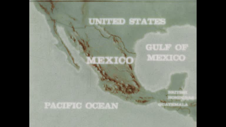
mexico: the land and the people (3rd edition) - part 6 of 36. the mexican people, closely connected to the land for 10,000 years, are leaving their farms and villages to seek economic opportunities in the cities. in affording viewers an intimate look at - us mexico map stock videos & royalty-free footage00:32Mexico: The Land and the People (3rd edition) - part 6 of 36. The Mexican people, closely connected to the land for 10,000 years, are leaving their farms and villages to seek economic opportunities in the cities. In affording viewers an intimate look atMexico, Map, USA
south america map - us mexico map stock videos & royalty-free footage00:28South America MapMexico, Map, Canada
recounts the history of texas and the southwest from the sixteenth to the mid-nineteenth century - us mexico map stock videos & royalty-free footage00:401950s: Men in period clothing on horseback. Men walk to edge of cliffMexico, Map, Landscape - Scenery
united states and north america- earth natural disaster - fire - us mexico map stock videos & royalty-free footage00:29United States and North America- Earth Natural Disaster - FireUSA, Map, Volcano
goodnight america, sunset and night. - us mexico map stock videos & royalty-free footage00:30Goodnight America, sunset and night.Mexico, USA, Satellite View
usa from night to day flyby - us mexico map stock videos & royalty-free footage00:30USA from night to day flybyMexico, Map, Globe - Navigational Equipment
santa fe and the trail - part 3 of 34. presents a picture of life in the spanish settlements of the old southwest. the film illustrates differences and similarities between spanish and american cultures, how they have blended over the years to give the so - us mexico map stock videos & royalty-free footage00:29Santa Fe and the Trail - part 3 of 34. Presents a picture of life in the Spanish settlements of the old Southwest. The film illustrates differences and similarities between Spanish and American cultures, how they have blended over the years to give the soUSA, Map, Immigrant
the westward movement iv - texas and the mexican war - part 27 of 31. the film reviews the causes of the texas settlers' revolt, which led to independence for texas; ties the annexation of texas to issues of slavery and territorial expansion. it points o - us mexico map stock videos & royalty-free footage00:35The Westward Movement IV - Texas and the Mexican War - part 27 of 31. The film reviews the causes of the Texas settlers' revolt, which led to independence for Texas; ties the annexation of Texas to issues of slavery and territorial expansion. It points oMap, War
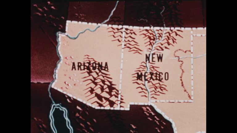
southwestern states (2nd edition) - part 1 of 19. traces population trends and explains geographical features by means of animated maps. illustrates such occupational activities as irrigation, stock raising, agriculture, mining, and oil extracting and ref - us mexico map stock videos & royalty-free footage00:29Southwestern States (2nd edition) - part 1 of 19. Traces population trends and explains geographical features by means of animated maps. Illustrates such occupational activities as irrigation, stock raising, agriculture, mining, and oil extracting and refMap, USA, New Mexico
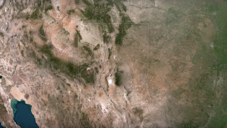
zoom in to new mexico, us from earth. satellite view of the united states of america. cinematic world map animation from outer space to territories. the concept of usa, highlight, globe, aerial view, tourism, travel, journey, cityscape - us mexico map stock videos & royalty-free footage00:16Zoom in to New Mexico, US from Earth. Satellite view of the United States of America. Cinematic world map animation from outer space to territories. The concept of USA, highlight, globe, aerial view, tourism, travel, journey, cityscapeNew Mexico, Map, USA
the westward movement iv - texas and the mexican war - part 29 of 31. the film reviews the causes of the texas settlers' revolt, which led to independence for texas; ties the annexation of texas to issues of slavery and territorial expansion. it points o - us mexico map stock videos & royalty-free footage00:28The Westward Movement IV - Texas and the Mexican War - part 29 of 31. The film reviews the causes of the Texas settlers' revolt, which led to independence for Texas; ties the annexation of Texas to issues of slavery and territorial expansion. It points o
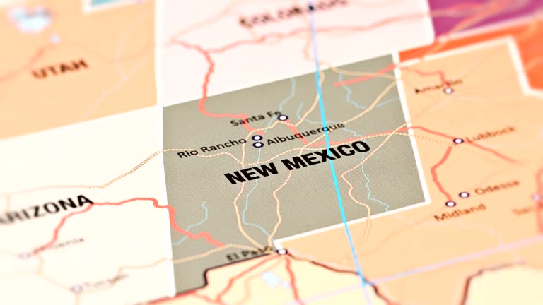
map of new mexico united states america usa, 3d animation - us mexico map stock videos & royalty-free footage00:10Map of NEW MEXICO United States America USA, 3D AnimationMap, New Mexico, USA
colour graphics of a map showing the usa, mexico, central america, and the caribbean. clip starts with a wide view of the area showing the mexican... - us mexico map stock videos & royalty-free footage00:11Zoom into map showing location of Puerto Rico; 1977Map, USA, Puerto Rico
4k mexico map with national flag - us mexico map stock videos & royalty-free footage00:174K Mexico map with national flagMexico City, Mexico, Spain
mexico economy rising chart with arrow - stock video - us mexico map stock videos & royalty-free footage00:09Mexico Economy Rising Chart with Arrow - Stock videoAnimated Video, Mexican Culture, Map
apple has renamed lake ontario to “lake america” on its maps service, following a similar change by google after an order from us president donald... - us mexico map stock videos & royalty-free footage01:02Apple renames Lake Ontario to ‘Lake America’ on US mapsLake Ontario, Map, Lake
united states mexico panama canal & south america. map of mexico & panama canal region. - us mexico map stock videos & royalty-free footage00:16Map of MexicoMexico, Map, 1940
and mexico linked by new super-highway" / vs cars driving over highway bridge over rio grande river between laredo, tx, and nuevo laredo, mexico /... - us mexico map stock videos & royalty-free footage00:40Shots in Laredo, TX, of highway connecting US to Mexico CityMexico, Map, 1930-1939
new mexico from usa states - us mexico map stock videos & royalty-free footage00:13New Mexico from USA StatesNew Mexico, Map
severe weather is expected to impact large portions of the united states this week, with violent thunderstorms forecast to sweep across the... - us mexico map stock videos & royalty-free footage00:14MOTION GRAPHIC - Severe storms to slam large parts of U.S.; tornadoes, hail and flooding possibleTornado, Map
map of u.s.a. highlighting plants, laboratories, colleges, universities, industrial firms. hanford,' washington; 'los alamos,' new mexico; 'oak... - us mexico map stock videos & royalty-free footage00:35Atomic Energy Plant MapLaboratory
discovery and exploration - part 8 of 18. surveys the period of discovery and exploration in north america between 1492 and 1700. analyzes three motives for this exploration--to find a new trade route to the far east, to search for riches, and to find bea - us mexico map stock videos & royalty-free footage00:35Discovery and Exploration - part 8 of 18. Surveys the period of discovery and exploration in North America between 1492 and 1700. Analyzes three motives for this exploration--to find a new trade route to the Far East, to search for riches, and to find beaMap, Kansas, 1940-1949
map of mexico, animated land of 'republic of texas.' - us mexico map stock videos & royalty-free footage00:09Map Republic of TexasMexico, Map, Newsreel
discovery and exploration - part 6 of 18. surveys the period of discovery and exploration in north america between 1492 and 1700. analyzes three motives for this exploration--to find a new trade route to the far east, to search for riches, and to find bea - us mexico map stock videos & royalty-free footage00:31Discovery and Exploration - part 6 of 18. Surveys the period of discovery and exploration in North America between 1492 and 1700. Analyzes three motives for this exploration--to find a new trade route to the Far East, to search for riches, and to find beaMap, Archival, Inca
panning drone view of the texas border, state line marker coming from anthony, new mexico entering el paso county - us mexico map stock videos & royalty-free footage00:06Panning Drone View of the Texas Border, State Line Marker Coming From Anthony, New Mexico Entering El Paso CountyTexas, Driving, Dallas - Texas
1953 a mexican official shows the hitchhiker murderer's logical route to a californian police officer - us mexico map stock videos & royalty-free footage00:181953 A Mexican official shows the Hitchhiker Murderer's logical route to a Californian police officerMexico, Police Force, USA
magnitude earthquake has hit mexico's central state of puebla, the us geological survey has said. - us mexico map stock videos & royalty-free footage00:10Map: 7.1 magnitude earthquake hits MexicoMexico, USA, Earthquake
immigration policy; texas: el paso:george w bush stands with border police officer and others next to car, looking at maps laid on bonnet, during... - us mexico map stock videos & royalty-free footage00:13Immigration policyMexico
the united states of america and mexico dual flag seamless loop alpha - us mexico map stock videos & royalty-free footage00:06The United States of America and Mexico Dual Flag Seamless Loop AlphaUSA, Map
woman in orange beach, alabama, wasn't sure what she saw out at sea from her balcony recently. but she knew one thing: "that sucker's huge." debbie... - us mexico map stock videos & royalty-free footage01:36'That Sucker's Huge': Endangered Whales Seen Off Alabama CoastGulf of Mexico, USA, Animal Wildlife
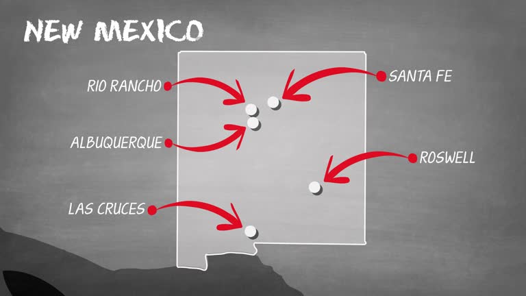
zoom in to new mexico, us from earth. satellite view of the united states of america. cinematic world map animation from outer space to territories. the concept of highlight the state, globe, tourism, travel, journey, aerial view of country, usa - us mexico map stock videos & royalty-free footage00:16Zoom in to New Mexico, US from Earth. Satellite view of the United States of America. Cinematic world map animation from outer space to territories. The concept of highlight the state, globe, tourism, travel, journey, aerial view of country, USARoswell - New Mexico, USA, Map
zoom in to new mexico, us from earth. satellite view of the united states of america. cinematic world map animation from outer space to territories. the concept of usa, highlight, globe, aerial view, tourism, travel, journey, cityscape - us mexico map stock videos & royalty-free footage00:16Zoom in to New Mexico, US from Earth. Satellite view of the United States of America. Cinematic world map animation from outer space to territories. The concept of USA, highlight, globe, aerial view, tourism, travel, journey, cityscapeUSA, Map, New Mexico
shows how life was revolutionized by the inventions of machines. an old settler recalls his first sights of the spinning jenny, cotton gin, steam... - us mexico map stock videos & royalty-free footage00:361950s: Telegraph lines. Map of United States in 1847 showing telegraph lines
ancient aztec indians of north america - part 1 of 13. describes the aztec invasion of mexico - when warlike barbarians sought to create the last great indian civilization. the tribes they conquered were forced to produce goods and offer sacrificial victi - us mexico map stock videos & royalty-free footage00:29Ancient Aztec Indians of North America - part 1 of 13. Describes the Aztec invasion of Mexico - when warlike barbarians sought to create the last great Indian civilization. The tribes they conquered were forced to produce goods and offer sacrificial victiAztec Civilization, Map, USA
mexico map connections ,digital data processing background 4k stock video - us mexico map stock videos & royalty-free footage00:20Mexico Map Connections ,Digital Data Processing Background 4K stock videoMap, Connection
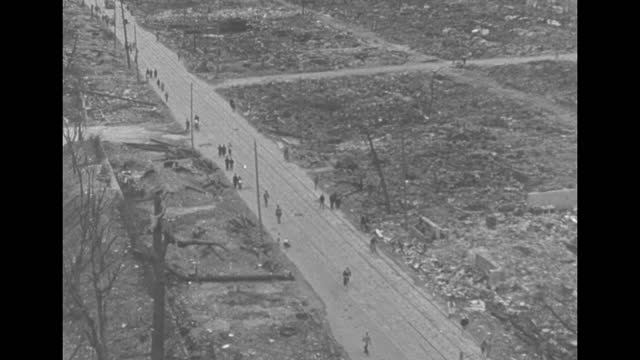
episode l-07] greatest headlines of the century title sequence / title: "a-bomb dropped on japan" with photo of mushroom cloud from atomic bomb test... - us mexico map stock videos & royalty-free footage03:23US drops atomic bombs in Japan during World War IIHiroshima Prefecture, Nagasaki City, Bomb
4k mexico map links 4k with full background details - us mexico map stock videos & royalty-free footage00:204K Mexico Map Links 4K with full background detailsEarthquake, COVID-19, Coronavirus
nearly 5 billion people suffered from extreme heat due to climate change from june 16 to june 24, according to climate central.due to climate change... - us mexico map stock videos & royalty-free footage00:48MOTION GRAPHIC: 5 billion people affected by extreme heat due to climate change in 9 days of JuneIndia, World Map, Heat - Temperature
south america map, zooming out into the space through a 4k photo real animated globe, with a panoramic view consisting of africa, west europe and usa. epic spinning world animation, realistic planet earth, america, highlight, satellite, aerial, - us mexico map stock videos & royalty-free footage00:09South America map, zooming out into the space through a 4K photo real animated globe, with a panoramic view consisting of Africa, West Europe and USA. Epic spinning world animation, Realistic planet earth, America, highlight, satellite, aerial,Map, South America, Globe - Navigational Equipment
new mexico from usa states - us mexico map stock videos & royalty-free footage00:13New Mexico from USA StatesNew Mexico, Map, Albuquerque - New Mexico
new mexico map - us mexico map stock videos & royalty-free footage00:10NEW MEXICO MAPMap, New Mexico, Satellite View
mexico alter border" / man standing at map on wall using pointer to show altered course of rio grande river / aerial shot of altered course of river... - us mexico map stock videos & royalty-free footage02:39Course of Rio Grande is altered, changing the border between US and MexicoMexico, Farmer, Texas
zoom in to new mexico, us from earth. satellite view of the united states of america. cinematic world map animation from outer space to territories. the concept of usa, highlight, globe, aerial view, tourism, travel, journey, cityscape - us mexico map stock videos & royalty-free footage00:16Zoom in to New Mexico, US from Earth. Satellite view of the United States of America. Cinematic world map animation from outer space to territories. The concept of USA, highlight, globe, aerial view, tourism, travel, journey, cityscapeMap, New Mexico
ancient aztec indians of north america - part 2 of 13. describes the aztec invasion of mexico - when warlike barbarians sought to create the last great indian civilization. the tribes they conquered were forced to produce goods and offer sacrificial victi - us mexico map stock videos & royalty-free footage00:30Ancient Aztec Indians of North America - part 2 of 13. Describes the Aztec invasion of Mexico - when warlike barbarians sought to create the last great Indian civilization. The tribes they conquered were forced to produce goods and offer sacrificial victiAztec Civilization, Old-fashioned, Central America
panning drone view of the texas border, state line marker coming from anthony, new mexico entering el paso county - us mexico map stock videos & royalty-free footage00:06Panning Drone View of the Texas Border, State Line Marker Coming From Anthony, New Mexico Entering El Paso CountyTexas, Map, El Paso - Texas
new mexico from usa states - us mexico map stock videos & royalty-free footage00:14New Mexico from USA StatesNew Mexico, Map, Flag
mexico of the plumed serpent; mexico: mexico city: extview of same square by day mainly empty / cars in streets surrounding square / shots of various... - us mexico map stock videos & royalty-free footage03:00ITN Roving Report: Mexico of the Plumed SerpentMexico
montage us b-29s fly over clouds / zoom in map of hiroshima with circle of light indicating zero point where bomb went off / mushroom cloud from... - us mexico map stock videos & royalty-free footage00:29Atomic bomb mushroom cloud from 1945 Trinity test in New MexicoHiroshima Prefecture, Atomic Bombing Of Hiroshima, Bomb
town near mexico/us border panbv policeman with sniffer dog running away past cars queueing at border tracktms man along from booth to speak to... - us mexico map stock videos & royalty-free footage03:03Mexico: Drugs trade:Mexico, Condoleezza Rice, National Border
college graduates are trekking from the start of the mississippi in minnesota down to the gulf of mexico with a giant google camera strapped their... - us mexico map stock videos & royalty-free footage02:09Google Map Journey to LouisianaMap, Google - Brand-name
airplane map route - us mexico map stock videos & royalty-free footage00:29airplane map routeMap, Connection, Illuminated
pogo professional tone staubs, @xpogotone, showed off his sticking skills across new mexico and colorado, video shows. in videos filmed in 2021 and... - us mexico map stock videos & royalty-free footage00:57Pogo Pro Uses Public Places to Pull Off Sick Rail GrindsUSA, The Americas
mexican national guard and army units were seen deploying to the us-mexico border on wednesday, february 5, after a deal between the two countries... - us mexico map stock videos & royalty-free footage01:26Mexican National Guard and Army Deployed to US Border After Trump Tariff DealMexico
presents a general view of the geographic and economic features of the southwestern states of oklahoma, texas, new mexico, and arizona. the ways of... - us mexico map stock videos & royalty-free footage00:331970s: Cowboy in chaps rides bucking bronco and falls off, hanging on to pommelRodeo, Wild West, Oklahoma
mexico coronavirus prevention, covid-19 with human cell - us mexico map stock videos & royalty-free footage00:19MEXICO Coronavirus Prevention, COVID-19 with human cell
mexico coronavirus prevention, covid-19 with human cell - us mexico map stock videos & royalty-free footage00:19MEXICO Coronavirus Prevention, COVID-19 with human cell
biologists look for hantavirus in the new mexico sevietta wildlife preserve. - us mexico map stock videos & royalty-free footage01:23Mystery Illness Rodents TrappedNew Mexico, Virus Organism, Rat
texas border sign in new mexico - us mexico map stock videos & royalty-free footage00:10Texas Border Sign in New MexicoTexas, Map, Driving
trade block; usa texas brownsvillecs reeds blowing in wind pull focus to waters of rio grande river flowing in b/ggv river flowing past group of... - us mexico map stock videos & royalty-free footage04:53Trade blockMexico, USA, Factory
map of mexico 'new spain, santa fe, el paso, san antonio, corpus christ, goliad.' - us mexico map stock videos & royalty-free footage00:05Map MexicoMexico, Newsreel
map of florida. animated map, showing location of canal moving down st. john river, moving west at palatka, moving under ocala & into gulf of mexico... - us mexico map stock videos & royalty-free footage00:131936: MAP: Map of Florida. CU Animated map, showing location of canal moving down St. John River, moving west at Palatka, moving under Ocala & into Gulf of Mexico below Inglis.Map
carbon dioxide visualization north america - us mexico map stock videos & royalty-free footage00:22Carbon Dioxide visualization North AmericaGreenhouse Gas, Coal
close up of new mexico on a political usa map - us mexico map stock videos & royalty-free footage00:14Close Up of New Mexico on a Political USA Map
funnel cloud was seen churning in the distance from lingo, new mexico, on thursday, june 5, as a tornado... - us mexico map stock videos & royalty-free footage00:49Gusty Conditions as Funnel Cloud Churns in the DistanceUSA, Extreme Weather
two people were killed after record-breaking rainfall triggered extensive https://x.com/nwsalbuquerque/status/1847888644977336705 flash flooding in... - us mexico map stock videos & royalty-free footage02:57Deadly Flooding Leaves Trail of Destruction in New MexicoNew Mexico, Map
russell marker, a chemist who contributed to the development of steroids that would later be used in the contraceptive pill, recounts his travels in... - us mexico map stock videos & royalty-free footage00:50Hormone scientist on journey to Orizaba, USA; 1977USA, Guidance
from high above, the drone captures the us/mexican border at tecate, where lines on a map become a visible reality. - us mexico map stock videos & royalty-free footage00:23From high above, the drone captures the US/Mexican border at Tecate, where lines on a map become a visible reality.Dusk, Refugee, Crossing
re-creates the life of a spanish colonial family living on a self-sufficient hacienda in southwestern united states in the early 19th century. shows... - us mexico map stock videos & royalty-free footage00:321950s: map of North America with arrows coming from Mexico into New Spain, 1800Mexico
1970s: pueblos on a map of new mexico. pueblo on a snowy mountaintop. painting of a native american dance - us mexico map stock videos & royalty-free footage00:311970s: Pueblos on a map of New Mexico. Pueblo on a snowy mountaintop. Painting of a Native American danceUSA, Dancing, Archival