close-ups of weather chart and weather data in uk met office; 1990 - vintage map elements stock videos & royalty-free footage00:06Close-ups of weather chart and weather data in UK Met Office; 1990Weather, Meteorology, Scientist
digital weather map based on satellite information / soviet weather forecaster broadcasts the forecast / meteor weather satellite in space. - vintage map elements stock videos & royalty-free footage00:59Soviet Meteor weather satellite helps predict weather patternsTelevision Set, Television Show, Television Industry
what makes weather? (2nd edition) - part 22 of 24. vivid satellite footage, helpful animation, and live action and time-lapse photography show the working forces that produce weather. the film examines the movement of winds and air masses caused by the un - vintage map elements stock videos & royalty-free footage00:35What Makes Weather? (2nd edition) - part 22 of 24. Vivid satellite footage, helpful animation, and live action and time-lapse photography show the working forces that produce weather. The film examines the movement of winds and air masses caused by the un1980-1989, Office, Weather
meteorologists work with radar and computers to track a hurricane. - vintage map elements stock videos & royalty-free footage00:41Meteorologists work with radar and computers to track a hurricane.Archival, Weather, 1970-1979
male office worker collects a meteorological map from a printer inside the new met office building in berkshire; 1961. - vintage map elements stock videos & royalty-free footage00:09An office worker collects a meterological map from a printer at the Met Offices new office in Berkshire. 1961.
pilgrims sail for america - vintage map elements stock videos & royalty-free footage00:25Pilgrims sail for AmericaCartoon, Immigrant, USA
sequence showing a panning shot of a man carrying a plastic weather map overlay and a close-up of the plastic map being placed over a computer screen... - vintage map elements stock videos & royalty-free footage00:29Man plots weather data onto computer map in UK Met Office; 19801980-1989, Office, Meteorology
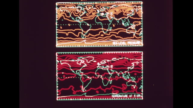
monitor displaying theoretical computer generated electronic temperature & sea-level pressure weather maps. 1960s, forecasting, meteorology,... - vintage map elements stock videos & royalty-free footage00:161968: NATIONAL METEOROLOGICAL CENTER: HD: VS Monitor displaying theoretical computer generated electronic temperature & sea-level pressure weather maps. 1960s, forecasting, meteorology, technology, science, research.Meteorology, Weather Map
what makes weather? (2nd edition) - part 23 of 24. vivid satellite footage, helpful animation, and live action and time-lapse photography show the working forces that produce weather. the film examines the movement of winds and air masses caused by the un - vintage map elements stock videos & royalty-free footage00:34What Makes Weather? (2nd edition) - part 23 of 24. Vivid satellite footage, helpful animation, and live action and time-lapse photography show the working forces that produce weather. The film examines the movement of winds and air masses caused by the unOld-fashioned, Weather Station, Outer Space
cu human hand draws isobar onto weather chart; 1953 - vintage map elements stock videos & royalty-free footage00:10CU human hand draws isobar onto weather chart; 19531950-1959, Climate, Scientist
man transcribes readings from machine / man adjusts dials on machine / men at table check machine readouts / man writes on wall map / pan from... - vintage map elements stock videos & royalty-free footage01:01US Navy takes first readings from newly launched weather balloonWeather Balloon, Archival, Technology
high angle dr. james kimball, noted weatherman, seated at desk studying weather map / kimball, pan down to his hand with pen moving on map / over the... - vintage map elements stock videos & royalty-free footage01:27Noted meteorologist Dr. James Kimball studies a weather mapMeteorology, Meteorologist, Weather
an instructor at bell laboratories in murray hill, new jersey offers instruction on the use of weather search radar in 1966. - vintage map elements stock videos & royalty-free footage00:18Weather Search Radar 1966Laboratory, Bell, Weather
learning to read maps (2nd edition) - part 6 of 21. a fanciful story done in mime and featuring a lost clown helps the younger viewer understand how maps are useful; how maps are pictorial representations of real places; how physical features are represen - vintage map elements stock videos & royalty-free footage00:32Learning to Read Maps (2nd edition) - part 6 of 21. A fanciful story done in mime and featuring a lost clown helps the younger viewer understand how maps are useful; how maps are pictorial representations of real places; how physical features are represen
young boy tuning in the new electric radio inside farmhouse / bill parkinson comes over and switches on the lamp next to radio / they listen to the... - vintage map elements stock videos & royalty-free footage00:18Rural family listen to electric radioRadio, Listening, Archival
1930s zoom in meteorological globe to "torrid zone" around equator - vintage map elements stock videos & royalty-free footage00:081930s zoom in meteorological globe to "Torrid Zone" around equatorGlobe - Navigational Equipment
world exploration map source provided by nasa - vintage map elements stock videos & royalty-free footage00:15world exploration map source provided by NASATechnology, World Map, Improvement
close-up of an engineer drawing a plan after a flood on the missouri river, north kansas city, mo, us, 1952. the floods of april 1952 in the milk... - vintage map elements stock videos & royalty-free footage00:30Close-up of an engineer drawing a plan after a flood on the Missouri River, North Kansas City, MO, USMap, Only Men, Office
animation man with large brain listens to weather words; 1966 - vintage map elements stock videos & royalty-free footage00:08Animation man with large brain listens to weather words; 1966Retro Style, Archival, Bizarre
us regions: contrasts of land and people - part 3 of 53. using both animation and live-action photography, this film enables viewers to tour a richly diverse country that can be divided into eight regions: new england, the middle atlantic, the south, the - vintage map elements stock videos & royalty-free footage00:30US Regions: Contrasts of Land and People - part 3 of 53. Using both animation and live-action photography, this film enables viewers to tour a richly diverse country that can be divided into eight regions: New England, the Middle Atlantic, the South, theMap, USA
the video focuses on various travel destinations in continental europe during the 1960s, highlighting popular vacation spots in countries like... - vintage map elements stock videos & royalty-free footage00:07Continental Holiday, Europe, 1965Map, France, Italy
engineers in the office reviewing plans and discussing the effects of flooding on the missouri river, north kansas city, mo, us, 1952. the floods of... - vintage map elements stock videos & royalty-free footage00:35Engineers in the office reviewing plans and discussing the effects of flooding on the Missouri River, North Kansas City, MO, USMap
captain john smith: founder of virginia - part 2 of 36. follows the career of john smith, whose influence and leadership contributed to the firm establishment of the first permanent english colony at jamestown in 1607. traces the events in england which p - vintage map elements stock videos & royalty-free footage00:36Captain John Smith: Founder of Virginia - part 2 of 36. Follows the career of John Smith, whose influence and leadership contributed to the firm establishment of the first permanent English colony at Jamestown in 1607. Traces the events in England which pShip, England, Map
what makes weather? (2nd edition) - part 24 of 24. vivid satellite footage, helpful animation, and live action and time-lapse photography show the working forces that produce weather. the film examines the movement of winds and air masses caused by the un - vintage map elements stock videos & royalty-free footage00:37What Makes Weather? (2nd edition) - part 24 of 24. Vivid satellite footage, helpful animation, and live action and time-lapse photography show the working forces that produce weather. The film examines the movement of winds and air masses caused by the unWeather, 1980-1989, Storm
day celebrations - weather; int/ england: london:cms alex hill in front of old fashioned weather map giving forecast as it might have been in 1944 )... - vintage map elements stock videos & royalty-free footage00:57D-Day celebrations - weatherWeather, D Day, Pattern
shot of german commanders looking over a map / shot of a map highlighting a nazi advance into greenland to set up a weather observation post / shot... - vintage map elements stock videos & royalty-free footage01:24Coast Guard Traps Nazis In Arctic At Weather StationGreenland, World War II, Nazism
1959 map of hawaii - vintage map elements stock videos & royalty-free footage01:581959 Map of HawaiiHawaii Islands, Map
meteorologist points to a weather map on a television screen. - vintage map elements stock videos & royalty-free footage00:04A meteorologist points to a weather map on a television screen.Meteorologist
water flowing from lake tana into blue nile & up to british sudan toward nile river. - vintage map elements stock videos & royalty-free footage00:12Animated map of EthiopiaSudan, Ethiopia, Africa
sequence showing a medium shot of a man collecting a print out of weather data and a close-up of his hands plotting it onto a large weather map in... - vintage map elements stock videos & royalty-free footage00:16Man plots weather data onto large map in UK Met Office; 1980Desk
the northeast: gateway for a nation - part 12 of 18. illustrates the effect that a major part of us industrial activity - the shipment of goods - has on industry itself and on the people involved. the mass of american goods that moves through the eastern - vintage map elements stock videos & royalty-free footage00:33The Northeast: Gateway for a Nation - part 12 of 18. Illustrates the effect that a major part of US industrial activity - the shipment of goods - has on industry itself and on the people involved. The mass of American goods that moves through the EasternCargo Container, Map, Storm
met office gvs and interviews; england: berkshire: bracknell: met office :intgvs staff working in met office with maps - vintage map elements stock videos & royalty-free footage02:38RUSHES: Great Storm of 1987: Met Office GVs and interviewsStorm, Weather
water conservation members looking at and pointing to topographical map on conference table / wales, united kingdom - vintage map elements stock videos & royalty-free footage00:09MONTAGE Water conservation members looking at and pointing to topographical map on conference table / Wales, United Kingdom
nassau; map showing location of bahama islands and nassaubahamas: nassau:extgeneral view coast with buildings and lighthouse in far background , gvs... - vintage map elements stock videos & royalty-free footage03:00ITN Roving Report: NassauMap, Flying
russian nuclear leak; naf england: oxfordshire: near oxford national radiological protection boardextbv scientist checking radiation monitor on roof... - vintage map elements stock videos & royalty-free footage01:06Russian nuclear leakRadioactive Contamination, Map
hurricaine report; hurricaine report; itnbracknell: me office:cms 'facsimile concentrator' sign pull out computerms meteorologist at printercms... - vintage map elements stock videos & royalty-free footage00:38Hurricaine reportWeather Forecaster, Map, Meteorologist
from boat looking across wake to soviet oil derricks in background / oil derrick spouts smoke / mls oil worker digs with shovel, derricks spew in... - vintage map elements stock videos & royalty-free footage00:30Soviet oil derricks in Caspian Sea and map animation showing Nazi German advance and Soviet repulsion during World War IICaspian Sea, World War II, Oil Field
"keep cool bud!" superimposed on crowded beach / mercury in thermometer rises to top / aerial view of coney island beach / woman in sun hat chewing,... - vintage map elements stock videos & royalty-free footage01:02Heat wave in New York and Coney IslandWeather, Beach, USA
long-range superpressure weather balloon w/ antenna flying in sky, vs ghost program researcher w/ stopwatch & paperwork, clock moving from 12:18 to... - vintage map elements stock videos & royalty-free footage00:431968: NEW ZEALAND: ATMOSPHERIC RESEARCHWeather Balloon, Sky
newspaper clippings w/ weather briefs & forecasts. vs printing machine printing out united states government daily weather map. mcu stack of... - vintage map elements stock videos & royalty-free footage00:131935: WEATHER REPORTS: MCU Newspaper clippings w/ weather briefs & forecasts. VS Printing machine printing out United States Government Daily Weather Map. MCU Stack of 'Immediate - US Weather Report' stuffed enveloped, hands folding paper.Weather
unidentified officers sot asking & receiving weather for pleiku, south vietnam. vs officer sot relating information, intel on people, count, current... - vintage map elements stock videos & royalty-free footage00:331965: USS ENTERPRISE (CVN-65)Archival
map of europe, pinpoint onto berlin, map of japan, pinpoint on tokyo / american women in the reserves walking together / women walking through a... - vintage map elements stock videos & royalty-free footage01:13Women Join Reserves To Help WWII War EffortBeach, Women, 1944
washington dc / fronts of residential houses / at desk, deputy administrator of rationing paul o'leary addresses the nation on rationing oil /... - vintage map elements stock videos & royalty-free footage01:31US Fuel Oil Rationing1940-1949, Furnace, Close-Up
large soviet antenna communicates with satellites / a soviet weather agency collects satellite information and photos to create a world map with... - vintage map elements stock videos & royalty-free footage01:12Soviet weather agency uses satellite info to create forecast
"first films show santo domingo laid waste by storm that took 5000 lives! paramount cameramen view devastated area from special pan-american plane,... - vintage map elements stock videos & royalty-free footage01:00Aerial view of destruction caused by hurricane in Santo Domingo, Dominican RepublicStorm, Archival
"what price cotton?" / pan down building to entrance and words over entrance "new orleans cotton exchange" / buyers in pit shouting / vs man at board... - vintage map elements stock videos & royalty-free footage01:08Cotton exchange in New Orleans and scenes in Louisiana of cotton gin and workers in cotton field picking cottonCotton, Gin, Weather
met office worker draws on a meteorological map. 1961. - vintage map elements stock videos & royalty-free footage00:08A Met Office worker draws on a meteorological map. 1961.Meteorology
reporter speaking / outline of map of us, "year of challenge" inside outline, then footage of factory, then footage of crowd / someone stepping on a... - vintage map elements stock videos & royalty-free footage02:59Paramount News film shows scenes of the US home front during World War IIWorld War II, Rationing, Women
an art gallery with people milling about the artworks / three men, possibly the artists, stand together / vs four framed caricatures of german fuhrer... - vintage map elements stock videos & royalty-free footage01:38An art show in Moscow featuring humorous caricatures of Nazi and Italian leadersHermann Goering, Nazism, Cartoon
boats and ships (3rd edition) - part 20 of 24. from a stormy sea, to a rivermouth harbor, to a vast ocean - the viewer rides along on a variety of boats and ships and learns about the various functions of each. using simple nautical terms, the film points - vintage map elements stock videos & royalty-free footage00:35Boats and Ships (3rd edition) - part 20 of 24. From a stormy sea, to a rivermouth harbor, to a vast ocean - the viewer rides along on a variety of boats and ships and learns about the various functions of each. Using simple nautical terms, the film pointsExxon, 1980-1989, Deep
earth science: exploring planet earth - part 28 of 35. earth science embraces broad areas of study. since ancient times, humans have tried to discover the secrets of earth. we have studied the motions of celestial bodies, made observations on volcanic act - vintage map elements stock videos & royalty-free footage00:30Earth Science: Exploring Planet Earth - part 28 of 35. Earth science embraces broad areas of study. Since ancient times, humans have tried to discover the secrets of Earth. We have studied the motions of celestial bodies, made observations on volcanic actArchival, Map, Tornado
learning to read maps (2nd edition) - part 13 of 21. a fanciful story done in mime and featuring a lost clown helps the younger viewer understand how maps are useful; how maps are pictorial representations of real places; how physical features are represe - vintage map elements stock videos & royalty-free footage00:29Learning to Read Maps (2nd edition) - part 13 of 21. A fanciful story done in mime and featuring a lost clown helps the younger viewer understand how maps are useful; how maps are pictorial representations of real places; how physical features are represeChicago - Illinois, Map
the northeast: gateway for a nation - part 11 of 18. illustrates the effect that a major part of us industrial activity - the shipment of goods - has on industry itself and on the people involved. the mass of american goods that moves through the eastern - vintage map elements stock videos & royalty-free footage00:33The Northeast: Gateway for a Nation - part 11 of 18. Illustrates the effect that a major part of US industrial activity - the shipment of goods - has on industry itself and on the people involved. The mass of American goods that moves through the EasternMeteorology, Shipping, Radio
the northeast: gateway for a nation - part 9 of 18. illustrates the effect that a major part of us industrial activity - the shipment of goods - has on industry itself and on the people involved. the mass of american goods that moves through the eastern s - vintage map elements stock videos & royalty-free footage00:33The Northeast: Gateway for a Nation - part 9 of 18. Illustrates the effect that a major part of US industrial activity - the shipment of goods - has on industry itself and on the people involved. The mass of American goods that moves through the Eastern SMap
the language of maps- part 15 of 18. combines aerial photography with topographic models and several different kinds of maps to show that the language of maps is made up of symbols representing natural and man-made features of a given area of the earth's - vintage map elements stock videos & royalty-free footage00:32The Language of Maps- part 15 of 18. Combines aerial photography with topographic models and several different kinds of maps to show that the language of maps is made up of symbols representing natural and man-made features of a given area of the earth'sUSA, Map
narrator discusses weather report as farmer heads down to his basement to look at the electric pump / plugs in pump / turns on basement shower / pump... - vintage map elements stock videos & royalty-free footage01:05Rural family get an electric pumpBasement
the pilgrims - part 23 of 40. authentic sets and period costumes bring alive the pilgrims, their religious persecution in england, their poverty in holland, the north atlantic crossing, the signing of the mayflower compact, and the first thanksgiving - vintage map elements stock videos & royalty-free footage00:30The Pilgrims - part 23 of 40. Authentic sets and period costumes bring alive the Pilgrims, their religious persecution in England, their poverty in Holland, the North Atlantic crossing, the signing of the Mayflower Compact, and the first ThanksgivingPilgrimage, USA, Map
the pilgrims - part 21 of 40. authentic sets and period costumes bring alive the pilgrims, their religious persecution in england, their poverty in holland, the north atlantic crossing, the signing of the mayflower compact, and the first thanksgiving - vintage map elements stock videos & royalty-free footage00:38The Pilgrims - part 21 of 40. Authentic sets and period costumes bring alive the Pilgrims, their religious persecution in England, their poverty in Holland, the North Atlantic crossing, the signing of the Mayflower Compact, and the first ThanksgivingNight, Archival, Sleeping
what makes the wind blow? - part 23 of 27. possible explanations for the cause of a typical onshore breeze are tried out in the laboratory and double-checked in nature. pressure differences are found to be associated with normal daytime air movements. exp - vintage map elements stock videos & royalty-free footage00:37What Makes the Wind Blow? - part 23 of 27. Possible explanations for the cause of a typical onshore breeze are tried out in the laboratory and double-checked in nature. Pressure differences are found to be associated with normal daytime air movements. ExpMap
footage compiled by paramount news for armed forces day 1951: pilot standing next to officer pointing at map / two shots of airman operating radio... - vintage map elements stock videos & royalty-free footage01:18Shots of various new kinds of planes being used by United States Air Force parked on airfields in USAeroplane
anti-radar missiles; england: london: westminster: st irmin's hotel: intms harm missile on display l-r to 'lucas' on sidecs display boardcs map... - vintage map elements stock videos & royalty-free footage00:29HARM / ALARM anti-radar missilesMissile
day four:; n)16.45: tom bradbyitaly: gioia del colle:extlms raf harrier aircraft in hangar underneath cloudy skiesharrier with cockpit and engine... - vintage map elements stock videos & royalty-free footage01:27Kosovo: NATO attacks: Day four:Kosovo, NATO, Weather
[fort myer, va] a graphic map showing flood path from pennsylvania to louisiana and a pointer shows the effected area / a radio tower over "signal... - vintage map elements stock videos & royalty-free footage01:00US Army Signal Corps at Ft. Myer, VA, and flooding in Evansville, INFlood
map ohio river states and cities with pointer on louisville / flooded street / boat with refugees and belongings, store in bg / men unload from truck... - vintage map elements stock videos & royalty-free footage00:52Flooded city streets in the OH River Valley; building sandbag levee
weather forecaster meets with pilots and an air display of current aircraft in farnborough / united kingdom - vintage map elements stock videos & royalty-free footage01:12MONTAGE Weather forecaster meets with pilots and an air display of current aircraft in Farnborough / United Kingdom
researchers study models of hydroelectric power stations in united kingdom - vintage map elements stock videos & royalty-free footage01:09MONTAGE Researchers study models of hydroelectric power stations in United Kingdom
storm passing the sandy coastline / england, united kingdom - vintage map elements stock videos & royalty-free footage00:47MONTAGE Storm passing the sandy coastline / England, United Kingdom
news reporters typing / forecaster observing charts / waves in sea / reporter sending telegram - vintage map elements stock videos & royalty-free footage01:06MONTAGE Forecaster reporting storm is passing / London, England, United Kingdom
coast guard captain receiving a telegram / london, england, united kingdom - vintage map elements stock videos & royalty-free footage01:05MONTAGE Coast guard captain receiving a telegram / London, England, United Kingdom
forecaster reviewing and preparing the weather report / england, united kingdom - vintage map elements stock videos & royalty-free footage01:04MONTAGE Forecaster reviewing and preparing the weather report / England, United Kingdom
. - vintage map elements stock videos & royalty-free footage00:111944 MONTAGE Soldiers marching in snow with mules / MS Officers review map / MS Soldier walking with mule / LS Soldier sitting while a line of soldiers march past / LS Soldiers walking down snowy hill / ArdennesBattle of the Bulge, Cold Temperature, France
documents with typewritten weather conditions and notations / teletype machine prints out weather reports and aviation codes / side shot man with... - vintage map elements stock videos & royalty-free footage01:07Air traffic control center with weather reports and flight map, circa 1930
aircraft carrier hms victorious - predicting the weather - vintage map elements stock videos & royalty-free footage00:37Aircraft carrier HMS Victorious - predicting the weatherWeather Balloon, 1950-1959, Military
three shots of man sitting at desk in office talking on phone / armband on man's arm saying "top brass" / man sitting at desk talking into... - vintage map elements stock videos & royalty-free footage00:51Men in charge of flood response during flood in Midwestern US
pres. harry truman, seated at table on board usaf independence, talks on telephone as he looks at map / from plane of flooded areas of the us midwest... - vintage map elements stock videos & royalty-free footage01:05US President Harry Truman views floods in Midwestern US
as a storm approaches, the benefits of space technology, weather satellites and satellite imaging are discussed - vintage map elements stock videos & royalty-free footage00:15As a storm approaches, the benefits of space technology, weather satellites and satellite imaging are discussed
chinese civilians blow up the southern dyke at chengchow railway junction flooding the yellow river, drowning invading japanese soldiers and slowing... - vintage map elements stock videos & royalty-free footage01:38WWII, Chinese civilians blow up the southern dyke at Chengchow (Zhengzhou) railway junction flooding the Yellow River, drowning invading Japanese soldiers and slowing their advanceRiver Huang He, Flood, 1938
"extra, flood warning" superimposed on high water / sign: "flood warning, a flood is coming. suggest you move to high ground, prepare now" / vs... - vintage map elements stock videos & royalty-free footage02:09Massive flooding in US in 1936Detonator
air force officer getting off plane at airfield and being greeted by other officers / he is greeted by other officers and official / two shots of... - vintage map elements stock videos & royalty-free footage00:33US Air Force officer and officials planning response to flooding near Topeka, KS
wind whips tree branches and awnings on ext building / desolated street in the wake of high winds / animated map shows track of winds sweeping across... - vintage map elements stock videos & royalty-free footage00:541935 Labor Day Hurricane strikes FloridaHurricane - Storm